


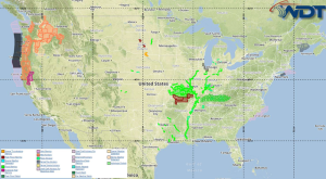
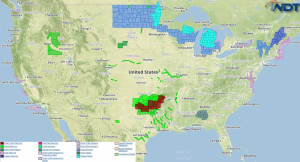
by David Moran, on Feb 22, 2016 10:38:50 AM
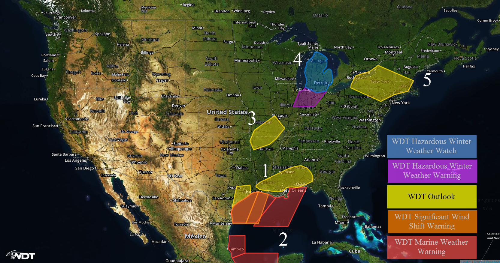
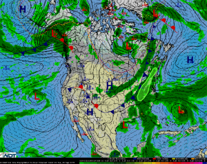
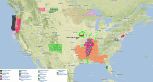
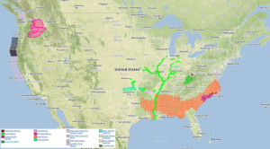
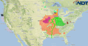
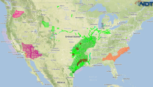
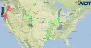
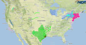
An area of low pressure moving through the Southern Plains and Ohio River Valley will bring snow from the Southern Plains and northeastward through the Great Lakes. Gale force winds …
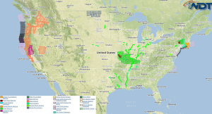
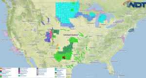
Read Storyby David Moran, on Feb 10, 2016 12:26:20 PM
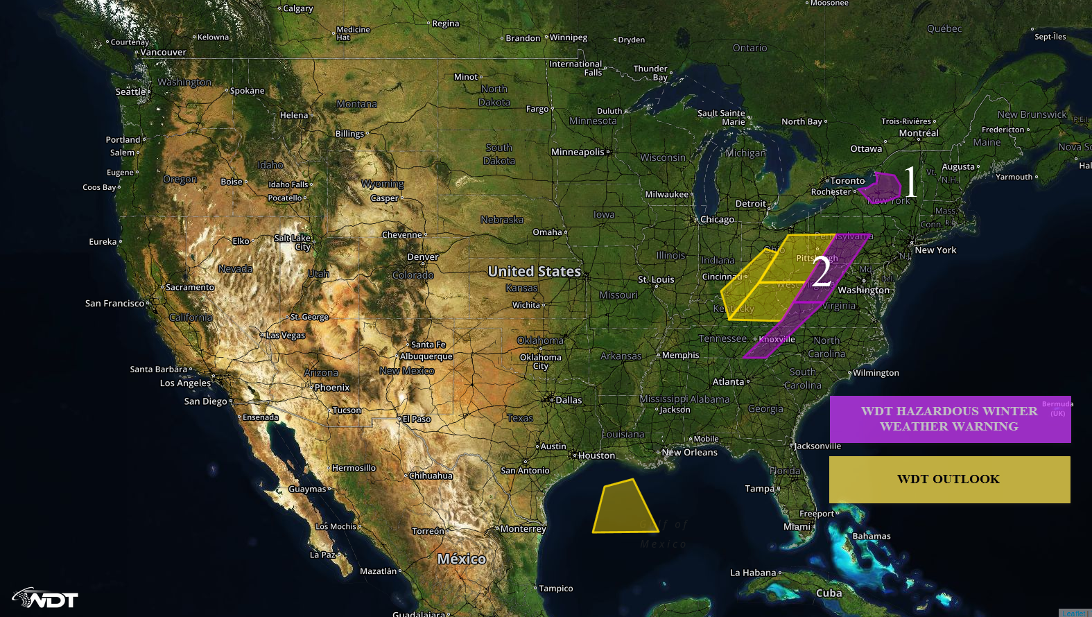
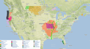
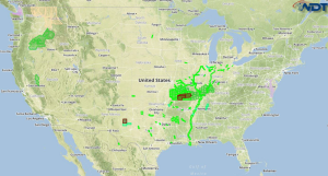
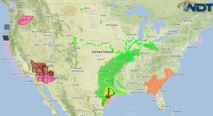
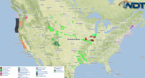
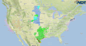
Light to moderate snow showers will continue across portions of the Northeast to the Ohio Valley ahead of a large upper level trough. US Hazards REGION 1 Snow showers will …
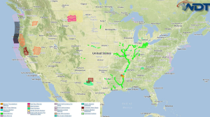
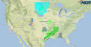
Read Storyby David Moran, on Feb 9, 2016 1:41:20 PM
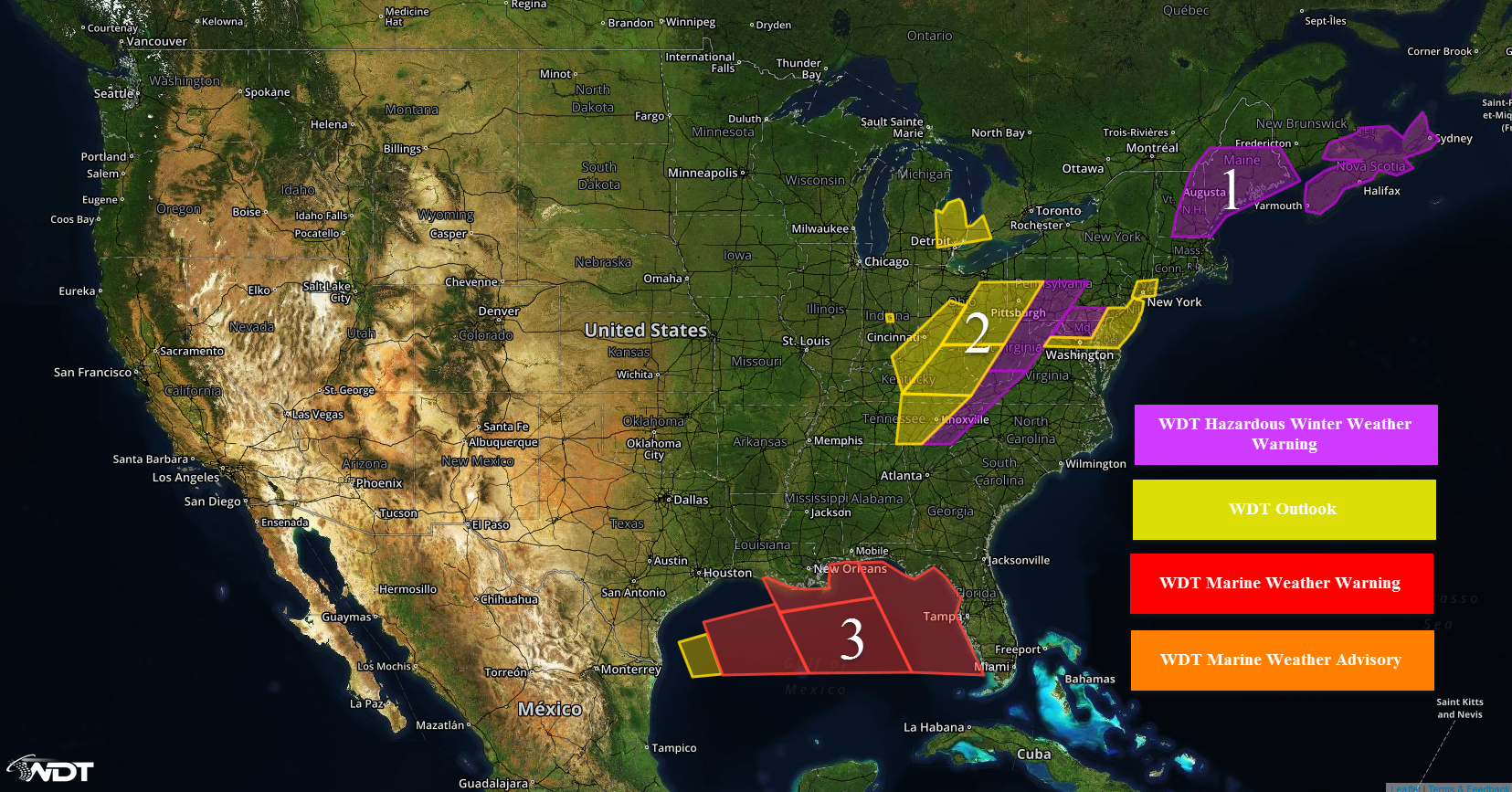
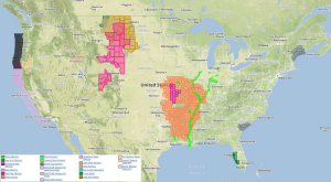
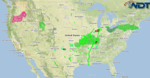
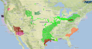
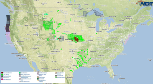
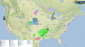
Light to moderate snowfall will be possible on Tuesday from the Northeastern US into the Ohio River Valley as a surface low deepens off the coast of Virginia. Elevated winds …
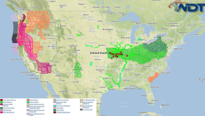
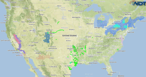
Read Storyby David Moran, on Feb 8, 2016 4:29:35 PM
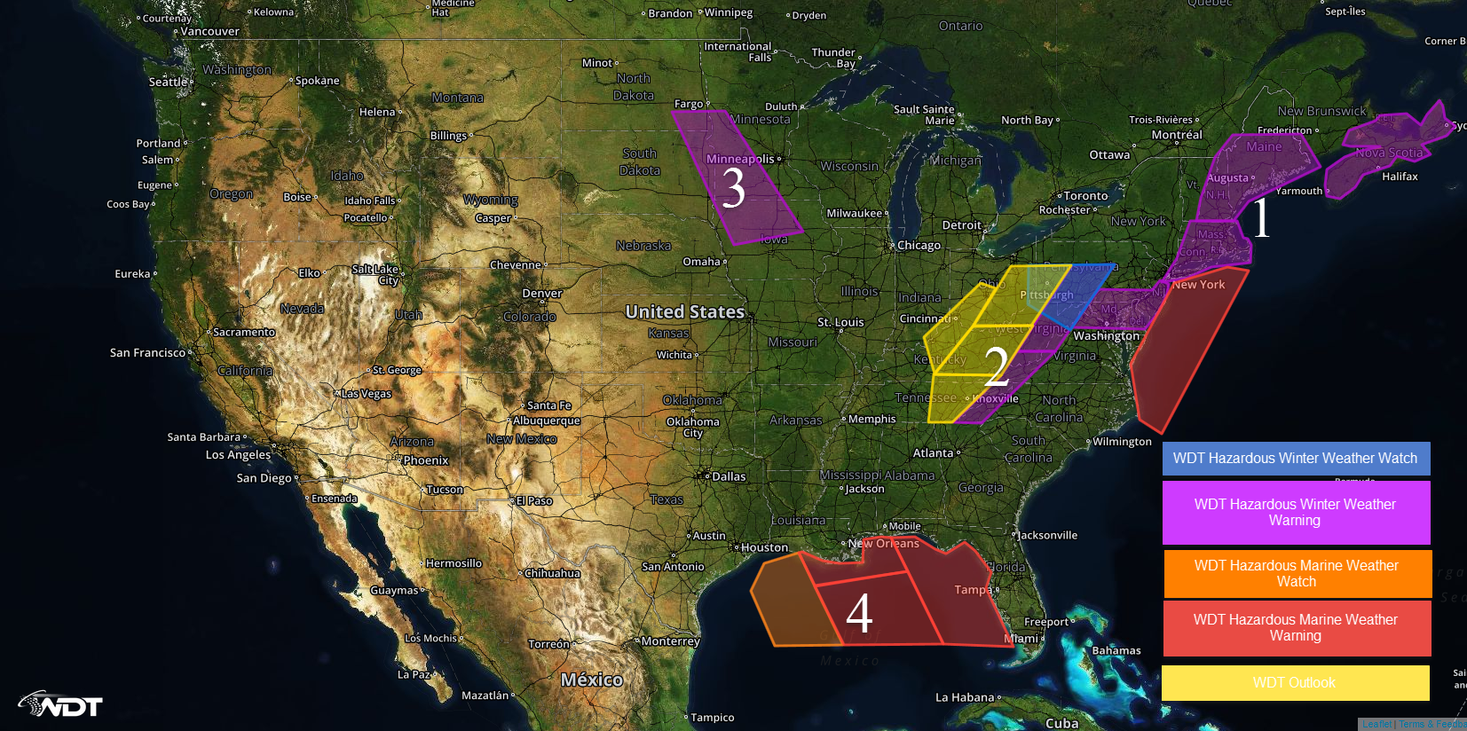
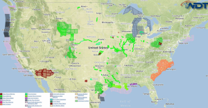
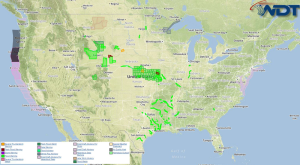
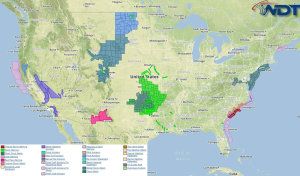
WDT Hazards Moderate to heavy snow will be possible on Monday across portions of New England. Rain will transition from rain to snow Monday and into Tuesday across the Appalachians …
Read Storyby WeatherOps, on Oct 28, 2015 4:49:48 AM
Excessive rainfall is possible on Wednesday across Southern New England. An area of low pressure over the eastern US is expected to amplify as it tracks from the Great Lakes …
Read Storyby WeatherOps, on Oct 27, 2015 10:21:29 AM
By Wednesday, scattered showers and thunderstorms will shift into the Mid Atlantic and Northeast. Isolated accumulations of 1-2 inches will be possible, but excessive rainfall is not expected as low …
Read Storyby WeatherOps, on Oct 27, 2015 4:41:28 AM
Excessive rainfall is possible on Tuesday across the Ohio and Tennessee Valleys. A series of upper level disturbances moving across the country will promote the development of a trough over …
Read Storyby WeatherOps, on Oct 26, 2015 10:28:38 AM
Excessive rainfall is possible on Tuesday across the Mississippi and Ohio Valleys. An area of low pressure over the Central US will amplify with a strong shortwave from the Rockies …
Read Storyby WeatherOps, on Oct 26, 2015 4:47:38 AM
Excessive rainfall is possible on Monday for the Central Gulf Coast. An upper level low is expected to push eastward over the Central Gulf Coast region through Monday. Ongoing precipitation …
Read Storyby WeatherOps, on Oct 23, 2015 10:45:09 AM
There is an elevated risk for excessive rainfall and flooding on Saturday across the Southern Plains and Texas. A cold front will slowly move southeastward into the south central US …
Read Storyby WeatherOps, on Oct 23, 2015 4:53:22 AM
There is an elevated threat for excessive rainfall and flooding on Friday across the Southern Plains and Texas. There is a marginal risk for strong to severe thunderstorms across Texas …
Read Storyby WeatherOps, on Oct 22, 2015 10:27:48 AM
There is a marginal risk for strong to severe thunderstorms on Friday across Texas. Excessive rainfall and flooding is possible from the Southern Plains through South Texas. The threat for …
Read Storyby WeatherOps, on Oct 22, 2015 4:39:39 AM
There will be a marginal risk for strong to severe thunderstorms, as well as a threat for excessive rainfall and flooding on Thursday from the Southern Plains through Southwest Texas …
Read Storyby WeatherOps, on Oct 21, 2015 10:33:01 AM
There is a slight risk for strong thunderstorms across portions of the Southern Plains, as well as a threat for excessive rainfall, on Thursday. The upper low is forecast to …
Read Storyby WeatherOps, on Oct 21, 2015 4:43:12 AM
There is a slight risk for severe thunderstorms from Southeast New Mexico into West Texas. Excessive rainfall will be possible for the Southern Plains. Significant snowfall is possible for the …
Read Storyby WeatherOps, on Oct 20, 2015 8:48:40 AM
Excessive rainfall is possible on Wednesday across West Texas. An upper level low is expected to move eastward slowly over Arizona. Isolated strong thunderstorms will be possible for southern and …
Read Storyby WeatherOps, on Oct 20, 2015 4:52:51 AM
There is a slight risk for severe thunderstorms on Tuesday across the Desert Southwest. An upper level low is expected to push eastward across Arizona and northern Mexico throughout the …
Read Storyby WeatherOps, on Oct 19, 2015 10:33:45 AM
There is a marginal risk for severe thunderstorms and a threat for excessive rainfall on Tuesday across the Desert Southwest. An upper level low will dig southward into the Southwest …
Read Storyby WeatherOps, on Oct 19, 2015 4:48:15 AM
There is a marginal risk for severe thunderstorms and excessive rainfall Monday across the Desert Southwest and Great Basin. Showers and thunderstorms are possible, once again, across the Desert Southwest …
Read Storyby WeatherOps, on Oct 16, 2015 10:24:32 AM
Excessive rainfall and isolated flash flooding are possible on Saturday across the Desert Southwest and Great Basin. Widespread showers and thunderstorms are expected to continue across portions of the Great …
Read Storyby WeatherOps, on Oct 16, 2015 4:50:53 AM
Excessive rainfall and isolated flash flooding is possible on Friday across the Desert Southwest. The potential for excessive rainfall will shift eastward into the Desert Southwest as an upper level …
Read Storyby WeatherOps, on Oct 15, 2015 9:19:51 AM
Excessive rainfall and isolated flash flooding is possible on Friday across the Desert Southwest. The potential for excessive rainfall will shift eastward into the Desert Southwest on Friday as the …
Read Storyby WeatherOps, on Oct 15, 2015 4:48:52 AM
Excessive rainfall and isolated flash flooding are possible on Thursday across Southern California. An upper level low will move onshore the Southwestern coast, allowing for widespread showers and thunderstorms. Showers …
Read Storyby WeatherOps, on Oct 14, 2015 10:28:11 AM
There is a chance for excessive rainfall and some flooding in southeastern California on Thursday ahead of an upper level low. Showers and thunderstorms will develop and increase in coverage …
Read Storyby WeatherOps, on Oct 14, 2015 4:40:37 AM
A cold front that produced showers and thunderstorms along the east coast and Gulf States has pushed off the coast, leaving a quiet pattern over the US. Light to moderate …
Read Storyby WeatherOps, on Oct 13, 2015 10:33:33 AM
Weather across the CONUS should be relatively quiet on Wednesday. Showers and thunderstorms could form in Southern California as a weak upper level low moves into the region. Moderate to …
Read Storyby WeatherOps, on Oct 13, 2015 4:40:54 AM
A cold front extending from Maine southwestward into the Gulf States will push off the coast late on Tuesday. Scattered showers and thunderstorms are expected across the Northeast with moderate …
Read Storyby WeatherOps, on Oct 12, 2015 10:29:10 AM
Rain showers are expected along a cold front that will be dissipating across the Southeast. In the Northeast, widespread rainfall is anticipated in association with a strong surface low moving …
Read Storyby WeatherOps, on Oct 12, 2015 4:33:38 AM
Rainy weather is expected across the Pacific Northwest as a strong coastal low continues to impact the Pacific Northwest. Over the Central US, thunderstorms are expected along a cold front …
Read Storyby WeatherOps, on Oct 8, 2015 10:17:39 AM
Isolated strong to severe thunderstorms are possible on Friday for the Delmarva Peninsula. By Friday, the risk of any type of severe weather across West Texas will diminish as a …
Read Storyby WeatherOps, on Oct 8, 2015 4:34:09 AM
Severe thunderstorms and moderate to heavy rainfall is possible on Thursday across West Texas. A closed upper level low over northern Mexico will allow showers and thunderstorms across the Del …
Read Storyby WeatherOps, on Oct 7, 2015 10:16:51 AM
Severe thunderstorms and locally heavy rainfall is possible on Thursday across West Texas. Isolated strong to severe thunderstorms are possible across the Midwest. The strong upper level low is forecast …
Read Storyby WeatherOps, on Oct 7, 2015 4:30:04 AM
Severe thunderstorms are possible on Wednesday from Arizona into Western Texas. Locally heavy rainfall is possible from Eastern Arizona into Western Texas. A strong upper level low is forecast to …
Read Storyby WeatherOps, on Oct 6, 2015 10:27:38 AM
Isolated strong to severe thunderstorms and locally heavy rainfall is possible for Southeastern New Mexico and Western Texas. An upper level low will continue to dig through the Southwest, allowing …
Read Storyby WeatherOps, on Oct 6, 2015 4:50:18 AM
Severe thunderstorms are possible on Tuesday across portions of Arizona, New Mexico, and Texas. Locally heavy rainfall is possible across the Desert Southwest. Thunderstorms are expected to develop across portions …
Read Storyby WeatherOps, on Oct 5, 2015 10:25:08 AM
Low pressure will clear the Southeast Coast by Tuesday morning with rainfall across the region finally clearing out. High pressure is forecast to build into the Central and Eastern US …
Read Storyby WeatherOps, on Oct 5, 2015 4:45:57 AM
Moderate to heavy rainfall is possible on Monday for portions of North Carolina and South Carolina. An area of low pressure over the Southeast will begin to weaken this afternoon …
Read Storyby WeatherOps, on Oct 2, 2015 8:57:11 AM
Moderate to heavy rainfall is possible on Saturday across the Carolinas and Southern Appalachians. Isolated thunderstorms will be possible due to the influence from Hurricane Joaquin. Joaquin is expected to …
Read Storyby WeatherOps, on Oct 2, 2015 4:39:26 AM
Moderate to heavy rainfall is possible Friday from the Carolinas into Virginia. A stationary front along the Southeastern US coast will likely produce widespread showers and thunderstorms. Heavy rainfall will …
Read Storyby WeatherOps, on Oct 1, 2015 10:16:12 AM
Moderate to heavy rainfall is possible on Friday from the Carolinas into New Jersey. A cold front that will stall across the eastern seaboard will allow for continued showers and …
Read Storyby WeatherOps, on Oct 1, 2015 4:31:40 AM
Moderate to heavy rainfall is possible on Thursday across North Carolina. Showers and thunderstorms are expected to linger across North Carolina, allowing for the risk of localized flooding. These showers …
Read Storyby WeatherOps, on Sep 30, 2015 10:18:30 AM
Moderate to heavy rainfall is possible on Thursday from the Carolinas into Virginia. A cold front will reach the Atlantic Coast by Thursday with showers and thunderstorms expected to promote …
Read Storyby WeatherOps, on Sep 30, 2015 4:34:04 AM
Moderate to heavy rain will be possible on Wednesday across New England. High pressure over Ontario and Quebec will drive a cold front eastward and toward the Atlantic Coast with …
Read Storyby WeatherOps, on Sep 29, 2015 10:10:42 AM
Moderate to heavy rainfall is possible on Wednesday for portions of New England. The cold front moving offshore will move off the Atlantic coast on Wednesday. Lingering showers and thunderstorms …
Read Storyby WeatherOps, on Sep 29, 2015 4:38:06 AM
Moderate to heavy rainfall is possible on Tuesday for the Appalachians. An eastward progressing cold front will move across the Appalachians with isolated to scattered thunderstorms bringing moderate to heavy …
Read Storyby WeatherOps, on Sep 28, 2015 10:21:35 AM
Moderate to heavy rainfall is possible on Tuesday from the Mid Atlantic to Upper Northeast. A frontal boundary moving toward the Atlantic coastline will provide the focus for showers and …
Read Storyby WeatherOps, on Sep 28, 2015 4:28:48 AM
Moderate to heavy rainfall and hazardous thunderstorms are possible on Monday for Florida. Current NWS Advisories/Watches/Warnings in iMapPro An area of low pressure will allow for thunderstorm activity across Florida …
Read Storyby WeatherOps, on Sep 25, 2015 8:25:31 AM
Excessive rainfall and flash flooding are possible on Saturday for the Mid Atlantic region. Excessive rainfall will be possible once again across the Mid Atlantic on Saturday as ample moisture …
Read Storyby WeatherOps, on Sep 25, 2015 4:41:29 AM
Excessive rainfall and flash flooding are possible on Friday across the Mid Atlantic. Current NWS Advisories/Watches/Warnings in iMapPro Ample moisture will continue to move into the Mid Atlantic on Friday …
Read Storyby WeatherOps, on Sep 24, 2015 10:16:59 AM
Excessive rainfall is possible on Friday for the Mid Atlantic coast. Ample moisture will continue to move into the Mid Atlantic. Showers and thunderstorms will continue through Friday with the …
Read Storyby WeatherOps, on Sep 24, 2015 4:50:48 AM
Excessive rainfall is possible on Thursday for portions of the Mid Atlantic and Southeast coasts. Current NWS Advisories/Watches/Warnings in iMapPro Showers and thunderstorms will be possible along the Mid Atlantic …
Read Storyby WeatherOps, on Sep 23, 2015 10:24:39 AM
Excessive rainfall is possible on Thursday for along the coasts of the Mid Atlantic and Southeast. The southeastern coastal areas will see some showers and heavy rain. Any developing showers …
Read Storyby WeatherOps, on Sep 23, 2015 4:51:01 AM
Excessive rainfall is possible on Wednesday for the Central and Northern Plains, as well as the Upper Midwest. Current NWS Advisories/Watches/Warnings in iMapPro Two weak lows will exist over the …
Read Storyby WeatherOps, on Sep 22, 2015 10:09:09 AM
Excessive rainfall is possible on Wednesday for portions of the Central and Northern Plains, as well as the Upper Midwest. An upper level disturbance interacting with a stationary front will …
Read Storyby WeatherOps, on Sep 22, 2015 4:49:18 AM
Excessive rainfall is possible on Tuesday across portions of the Southwest and High Plains. Strong to marginally severe thunderstorms are possible for the Northern Plains and Upper Midwest. Current NWS …
Read Storyby WeatherOps, on Sep 21, 2015 11:57:20 AM
Excessive rainfall is possible on Tuesday across the Desert Southwest. Tropical Depression 16-E will continue to track northward on Tuesday, with likely dissipation over Northern Arizona and New Mexico. Scattered …
Read Storyby WeatherOps, on Sep 21, 2015 4:37:10 AM
There is a moderate chance for heavy rainfall across the Southwest US today. Current NWS Advisories/Watches/Warnings in iMapPro Tropical Depression 16-E is currently over the Gulf of California is forecast …
Read Storyby WeatherOps, on Sep 18, 2015 10:22:03 AM
The cold front moving across the Central Plains and Midwest will lift northeastward on Saturday allowing for showers and thunderstorms from Northern Texas into the Great Lakes region. A lack …
Read Storyby WeatherOps, on Sep 18, 2015 4:43:02 AM
Strong to severe thunderstorms are possible on Friday for the Central Plains and Upper Missouri Valley. Heavy rain in excess of 2.50 inches is expected with flash flooding possible across …
Read Storyby WeatherOps, on Sep 17, 2015 9:36:37 AM
Strong to severe thunderstorms are possible on Monday for the Central Plains and Upper Mississippi Valley. A surface low is forecast to form on the lee side of the Rockies …
Read Storyby WeatherOps, on Sep 17, 2015 4:50:48 AM
Strong to severe thunderstorms are possible on Thursday across portions of the Eastern Plains and Great Lakes. Excessive rainfall is possible for portions of Florida. Current NWS Advisories/Watches/Warnings from iMapPro …
Read Storyby WeatherOps, on Sep 16, 2015 10:08:27 AM
Strong to severe thunderstorms are possible on Thursday for the Eastern Plains and Great Lakes region. Excessive rainfall is possible for portions of Florida. A strong shortwave trough and a …
Read Storyby WeatherOps, on Sep 16, 2015 4:49:03 AM
Excessive rainfall is possible on Wednesday across portions of Florida and the Pacific Northwest. Current NWS Advisories/Watches/Warnings in iMapPro Heavy precipitation is possible on Wednesday across the Pacific Northwest as …
Read Storyby WeatherOps, on Sep 15, 2015 10:17:06 AM
Excessive rainfall is possible on Wednesday for portions of the Pacific Northwest and Florida. Heavy precipitation is possible on Wednesday along the coast of Washington and Oregon. An area of …
Read Storyby WeatherOps, on Sep 15, 2015 4:36:25 AM
Isolated strong to severe thunderstorms are possible on Tuesday across the Central Plains. NWS Advisories/Watches/Warnings in iMapPro There is a conditional chance for strong to severe thunderstorms across the Central …
Read Storyby WeatherOps, on Sep 14, 2015 10:05:31 AM
Locally heavy rainfall is possible on Tuesday across portions of Idaho, Nevada, and Utah. Strong to severe thunderstorms are possible across the Great Plains. A persistent upper level trough over …
Read Storyby WeatherOps, on Sep 14, 2015 4:46:54 AM
Locally heavy rainfall is possible on Monday across portions of Northern Arizona and Utah. Current NWS Advisories/Watches/Warnings in iMapPro A strong upper level trough will move onto the West Coast …
Read Storyby WeatherOps, on Sep 11, 2015 10:25:20 AM
Moderate to heavy rainfall is possible on Saturday for the Central Appalachians. Showers and thunderstorms will continue along and ahead of a cold front progressing into the Eastern Seaboard with …
Read Storyby WeatherOps, on Sep 11, 2015 4:46:29 AM
Current NWS Advisories/Watches/Warnings from iMapPro High pressure will continue to expand across the Central US while a broad trough develops over the eastern US. At the surface, a cold front …
Read Storyby WeatherOps, on Sep 10, 2015 10:19:43 AM
No organized severe weather is expected on Friday. Building high pressure over the Central US will push a cold front into the Lower Mississippi and Ohio Valleys. Isolated to scattered …
Read Storyby WeatherOps, on Sep 10, 2015 4:55:25 AM
Isolated strong to severe thunderstorms are possible Thursday for portions of the Central Plains and Missouri Valley. Heavy rain and flash flooding is possible from the Mid Atlantic to the …
Read Storyby WeatherOps, on Sep 9, 2015 10:12:04 AM
Heavy rainfall and flash flooding are possible on Thursday for the coastal areas of New England. Excessive rainfall is possible for portions of Coastal New England. Rainfall amounts between 2 …
Read Storyby WeatherOps, on Sep 9, 2015 4:40:32 AM
Isolated strong to severe thunderstorms are possible on Wednesday across portions of the Northeast. Current NWS Advisories/Watches/Warnings in iMapPro A cold front from the lower Great Lakes will move eastward …
Read Storyby WeatherOps, on Sep 8, 2015 10:14:47 AM
No significant severe weather is expected on Wednesday. High pressure will build over the northern Plains, pushing a front south and east. Showers and thunderstorms will be possible from Texas …
Read Storyby WeatherOps, on Sep 8, 2015 4:36:44 AM
Hazardous to severe thunderstorms are possible on Tuesday for portions of the Central and Southern Plains. Heavy rain is possible from the Southern Plains through the Midwest. Current NWS Advisories/Watches/Warnings …
Read Storyby WeatherOps, on Sep 4, 2015 10:34:52 AM
Hazardous thunderstorms are possible on Saturday for the Central Plains and Upper Midwest. Locally heavy rainfall is possible for portions of the Upper Midwest. A trough over the western US …
Read Storyby WeatherOps, on Sep 4, 2015 4:49:11 AM
Particularly hazardous thunderstorms are possible on Friday from the Northern Plains into the Upper Midwest. Locally heavy rainfall is possible across the Northern Plains. Current NWS Advisories/Watches/Warnings in iMapPro A …
Read Storyby WeatherOps, on Sep 3, 2015 10:12:26 AM
Locally heavy rainfall is possible Friday across the Northern Great Plains. A slow moving cold front across the northern Great Plains will act as a focus for shower and thunderstorm …
Read Storyby WeatherOps, on Sep 3, 2015 4:41:07 AM
No significant hazardous weather is expected on Thursday. An upper level trough over the Pacific Northwest will bring a surface low into Manitoba with a cold front extending into the …
Read Storyby WeatherOps, on Sep 2, 2015 10:18:44 AM
The eastward progression of an upper level trough out of the Pacific Northwest will usher a cold front into the Northern Plains on Thursday. Rain chances will increase, however the …
Read Storyby WeatherOps, on Sep 2, 2015 4:39:56 AM
No significant weather hazards are anticipated on Wednesday as high pressure continues to persist and limit severe weather potential. A strong ridge of high pressure in the Eastern Pacific will …
Read Storyby WeatherOps, on Sep 1, 2015 10:13:04 AM
High pressure across the eastern half of the US will continue to dominate. Daytime heating will allow for thunderstorms along the east coast. Elsewhere, a midlevel disturbance is forecast to …
Read Storyby WeatherOps, on Sep 1, 2015 4:49:39 AM
Locally heavy rainfall in excess of 1-2 inches is possible on Tuesday across Western Florida. Current NWS Advisories/Watches/Warnings in iMapPro The remnants of Tropical Storm Erika are forecast to affect …
Read Storyby WeatherOps, on Aug 31, 2015 10:17:35 AM
The remains of Erika will move across the Southern US on Tuesday, allowing for moderate to heavy rain throughout the day. Rainfall accumulations of 1-1.5 inches are expected with the …
Read Storyby WeatherOps, on Aug 31, 2015 4:52:12 AM
Heavy rain in excess of 2 inches will be possible on Monday across Western Florida due to the remnants of Tropical Storm Erika. Current NWS Advisories/Watches/Warnings in iMapPro The remnants …
Read Storyby WeatherOps, on Aug 28, 2015 10:22:12 AM
No significant hazards are anticipated on Saturday. An area of low pressure will continue to track eastward and move through the southern Great Lakes, but conditions are not favorable for …
Read Storyby WeatherOps, on Aug 28, 2015 4:51:45 AM
Strong thunderstorms are possible on Friday across the Upper Midwest. Heavy rain is possible across the Midwest. Current NWS Advisories/Watches/Warnings in iMapPro An upper level disturbance moving eastward across the …
Read Storyby WeatherOps, on Aug 27, 2015 10:08:12 AM
Excessive rainfall is possible on Friday across the Great Lakes. A surface low tracking into the Great Lakes will bring widespread rainfall to the region. Moderate to heavy rainfall is …
Read Storyby WeatherOps, on Aug 27, 2015 4:49:24 AM
Isolated strong to severe thunderstorms, excessive rainfall, and flash flooding are possible on Thursday for portions of the North Central High Plains. Current NWS Advisories, Watches, and Warnings in iMapPro …
Read Storyby WeatherOps, on Aug 26, 2015 9:59:26 AM
Moderate to heavy rainfall and flash flooding are possible on Thursday across the Upper Midwest. An upper level trough is forecast to move across the Upper Midwest on Thursday. As …
Read Storyby WeatherOps, on Aug 26, 2015 4:40:05 AM
Isolated strong thunderstorms are possible on Wednesday across the North Central High Plains. Current NWS Advisories/Watches/Warnings in iMapPro Isolated marginally severe thunderstorms are possible this afternoon and evening across the …
Read Storyby WeatherOps, on Aug 25, 2015 10:18:55 AM
Isolated strong thunderstorms are possible on Wednesday across portions of the North Central High Plains. Isolated marginally severe thunderstorms will be possible during the afternoon and evening hours across portions …
Read Storyby WeatherOps, on Aug 25, 2015 4:35:02 AM
Strong thunderstorms are possible on Tuesday for portions of New England. Current NWS Advisories/Watches/Warnings in iMapPro A few strong storms will be possible across the New England region as an …
Read Storyby WeatherOps, on Aug 24, 2015 10:08:12 AM
Strong thunderstorms are possible on Tuesday across Southern New England. A few strong thunderstorms will be possible across southern New England throughout the day. A moist air mass will be …
Read Storyby WeatherOps, on Aug 24, 2015 4:30:08 AM
Current NWS Advisories/Watches/Warnings in iMapPro An upper level low is expected to push eastward across the Great Lakes as a cold front pushes eastward across the Appalachians. Isolated to scattered …
Read Storyby WeatherOps, on Aug 21, 2015 10:27:25 AM
Excessive rainfall is possible on Saturday for portions of the Northern Plains and Midwest. Scattered thunderstorms will be likely during the afternoon and evening across portions of Iowa and Minnesota …
Read Storyby WeatherOps, on Aug 21, 2015 4:44:25 AM
Isolated strong to severe thunderstorms are possible Friday for portions of the Central Plains. Current NWS Advisories/Watches/Warnings in iMapPro A weak midlevel trough will move across the Central Plains today …
Read Storyby WeatherOps, on Aug 20, 2015 10:04:11 AM
Excessive rainfall is possible on Friday across portions of New England. A strong cold front moving across the Northeast and into Canada will allow for heavy rainfall across New England …
Read Storyby WeatherOps, on Aug 20, 2015 4:45:19 AM
Excessive rainfall is possible on Thursday across portions of South Texas, Northeast, and from New England to the Mid Atlantic. Current NWS Advisories/Watches/Warnings in iMapPro A strong cold front will …
Read Storyby WeatherOps, on Aug 19, 2015 9:58:14 AM
Locally heavy rainfall is expected Thursday across the Northeast. A cold front associated with a strong surface low will bring widespread showers and thunderstorms through portions of the Northeast on …
Read Storyby WeatherOps, on Aug 19, 2015 4:37:03 AM
Strong to severe thunderstorms are possible Wednesday afternoon and evening across the Ohio Valley and Michigan. Excessive rainfall is possible for the Ohio and Mississippi Valleys. Current NWS Advisories/Watches/Warnings in …
Read Storyby WeatherOps, on Aug 18, 2015 9:55:02 AM
Strong to severe thunderstorms will be possible on Wednesday for the Mississippi Valley. Heavy rainfall with locally heavy rainfall expected for portions of Ontario. Strong to severe thunderstorms are possible …
Read Storyby WeatherOps, on Aug 18, 2015 4:44:10 AM
Strong to severe thunderstorms are possible Tuesday afternoon and evening across the Central Plains. Widespread heavy rainfall with locally excessive rainfall is expected across the Northern Plains. Current NWS Advisories/Watches/Warnings …
Read Storyby WeatherOps, on Aug 17, 2015 10:19:28 AM
Scattered severe thunderstorms are possible on Tuesday across the Central Great Plains. Locally heavy rainfall is possible across the Northern Great Plains. A surface low will develop over the Northern …
Read Storyby WeatherOps, on Aug 17, 2015 4:38:18 AM
Scattered severe thunderstorms are possible on Monday across the Colorado Front Range. Locally heavy rainfall is possible across the Northern Great Plains. Current NWS Advisories/Watches/Warnings in iMapPro A developing low …
Read Storyby WeatherOps, on Aug 14, 2015 9:56:24 AM
Thunderstorms are possible Saturday afternoon and evening across the Northern Plains ahead of a cold front. The area of low pressure across Southern Canada will continue to track eastward with …
Read Storyby WeatherOps, on Aug 14, 2015 4:35:42 AM
Strong to severe thunderstorms are possible Friday afternoon and evening across the Northern Rockies. Scattered thunderstorms are likely across Florida. Current NWS Advisories/Watches/Warnings in iMapPro A potent shortwave trough is …
Read Storyby WeatherOps, on Aug 13, 2015 10:14:02 AM
A few thunderstorms will be possible Friday afternoon and evening for the Northern Rockies. Across Central Florida, scattered thunderstorms with an isolated flash flood threat will be possible. With a …
Read Storyby WeatherOps, on Aug 13, 2015 4:27:47 AM
Thunderstorms are possible on Thursday across the Great Lakes. Isolated thunderstorms will be possible across the Northern Plains. Scattered thunderstorms are likely across Florida. Current NWS Advisories/Watches/Warnings in iMapPro A …
Read Storyby WeatherOps, on Aug 12, 2015 10:23:05 AM
Scattered thunderstorms, some strong, will be possible late in the day on Thursday. Scattered thunderstorms and isolated flash flooding will be possible across Central Florida. Isolated strong to scattered thunderstorms, …
Read Storyby WeatherOps, on Aug 12, 2015 4:48:47 AM
Isolated strong thunderstorms are possible on Wednesday across Minnesota and North Dakota. Scattered to numerous thunderstorms will be possible across Northern Florida. Scattered to numerous thunderstorms with locally heavy rain …
Read Storyby WeatherOps, on Aug 11, 2015 9:48:46 AM
The potential for significant weather will be rather low across the country on Wednesday. A few showers and thunderstorms will linger across New England and along the Gulf Coast. Additional …
Read Storyby WeatherOps, on Aug 11, 2015 4:49:42 AM
Scattered to numerous thunderstorms, a few severe, will be possible on Tuesday along the East Coast and across the Southeast. Current NWS Advisories/Watches/Warnings in iMapPro East Coast and Southeast: A …
Read Storyby WeatherOps, on Aug 10, 2015 10:04:09 AM
Marginally severe thunderstorms are possible on Tuesday along the Eastern Seaboard. Building high pressure on Tuesday over the Northern Plains and Upper Midwest regions will maintain the eastward progression of …
Read Storyby WeatherOps, on Aug 10, 2015 4:36:46 AM
Marginally severe thunderstorms are possible on Monday for portions of the Mid Mississippi River and Ohio Valleys. Current NWS Advisories/Watches/Warnings in iMapPro Middle Mississippi River and Ohio Valleys: A cold …
Read Storyby WeatherOps, on Aug 7, 2015 10:23:50 AM
Scattered strong to severe thunderstorms are possible on Saturday across the Central Plains and Midwest. The disturbance advancing into the central Plains on Friday will continue eastward Saturday resulting in …
Read Storyby WeatherOps, on Aug 7, 2015 4:35:50 AM
Scattered strong to severe thunderstorms are expected to develop on Friday across the Central Plains, as well as across Utah and Nevada. Excessive rainfall is possible across portions of Utah …
Read Storyby WeatherOps, on Aug 6, 2015 10:08:00 AM
Scattered strong to severe thunderstorms will be possible on Friday across the Northern Plains. Scattered to numerous thunderstorms will be possible across the Southeast. Heavy rain and flooding is possible …
Read Storyby WeatherOps, on Aug 6, 2015 4:40:51 AM
Scattered strong to severe thunderstorms will be possible Thursday across the Northern Plains and Upper Midwest. Widespread showers and thunderstorms, some strong to severe, will be possible across the Southeast …
Read Storyby WeatherOps, on Aug 5, 2015 10:11:21 AM
Strong thunderstorms are possible on Thursday from the Ozarks into the Middle Mississippi Valley. Excessive rainfall is possible for portions of the Middle Mississippi Valley. Upper Midwest: Severe weather is …
Read Storyby WeatherOps, on Aug 5, 2015 4:53:33 AM
Severe thunderstorms are possible Wednesday from the Ozarks to the Middle Mississippi River Valley. Excessive rainfall is possible for the Middle Mississippi River Valley. Current NWS Advisories/Watches/Warnings in iMapPro Ozark …
Read Storyby WeatherOps, on Aug 4, 2015 10:13:50 AM
Strong thunderstorms are possible Wednesday from the Ozarks into the Middle Mississippi Valley. Excessive rainfall is possible for the Middle Mississippi Valley. Ozark Region into the Middle Mississippi River Valley: …
Read Storyby WeatherOps, on Aug 4, 2015 4:49:38 AM
Severe thunderstorms are possible on Tuesday across the Delmarva peninsula. Strong thunderstorms are possible from the Great Plains into the Mid Mississippi Valley. Excessive rainfall is possible across the Central …
Read Storyby WeatherOps, on Aug 3, 2015 10:08:24 AM
Strong thunderstorms are possible on Tuesday from the Central and Southern Plains through the Tennessee Valley, as well as from the Mid Atlantic through the Upper Northeast. Central and Southern …
Read Storyby WeatherOps, on Aug 3, 2015 4:41:19 AM
Severe thunderstorms are possible on Monday from the Ohio Valley to the Upper Northeast. Strong thunderstorms are possible from the Central and High Plains into the Southern Plains. Excessive rainfall …
Read Storyby WeatherOps, on Jul 31, 2015 4:47:40 AM

Strong thunderstorms are possible Friday across the Midwest. Excessive rainfall is possible from New Mexico to the Southern Plains. Current NWS Advisories/Watches/Warnings in iMapPro Midwest: Thunderstorms are forecast to develop …
Read Storyby WeatherOps, on Jul 30, 2015 10:05:35 AM
Strong thunderstorms are possible Friday for the Central Plains. Locally heavy rainfall is expected across northern portions of New Mexico and Texas. Central Plains/Midwest: There is a chance for strong …
Read Storyby WeatherOps, on Jul 30, 2015 4:53:34 AM
Strong to severe thunderstorms are possible on Thursday from the Northeast to the Gulf Coast. Locally heavy rain is expected across the Southwest. Current NWS Advisories/Watches/Warnings in iMapPro An upper …
Read Storyby WeatherOps, on Jul 29, 2015 10:33:15 AM
Strong thunderstorms are possible Thursday from the Northeast to the Gulf Coast. A trough stretching all the way down the Atlantic Coast along with an attendant cold front will allow …
Read Storyby WeatherOps, on Jul 29, 2015 4:50:06 AM
Strong thunderstorms are possible Wednesday for the Great Lakes and Ohio River Valley, as well as from the Tennessee Valley to the Gulf Coast. Heavy rainfall is expected from the …
Read Storyby WeatherOps, on Jul 28, 2015 9:24:50 AM
Strong thunderstorms are possible on Wednesday from the Great Lakes to Ohio Valley as well as from the Tennessee Valley to the Gulf Coast. Heavy rain is possible across the …
Read Storyby WeatherOps, on Jul 28, 2015 4:41:16 AM
Strong to severe thunderstorms are possible Tuesday across the Upper Midwest and Central Plains. Strong thunderstorms are possible across the Northeast. Moderate to heavy rainfall is expected across Florida. Current …
Read Storyby WeatherOps, on Jul 27, 2015 10:10:33 AM
Strong to severe thunderstorms are possible Tuesday across the Upper Midwest to Central Plains. Strong thunderstorms are possible for portions of the Northeast. Heavy rain is likely across the Upper …
Read Storyby WeatherOps, on Jul 27, 2015 4:41:31 AM
Severe thunderstorms are possible Monday for the Great Plains and Upper Midwest. Heavy rain is possible for the Northern Plains and Florida. Current NWS Advisories/Watches/Warnings in iMapPro Great Plains to …
Read Storyby WeatherOps, on Jul 22, 2015 10:11:12 AM
Severe thunderstorms are possible Thursday across the Northern Plains. Strong to marginally severe thunderstorms are possible for the Intermountain West and Northern Rockies. Strong thunderstorms are possible across the Southeast …
Read Storyby WeatherOps, on Jul 22, 2015 4:55:56 AM
Strong to marginally severe thunderstorms are possible Wednesday across the Southeast and Central and Southern Plains, as well as the Intermountain West and Northern Rockies. Heavy rainfall is likely for …
Read Storyby WeatherOps, on Jul 21, 2015 4:48:17 AM

Strong to marginally severe thunderstorms are possible Tuesday across the Northeast and Mid Atlantic. Heavy rain and strong thunderstorms are possible for the Southern Plains. Current NWS Advisories/Watches/Warnings in iMapPro …
Read Storyby WeatherOps, on Jul 16, 2015 10:07:39 AM
Scattered thunderstorms are possible on Friday across the Central Plains. Scattered strong to severe thunderstorms are possible across portions of the Central Plains into the afternoon and evening. A cold …
Read Storyby WeatherOps, on Jul 16, 2015 4:46:40 AM
Isolated strong to severe thunderstorms are possible this afternoon and evening across the Midwest. Current NWS Advisories/Watches/Warnings in iMapPro Scattered strong to severe thunderstorms are possible across portions of the …
Read Storyby WeatherOps, on Jul 15, 2015 9:55:33 AM
Scattered thunderstorms, some severe, will be possible on Thursday across the Central Plains and Midwest, as well as Florida. Central Plains and Midwest: Scattered thunderstorm activity is expected across the …
Read Storyby WeatherOps, on Jul 15, 2015 4:39:34 AM

Scattered to numerous thunderstorms are possible Wednesday across the Northern and Central Plains. Scattered severe thunderstorms are possible for the coastal Carolinas and Southern Georgia. Current NWS Advisories/Watches/Warnings in iMapPro …
Read Storyby WeatherOps, on Jul 14, 2015 10:05:53 AM
Scattered severe thunderstorms are likely on Wednesday across the Carolinas and Southern Georgia, as well as the Northern and Central Plains. Coastal Carolinas and Southern Georgia:Scattered strong to severe thunderstorms …
Read Storyby WeatherOps, on Jul 14, 2015 8:32:19 AM
A Severe Thunderstorm Watch is in effect until 7pm CDT for portions of Arkansas and Missouri. Hail to 1.5" and damaging winds to 70 mph will be possible …
Read Storyby WeatherOps, on Jul 14, 2015 8:23:46 AM
A Severe Thunderstorm Watch is in effect until 8pm EDT for portions of Indiana, Kentucky, Maryland, Ohio, Pennsylvania, and West Virginia. Hail to 2 inches, damaging winds to 70 mph, …
Read Storyby WeatherOps, on Jul 14, 2015 4:56:34 AM
Severe thunderstorms are likely Tuesday for portions of the Ohio River Valley, Tennessee Valley, and the Carolinas. Scattered severe thunderstorms are possible late in the day for portions of Kansas …
Read Storyby WeatherOps, on Jul 13, 2015 10:06:50 AM
Strong to severe thunderstorms are possible Tuesday afternoon and evening across the Southeast. Severe thunderstorms are likely to develop across portions of the southeast on Tuesday, with large hail, tornados, …
Read Storyby WeatherOps, on Jul 13, 2015 7:23:57 AM
A Severe Thunderstorm Watch is in effect until 8pm EDT for portions of Indiana, Kentucky, Ohio, Virginia, and West Virginia. Hail to 1.5", damaging winds to 80 mph, and isolated …
Read Storyby WeatherOps, on Jul 13, 2015 4:31:29 AM
Severe thunderstorms are likely Monday across the Midwest. Current NWS Advisories/Watches/Warnings in iMapPro Multiple rounds of severe thunderstorms are likely into Monday capable of producing damaging winds, large hail, and …
Read Storyby WeatherOps, on Jul 10, 2015 10:00:21 AM
Strong to severe thunderstorms are possible across the Northern Plains on Saturday. Scattered strong-to-severe storms are expected to form Saturday afternoon into the evening in the Northern Plains. The combination …
Read Storyby WeatherOps, on Jul 10, 2015 7:28:55 AM
A Severe Thunderstorm Watch is in effect until 4pm EDT for portions of Indiana, Kentucky, Ohio, Virginia, and West Virginia. Large hail to 1 inch and damaging winds to 70 …
Read Storyby WeatherOps, on Jul 10, 2015 4:50:58 AM
Strong to severe thunderstorms are possible Friday afternoon and evening for portions of the Plains and the Ohio River Valley. Current NWS Advisories, Watches, Warnings in iMapPro Strong to severe …
Read Storyby WeatherOps, on Jul 9, 2015 9:56:57 AM
No significant weather hazards are forecast on Friday. The meandering frontal boundary across the Central Plains and portions of the Midwest will continue to bring moderate rainfall and thunderstorms to …
Read Storyby WeatherOps, on Jul 9, 2015 8:13:32 AM
A Tornado Watch is in effect until 9pm EDT for portions of Maryland, Pennsylvania, Virginia, and West Virginia. Damaging winds to 70 mph and tornadoes will be possible …
Read Storyby WeatherOps, on Jul 9, 2015 4:42:52 AM
Severe thunderstorms are possible Thursday afternoon and evening across the Mid Atlantic. Heavy rainfall will be possible across the Southern Plains. Current NWS Advisories/Watches/Warnings in iMapPro Mid-Atlantic: An upper-level trough …
Read Storyby WeatherOps, on Jul 8, 2015 10:00:37 AM
No significant weather hazards are forecast on Thursday. Scattered showers and thunderstorms are possible across portions of the Central Appalachians. With the weak frontal boundary across the central United States …
Read Storyby WeatherOps, on Jul 8, 2015 4:37:30 AM
Heavy rainfall is anticipated on Wednesday across the Midwest. NWS Advisories/Watches/Warnings in iMapPro An area of low pressure and associated warm front will lift northward into the Midwest on Thursday, …
Read Storyby WeatherOps, on Jul 7, 2015 10:06:05 AM
Excessive rainfall is expected to continue and flooding is likely Wednesday across the Missouri Valley. Additional heavy rainfall will be possible into Wednesday as the stalled frontal boundary begins to …
Read Storyby WeatherOps, on Jul 7, 2015 7:52:38 AM
Flash Flood Watches are in effect through tomorrow evening across the Plains and into the Ohio River Valley as heavy rain continues across the region. Some areas may pick up …
Read Storyby WeatherOps, on Jul 7, 2015 4:38:03 AM
Excessive heavy rainfall and widespread flooding are likely Tuesday across the Southern Plains. NWS Advisories/Watches/Warnings in iMapPro Heavy rainfall is expected over the Southern Plains into Tuesday as a cold …
Read Storyby WeatherOps, on Jul 6, 2015 10:01:29 AM
Heavy rain and widespread flooding is likely on Tuesday across the Southern Plains. Heavy rainfall is anticipated over the southern plains going on Tuesday as the cold front continues to …
Read Storyby WeatherOps, on Jul 6, 2015 4:47:14 AM
Scattered thunderstorms and isolated severe thunderstorms are expected Monday from the Central Plains into the Great Lakes. Heavy rain and flooding is likely from the Southern Plains into the Midwest …
Read Storyby WeatherOps, on Jul 3, 2015 10:36:06 AM
Strong to severe thunderstorms are possible Saturday across the Lower Mississippi Valley and Great Plains. Strong thunderstorms are possible over the Great Basin. Lower Mississippi Valley: A weak upper level …
Read Storyby WeatherOps, on Jul 3, 2015 7:20:39 AM
A Severe Thunderstorm Watch is in effect until 6pm EDT for portions of Georgia and South Carolina. Hail to 1.5 inches and damaging winds to 70 mph will be possible …
Read Storyby WeatherOps, on Jul 3, 2015 4:46:46 AM
Severe thunderstorms are possible on Friday across portions of the Mid Atlantic, Southeast, and Southern Plains. Isolated strong to severe thunderstorms are possible across the High Plains. Heavy rainfall and …
Read Storyby WeatherOps, on Jul 2, 2015 9:58:34 AM
Strong to severe thunderstorms are possible Friday for portions of the Southern Plains and Southeast. Heavy rainfall and flooding is possible for the Southern Plains and Mid South. Central & …
Read Storyby WeatherOps, on Jul 2, 2015 4:54:55 AM
Severe thunderstorms are possible Thursday for the Central Plains and Southeast. Heavy rain and flooding is possible across the Mid South. Current NWS Advisories, Watches,Warnings in iMapPro Central & Southeast: …
Read Storyby WeatherOps, on Jul 1, 2015 10:02:45 AM
Severe thunderstorms are possible Thursday from the Central Plains through the Appalachians. Heavy rainfall and flooding are expected for the Tennessee region. Central US through Appalachians: A frontal boundary draped …
Read Storyby WeatherOps, on Jul 1, 2015 7:49:37 AM
Thunderstorms are currently moving through the Nashville area. As these storms progress eastward, hail in excess of .5 inch and winds in excess of 60 mph will be possible. A …
Read Storyby WeatherOps, on Jul 1, 2015 4:36:25 AM
Severe thunderstorms are possible Wednesday from the Central Plains through Georgia. Heavy rain and flooding is likely for Missouri. Current NWS Advisories/Watches/Warnings in iMapPro An area of low pressure will …
Read Storyby WeatherOps, on Jun 30, 2015 10:20:23 AM
Strong to severe thunderstorms are possible Wednesday for the Northeast, Missouri and Ohio River Valleys, and Northern High Plains. Heavy rainfall and flooding are possible for the Mississippi and Ohio …
Read Storyby WeatherOps, on Jun 30, 2015 10:03:32 AM
A Severe Thunderstorm Watch is in effect until 10pm EDT for portions of Virginia and North Carolina. Hail to 1.5 inches and damaging winds to 70 mph will be possible …
Read Storyby WeatherOps, on Jun 30, 2015 8:42:29 AM
A Severe Thunderstorm Watch is in effect until 9pm EDT for portions of Maryland, North Carolina, Virginia, and West Virginia. Hail to 1.5" and damaging winds will be possible …
Read Storyby WeatherOps, on Jun 30, 2015 8:34:35 AM
A Severe Thunderstorm Watch is in effect until 9pm EDT for portions of Alabama, Florida, and Georgia. Hail to 1.5" and damaging winds to 70 mph will be possible …
Read Storyby WeatherOps, on Jun 30, 2015 8:03:50 AM
A Severe Thunderstorm Watch is in effect until 9pm EDT for portions of Florida, Georgia, Kentucky, North Carolina, South Carolina, Tennessee, Virginia, and West Virginia. Hail to 2" and damaging …
Read Storyby WeatherOps, on Jun 30, 2015 7:38:57 AM
A Severe Thunderstorm Watch is in effect until 8pm EDT for portions of Delaware, Indiana, Kentucky, Maryland, New Jersey, New York, Ohio, Pennsylvania, and West Virginia. Large hail to 2 …
Read Storyby WeatherOps, on Jun 30, 2015 4:42:50 AM
Severe thunderstorms are possible Tuesday for the Southeast, Ohio River Valley, and Mid Atlantic, as well as the Northern High Plains. Current NWS Advisories, Watches, and Warnings in iMapPro An …
Read Storyby WeatherOps, on Jun 26, 2015 10:05:55 AM
Severe thunderstorms are possible Saturday across the Mid Atlantic. Heavy rain and flooding is possible for the Northeast. Mid-Atlantic: An upper level low will continue to deepen and strengthen over …
Read Storyby WeatherOps, on Jun 26, 2015 9:26:32 AM
A Severe Thunderstorm Watch is in effect until 11pm EDT for portions of Indiana, Kentucky, Ohio, and Tennessee. Hail to 2 inches and damaging winds to 70 mph will be …
Read Storyby WeatherOps, on Jun 26, 2015 8:07:54 AM
A Severe Thunderstorm Watch is in effect until 8pm CDT for portions of Arkansas, Illinois, Indiana, Kentucky, Missouri, and Tennessee. Hail to 2 inches and damaging winds to 70 mph …
Read Storyby WeatherOps, on Jun 26, 2015 4:55:24 AM
Severe thunderstorms are possible Friday from the Southern Plains to the Mid Atlantic. Heavy rain and flooding is possible from the Midwest to the Ohio Valley. Current NWS Advisories/Watches/Warnings in …
Read Storyby WeatherOps, on Jun 25, 2015 10:09:59 AM
Severe thunderstorms are possible Friday from the Southern Plains to the Ohio Valley. Heavy rainfall and flooding are possible from the Midwest to Ohio Valley. Southern Plains to Ohio Valley: …
Read Storyby WeatherOps, on Jun 25, 2015 7:50:19 AM
Thunderstorms are developing across portions of the High Plains as upslope flow continues through the day. As storms continue to develop, large hail and damaging winds will be the primary …
Read Storyby WeatherOps, on Jun 25, 2015 4:54:48 AM
Severe thunderstorms are possible Thursday across the Central High Plains, as well as the Central Plains to the Mid Atlantic. Heavy rain and flooding is possible from the Central Plains …
Read Storyby WeatherOps, on Jun 24, 2015 9:09:27 AM
A Severe Thunderstorm Watch is in effect until 10pm EDT for portions of Alabama and Georgia. Hail to 1.5" and damaging winds to 70 mph will be possible …
Read Storyby WeatherOps, on Jun 24, 2015 7:55:21 AM
Thunderstorms have developed across portions of the Plains and Midwest. These storms will continue to develop across Iowa and Illinois through the afternoon and evening. Large hail, damaging winds, and …
Read Storyby WeatherOps, on Jun 24, 2015 4:47:21 AM
Severe thunderstorms are likely Wednesday from the Northern Plains into the Midwest. Current NWS Advisories/Watches/Warnings in iMapPro Moderate to extreme instability will be in place this afternoon from the Northern …
Read Storyby WeatherOps, on Jun 23, 2015 9:55:38 AM
Severe thunderstorms are likely Wednesday across the Northern Plains and into the Midwest. A belt of westerly jet stream winds should be situated across the Northern Plains and Upper Midwest …
Read Storyby WeatherOps, on Jun 23, 2015 9:51:01 AM
A Severe Thunderstorm Watch is in effect for portions of Connecticut, Massachusetts, New Jersey, New York, and Vermont. Hail to 1", damaging winds to 70 mph, and isolated tornadoes will …
Read Storyby WeatherOps, on Jun 23, 2015 7:45:32 AM
A Severe Thunderstorm Watch is in effect until 10pm EDT for portions of Maryland, Ohio, Pennsylvania, and West Virginia. Hail 1.5", damaging winds to 70 mph, and isolated tornadoes will …
Read Storyby WeatherOps, on Jun 23, 2015 4:47:23 AM
Severe thunderstorms are likely Tuesday from the Ohio Valley into New England. Severe thunderstorms are possible for the Northern and Central High Plains, as well as the Mid Mississippi Valley …
Read Storyby WeatherOps, on Jun 22, 2015 10:01:16 AM
Isolated strong to severe thunderstorms are possible Tuesday across the Ohio Valley and into New England, as well as the Northern High Plains. Ohio Valley & Northeast: An upper level …
Read Storyby WeatherOps, on Jun 22, 2015 8:23:56 AM
A Severe Thunderstorm Watch is in effect until 9pm EDT for portions of Lower Michigan. Hail to 2 inches, damaging winds to 70 mph, and isolated tornadoes will be possible …
Read Storyby WeatherOps, on Jun 22, 2015 7:57:44 AM
Thunderstorms are continuing to progress across Michigan this afternoon. Further development is possible ahead of the main low. Damaging winds and isolated tornadoes will be the main concerns, but some …
Read Storyby WeatherOps, on Jun 22, 2015 4:47:08 AM

Scattered strong to severe thunderstorms are likely Monday across the Great Lakes. Strong to severe thunderstorms are likely across the Upper Midwest. On Monday, a primary shortwave trough is forecast …
Read Storyby WeatherOps, on Jun 19, 2015 10:27:17 AM
Strong to severe thunderstorms are possible from the Midwest into the Mid Atlantic and Northeast. Heavy rainfall and flooding is possible across the Tennessee Valley. Midwest into Mid-Atlantic and Northeast: …
Read Storyby WeatherOps, on Jun 19, 2015 4:40:32 AM
Thunderstorms are expected to continue on Friday across the Northern Plains; some may be severe. Heavy rainfall will continue across the Mississippi Valley; flooding possible. Current NWS Advisories/Watches/Warnings in iMapPro …
Read Storyby WeatherOps, on Jun 18, 2015 10:05:05 AM
Severe thunderstorms are expected Friday across the Northern Plains. Heavy rainfall is expected across the Mississippi Valley. Northern Plains: Thunderstorms are likely to be ongoing during the morning hours on …
Read Storyby WeatherOps, on Jun 18, 2015 9:30:18 AM
A Severe Thunderstorm Watch is in effect for portions of Colorado, Kansas, New Mexico, Oklahoma, and Texas until 10pm CDT. Hail to 1.5", damaging winds to 70 mph, and isolated …
Read Storyby WeatherOps, on Jun 18, 2015 7:53:15 AM
Thunderstorms are developing across the Ohio River Valley ahead of a cold front approaching the area. As thunderstorms continue to develop, small hail to .5" and damaging winds to 60 …
Read Storyby WeatherOps, on Jun 18, 2015 4:42:57 AM
Heavy rain will be possible on Thursday for portions of Oklahoma, Arkansas, and Missouri. Isolated severe thunderstorms are possible this afternoon and evening for the Northern High Plains. Strong to …
Read Storyby WeatherOps, on Jun 17, 2015 10:04:03 AM
Heavy rain with amounts of 2-4 inches will be possible Thursday across Northeastern Oklahoma and Southwestern Missouri. Isolated severe thunderstorms will be possible across the Northern High Plains. Strong to …
Read Storyby WeatherOps, on Jun 17, 2015 7:48:51 AM
Flash Flood Watches are in effect for portions of Arkansas and Oklahoma through Friday morning. As the remnants of Tropical Storm Bill move across the region, 3-5 inches with isolated …
Read Storyby WeatherOps, on Jun 17, 2015 5:10:03 AM
Heavy rainfall is possible Wednesday for portions of Eastern Texas and Oklahoma. Isolated severe thunderstorms are possible across the High Plains. Strong to severe thunderstorms are possible across the Ohio …
Read Storyby WeatherOps, on Jun 16, 2015 11:47:10 AM
Heavy rain will be possible Wednesday across the Southern Plains in association with the remnants of Tropical Storm Bill. Isolated severe thunderstorms are possible during the afternoon over the Northern …
Read Storyby WeatherOps, on Jun 16, 2015 4:44:52 AM
Heavy rain associated with Tropical Storm Bill is expected Tuesday across Eastern Texas. Severe thunderstorms are likely during the afternoon across the Northern Rockies into the Northern Great Plains. Current …
Read Storyby WeatherOps, on Jun 15, 2015 10:09:24 AM
Severe thunderstorms are possible Tuesday from the Midwest into the Northeast, as well as the Northern Rockies into the Northern Great Plains. Heavy rainfall is likely for eastern Texas. Midwest …
Read Storyby WeatherOps, on Jun 15, 2015 4:39:19 AM
Heavy rainfall is likely Monday across the coastal areas of Texas. Current NWS Advisories/Watches/Warnings in iMapPro An area of low pressure in the southern Gulf of Mexico is being monitored …
Read Storyby WeatherOps, on Jun 12, 2015 10:04:02 AM
A series of weak low pressure troughs and fronts are forecast to slowly move across the on Saturday allowing for periods of showers and general thunderstorms from the Northern Plains, …
Read Storyby WeatherOps, on Jun 12, 2015 9:24:48 AM
A Severe Thunderstorm Watch is in effect until 10pm EDT for portions of New York and Pennsylvania. Damaging winds to 70 mph will be the primary concern. A Tornado Watch …
Read Storyby WeatherOps, on Jun 12, 2015 7:30:34 AM
A Severe Thunderstorm Watch is in effect for portions of Ohio, Pennsylvania, and West Virginia until 9pm EDT. Large hail to 1 inch and damaging winds to 70 mph will …
Read Storyby WeatherOps, on Jun 12, 2015 4:49:54 AM
Isolated to strong severe thunderstorms are possible Friday for the Texas Panhandle and Western Oklahoma, as well as from the Ohio Valley to Central New York. Heavy rain is possible …
Read Storyby WeatherOps, on Jun 11, 2015 10:09:21 AM
Isolated strong to severe thunderstorms will be possible for the Texas Panhandle and Western Oklahoma,. as well as from the Ohio River Valley. Heavy rain is possible for the Texas …
Read Storyby WeatherOps, on Jun 11, 2015 9:12:46 AM
A Tornado Watch is in effect until 9pm CDT for portions of Iowa, Missouri, and Nebraska. Hail to 2 inches, damaging winds to 70 mph, and tornadoes will be possible …
Read Storyby WeatherOps, on Jun 11, 2015 8:57:38 AM
A Severe Thunderstorm Watch is in effect for portions of Eastern Colorado until 8pm MDT. Hail to 2 inches, damaging winds to 70 miles per hour, and tornadoes will be …
Read Storyby WeatherOps, on Jun 11, 2015 8:00:00 AM
Thunderstorms have developed across the Central Plains and Midwest ahead of a shortwave trough. Thunderstorms will increase in coverage and intensity through the afternoon. Large hail and damaging winds will …
Read Storyby WeatherOps, on Jun 11, 2015 4:44:59 AM
Scattered severe thunderstorms will be possible Thursday from the Central Plains to the Southern Great Lakes. Heavy rain is likely across the Midwest. Current NWS Advisories/Watches/Warnings in iMapPro Thunderstorms are …
Read Storyby WeatherOps, on Jun 10, 2015 9:58:56 AM
Hazardous thunderstorms are possible Wednesday across the Central Great Plains. Heavy rain is expected across the Northern Great Plains. Central Great Plains:Thunderstorms are expected to develop near a stationary front …
Read Storyby WeatherOps, on Jun 10, 2015 7:53:53 AM
Thunderstorms are continuing to move across portions of Northern and Central Florida along a weak cold front. Main hazards will be hail to 1 inch, gusty winds to 50 miles …
Read Storyby WeatherOps, on Jun 10, 2015 4:51:37 AM
Hazardous thunderstorms are possible Wednesday for Kansas and Nebraska, as well as Upstate New York. Heavy rain is possible for Eastern Nebraska. Current NWS Advisories, Watches/Warnings in iMapPro Kansas and …
Read Storyby WeatherOps, on Jun 9, 2015 9:50:05 AM
Hazardous thunderstorms are possible Wednesday across Western Nebraska. Heavy rain is also expected for portions of Nebraska and South Dakota. Western Nebraska:Thunderstorms are expected to develop near a stationary front …
Read Storyby WeatherOps, on Jun 9, 2015 9:34:08 AM
A Severe Thunderstorm Watch is in effect until 8pm EDT for portions of Connecticut, Masssachusetts, New Hampshire, and Vermont. Hail to 1.5" and damaging winds to 70 mph will be …
Read Storyby WeatherOps, on Jun 9, 2015 7:56:12 AM
Thunderstorms are moving across New England ahead of an upper level trough. As they move across Eastern New York and into Massachusetts, hail to 1 inch and damaging winds in …
Read Storyby WeatherOps, on Jun 9, 2015 4:55:31 AM
Hazardous thunderstorms will be possible Tuesday across the Upper Midwest and Northern Plains, as well as Upstate New York and New England. Current NWS Advisories/Watches/Warnings in iMapPro Upper Midwest and …
Read Storyby WeatherOps, on Jun 8, 2015 10:06:31 AM
Hazardous thunderstorms are possible Tuesday from the Atlantic Seaboard through the Gulf Coast States, the Upper Midwest into the Great Lakes, Montana into the Northern High Plains. and the South …
Read Storyby WeatherOps, on Jun 8, 2015 9:04:22 AM
A Severe Thunderstorm Watch is in effect until 8pm EDT for portions of Kentucky, Maryland, Tennessee, Virginia, and West Virginia. Hail to 1.5 inches and damaging winds to 70 mph …
Read Storyby WeatherOps, on Jun 8, 2015 8:57:59 AM
A Tornado Watch is in effect until 8pm EDT for portions of Maryland, Pennsylvania, Virginia, and West Virginia. Hail to 1.5 inches, damaging winds to 70 miles per hour, and …
Read Storyby WeatherOps, on Jun 8, 2015 8:13:31 AM
A Severe Thunderstorm Watch is in effect until 7pm CDT for portions of Arkansas, Kentucky, Missouri, and Tennessee. Hail to 2 inches and damaging winds to 70 mph will be …
Read Storyby WeatherOps, on Jun 8, 2015 7:55:08 AM
A Tornado Watch is in effect for portions of Massachusetts, New York, Pennsylvania, and Vermont until 8pm EDT. Hail to 2 inches, damaging winds to 70 mph, and tornadoes will …
Read Storyby WeatherOps, on Jun 8, 2015 4:55:12 AM
Particularly hazardous thunderstorms are possible Monday from the Ohio and Tennessee Valleys through the Delmarva Peninsula. Hazardous thunderstorms are possible from the South Central High Plains through the Ozarks. Heavy …
Read Storyby WeatherOps, on Jun 5, 2015 9:58:18 AM
Hazardous thunderstorms are possible Saturday across the Central Plains, Midwest, and Southwest. Heavy rain is possible across the Upper Midwest. Central Plains & Midwest: A developing surface low pressure area …
Read Storyby WeatherOps, on Jun 5, 2015 9:26:47 AM
A Tornado Watch is in effect until 7pm MDT for portions of Eastern Colorado. Hail to 2.5", damaging winds to 70 miles per hour, and tornadoes will be possible …
Read Storyby WeatherOps, on Jun 5, 2015 4:55:21 AM
Hazardous thunderstorms are possible Friday for portions of the Central Plains, Midwest, and Southwest. Heavy rain is possible across the Upper Midwest. Current NWS Advisories/Watches/Warnings in iMapPro Low level moisture …
Read Storyby WeatherOps, on Jun 4, 2015 10:02:39 AM
Particularly hazardous thunderstorms are possible Friday for the Front Range and High Plains. Hazardous thunderstorms are possible for portions of the Great Plains, Central US, Utah, and Arizona. Heavy rain …
Read Storyby WeatherOps, on Jun 4, 2015 7:57:37 AM
Thunderstorms are continuing to move across Northeast Kansas. Further development is possible later this afternoon ahead of the line. Hail to 1 inch, damaging winds to 60 mph, heavy rain, …
Read Storyby WeatherOps, on Jun 4, 2015 4:51:32 AM
Particularly hazardous thunderstorms are possible Thursday across the Central Plains. Hazardous thunderstorms are possible for the High Plains and Central US. Heavy rain is possible across the Mid Atlantic. Current …
Read Storyby WeatherOps, on Jun 3, 2015 10:02:12 AM
Hazardous thunderstorms are possible Thursday across the Central High Plains and the Southeast. Heavy rainfall and localized flash flooding is possible for portions of Nebraska and Iowa. Central High Plains/Central …
Read Storyby WeatherOps, on Jun 3, 2015 7:52:59 AM
Flash Flood Warnings continue through mid afternoon for the Kansas City area. Slow moving storms will produce 2-3 inches of rain with possibly locally higher amounts in some areas …
Read Storyby WeatherOps, on Jun 3, 2015 4:54:03 AM
Particularly hazardous thunderstorms will be possible Wednesday from portions of Wyoming into the Central Plains/ Marginally hazardous thunderstorms are possible for the North Central US and the Southeast. Current NWS …
Read Storyby WeatherOps, on Jun 2, 2015 9:55:10 AM
Particularly hazardous thunderstorms are possible Wednesday from Wyoming into the Southern Plains. Marginally hazardous thunderstorms are possible across the Southeast. Wyoming through Central Plains/Central CONUS:As low pressure departs the Northern …
Read Storyby WeatherOps, on Jun 2, 2015 7:56:05 AM
Thunderstorms are continuing to move across Florida ahead of an area of low pressure. As thunderstorms continue to progress across the peninsula, heavy rain, frequent lightning, and damaging winds will …
Read Storyby WeatherOps, on Jun 2, 2015 4:53:44 AM
Particularly hazardous thunderstorms are possible Tuesday for the Northern Plains. Marginally hazardous thunderstorms are possible across the Southeast. Moderate to heavy rainfall is possible for the Carolinas and Virginia. Current …
Read Storyby WeatherOps, on Jun 1, 2015 10:00:43 AM
Particularly hazardous thunderstorms are possible Tuesday for the Northern Plains. Marginally hazardous thunderstorms are possible for the Southeast. Northern Plains/Great Plains:A shortwave trough over the Rockies will lift across the …
Read Storyby WeatherOps, on Jun 1, 2015 7:32:59 AM
Showers and thunderstorms will continue across the Florida Panhandle through the afternoon. As they continue, small hail, gusty winds, and lightning will be possible …
Read Storyby WeatherOps, on Jun 1, 2015 4:43:31 AM
Hazardous thunderstorms are possible Monday across the Northern and Central High Plains. Marginally hazardous thunderstorms are possible across the Southeast and Delmarva. Current NWS Advisories/Watches/Warnings in iMapPro A low amplitude …
Read Storyby WeatherOps, on May 29, 2015 10:25:34 AM
A cold front will extend from the Great Lakes through Texas on Saturday. Storms will form along and ahead of this boundary during the day; however, severe parameters including shear …
Read Storyby WeatherOps, on May 29, 2015 9:28:19 AM
A Tornado Watch is in effect until 7pm CDT for portions of Arkansas, Missouri, and Oklahoma. Hail to 1 inch, damaging winds to 70 miles per hour, and tornadoes will …
Read Storyby WeatherOps, on May 29, 2015 7:46:22 AM
Thunderstorms are possible this afternoon across portions of West Texas ahead of an upper level trough. Daytime heating and low level moisture will provide sufficient destabilization for the development of …
Read Storyby WeatherOps, on May 29, 2015 4:32:41 AM
Strong to severe thunderstorms are possible Friday across portions of Texas. The potential for heavy rain will continue for portions of the Central and Southern Plains. Current NWS Advisories/Watches/Warnings in …
Read Storyby WeatherOps, on May 28, 2015 9:54:54 AM
Heavy rainfall is possible Friday for portions of the Central and Southern Plains. An upper level trough will continue progressing eastward into the Central United States on Friday. A surface …
Read Storyby WeatherOps, on May 28, 2015 9:48:51 AM
A Severe Thunderstorm Watch is in effect until 8pm MDT for portions of Colorado, Kansas, Nebraska, New Mexico, Oklahoma. and Texas. Hail to 2 inches, damaging winds to 70 moh, …
Read Storyby WeatherOps, on May 28, 2015 8:03:54 AM
A Tornado Watch is in effect for portions of Southeastern New Mexico and Western Texas until 8pm CDT. Hail to 3 inches, damaging winds to 70 mph, and tornadoes will …
Read Storyby WeatherOps, on May 28, 2015 6:22:40 AM
A Severe Thunderstorm Watch is in effect until 7pm EDT for portions of Connecticut, Massachusetts, Maine, New Hampshire, New Jersey, New York, Rhode Island, and Vermont. Hail to 1" and …
Read Storyby WeatherOps, on May 28, 2015 4:47:41 AM
Strong to severe thunderstorms are possible Thursday for the Central and Southern Plains, as well as the Upper Northeast. Heavy rainfall is possible for the Central and Southern Plains. Current …
Read Storyby WeatherOps, on May 27, 2015 10:03:26 AM
Strong to severe thunderstorms are possible Thursday across the Central and Southern Plains. Heavy rainfall is possible across Northwest Texas and Southwest Oklahoma. High Plains: An upper level trough will …
Read Storyby WeatherOps, on May 27, 2015 9:50:03 AM
A Tornado Watch is in effect until 10pm CDT for portions of Colorado, Kansas, and Nebraska. Hail to 2", damaging winds to 70 mph, and tornadoes will be possible …
Read Storyby WeatherOps, on May 27, 2015 7:23:54 AM
A Severe Thunderstorm Watch is in effect until 7pm EDT for portions of Connecticut, Delaware, Massachusetts, Maryland, New Jersey, New York, Pennsylvania, Virginia and Vermont. Hail to 1.5 inches and …
Read Storyby WeatherOps, on May 27, 2015 4:55:13 AM
Strong to severe thunderstorms are possible Wednesday for the Central and Southern Plains, Great Lakes, Northeast, and Mid Atlantic. Current NWS Advisories/Watches/Warnings in iMapPro A broad upper level trough will …
Read Storyby WeatherOps, on May 26, 2015 10:05:18 AM
Strong to severe thunderstorms are possible Wednesday for the Central and Southern Plains. Increasing instability aided by an expected dryline will bring a threat of strong to severe thunderstorms across …
Read Storyby WeatherOps, on May 26, 2015 7:47:14 AM
Showers and thunderstorms are moving across portions of Southeastern Alabama, Southwestern Georgia, and the Florida Panhandle. Heavy rain, lightning, and damaging winds will be possible. These storms will continue to …
Read Storyby WeatherOps, on May 26, 2015 4:43:36 AM
Strong to severe thunderstorms are possible Tuesday for the Great Lakes and Ohio River Valley, as well as the Central and Southern Plains. Current NWS Advisories/Watches/Warnings in iMapPro A deepening …
Read Storyby WeatherOps, on May 21, 2015 9:58:19 AM
Strong to severe thunderstorms are possible Friday for Eastern New Mexico and West Texas. A potent upper-level trough will move into the Desert Southwest on Friday, providing ample lift for …
Read Storyby WeatherOps, on May 21, 2015 7:38:17 AM
A Severe Thunderstorm Watch is in effect for portions of Eastern North Carolina until 8pm EDT. Hail to 1 inch, damaging winds and 70 miles per hour, and isolated tornadoes …
Read Storyby WeatherOps, on May 21, 2015 4:48:44 AM
Isolated strong to severe thunderstorms are possible on Thursday across West Texas and the North Carolina Coast. Current NWS Advisories/Watches/Warnings in iMapPro A weak upper level trough moving into West …
Read Storyby WeatherOps, on May 20, 2015 10:00:27 AM
Isolated strong to severe thunderstorms are possible Thursday across West Texas and the Coastal Carolinas. Southwest Texas: A decaying surface front across the Big Bend region of Texas on Thursday …
Read Storyby WeatherOps, on May 20, 2015 7:46:20 AM
Showers and thunderstorms are moving across the Mississippi Valley ahead of an upper level trough. While widespread severe weather is not anticipated, some storms will have the potential for small …
Read Storyby WeatherOps, on May 20, 2015 4:52:57 AM
Isolated strong to severe thunderstorms are possible Wednesday across Southwest Texas. Current NWS Advisories/Watches/Warnings in iMapPro An isolated risk for severe thunderstorms will be possible across Southwest Texas as a …
Read Storyby WeatherOps, on May 19, 2015 10:13:05 AM
Isolated strong to severe thunderstorms are possible Wednesday across West Texas. An isolated risk for severe thunderstorms will be possible across parts of West Texas on Wednesday as a slow …
Read Storyby WeatherOps, on May 19, 2015 8:52:58 AM
A Tornado Watch is in effect until 9pm CDT for portions of Southwest and South Central Oklahoma and Northwest Texas. Hail to 1.5", damaging winds to 70 mph, and tornadoes …
Read Storyby WeatherOps, on May 19, 2015 7:52:30 AM
Thunderstorms have developed across the Texas Panhandle ahead of an upper level trough. As storms continue to move eastward across the Panhandle and into Oklahoma, large hail, damaging winds, and …
Read Storyby WeatherOps, on May 19, 2015 4:54:43 AM
Isolated strong to severe thunderstorms are possible Tuesday across West Texas. North Locally heavy rainfall is possible across North Central Texas and Southern Oklahoma. Current NWS Advisories/Watches/Warnings in iMapPro A …
Read Storyby WeatherOps, on May 18, 2015 10:07:14 AM
Isolated strong to severe thunderstorms are possible Tuesday across West Texas. Locally heavy rainfall is possible for the Southern Plains. West Texas: A strong upper-level trough will move into the …
Read Storyby WeatherOps, on May 18, 2015 7:56:45 AM
Thunderstorms are possible this afternoon and evening ahead of an upper level trough moving out of the Rockies. Daytime heating and increased moisture will increase instability allowing for thunderstorm development …
Read Storyby WeatherOps, on May 18, 2015 4:51:53 AM
Isolated strong to severe thunderstorms are possible Monday across West Texas, Locally heavy rainfall is possible across Northern Louisiana. Current NWS Advisories/Watches/Warnings in iMapPro Another round of showers and thunderstorms …
Read Storyby WeatherOps, on May 15, 2015 9:50:57 AM
Strong to severe thunderstorms are possible Saturday for portions of the Great Plains. Isolated to scattered severe storms are forecast across portions of the Great Plains on Saturday. As an …
Read Storyby WeatherOps, on May 15, 2015 9:07:52 AM
A Tornado Watch is in effect until 8pm MDT for portions of Colorado, Nebraska. and Wyoming. Hail to 2 inches, damaging winds to 70 miles per hour, and tornadoes will …
Read Storyby WeatherOps, on May 15, 2015 7:53:21 AM
Storms are developing across the Central High Plains from Nebraska to Western Texas ahead of an upper level trough. As thunderstorms develop, large hail, damaging winds, and isolated tornadoes will …
Read Storyby WeatherOps, on May 14, 2015 10:02:15 AM
Severe thunderstorms are possible Friday across the Central and Southern Plains during the afternoon and evening. An upper-level trough will move slowly eastward through the Great Basin and across the …
Read Storyby WeatherOps, on May 14, 2015 7:55:11 AM
Thunderstorms are possible today across West Texas ahead of an upper level trough. Daytime heating and moisture advection will allow for instability leading to thunderstorm development. Large hail and damaging …
Read Storyby WeatherOps, on May 14, 2015 4:14:04 AM
Strong thunderstorms, some severe, are possible late Thursday afternoon and evening across West Texas. Current NWS Advisories/Watches/Warnings in iMapPro A weak midlevel trough of low pressure will move across western …
Read Storyby WeatherOps, on May 13, 2015 9:49:19 AM
Look for rainy conditions across the central United States, and in parts of California, but widespread hazardous weather is not anticipated …
Read Storyby WeatherOps, on May 13, 2015 7:48:06 AM
Flash Flood Watches continue for much of Oklahoma and Texas through early Thursday ahead of an upper level trough. 1-3 inches of rain will be possible for much of the …
Read Storyby WeatherOps, on May 13, 2015 5:03:54 AM
A Tornado Watch is in effect until 5pm CDT for portions of South Texas. Hail to 1 inch, damaging winds to 70 mph, and a few tornadoes possible …
Read Storyby WeatherOps, on May 13, 2015 4:45:07 AM
Locally heavy rainfall is expected Wednesday across the South Central US. Current NWS Advisories/Watches/Warnings in iMapPro An intense upper level trough will move into the southern High Plains, providing the …
Read Storyby WeatherOps, on May 12, 2015 10:03:59 AM
Locally heavy rainfall is likely Wednesday across the South Central Plains. A potent upper-level trough will move into the southern high plains on Wednesday, providing the lift necessary for the …
Read Storyby WeatherOps, on May 12, 2015 7:52:34 AM
Flash Flood Watches are in effect through Wednesday across much of Texas. Most areas will see up to 4 inches of rain with some isolated areas seeing up to 6 …
Read Storyby WeatherOps, on May 12, 2015 4:45:22 AM
Locally heavy rainfall is likely Tuesday across South Texas. Current NWS Advisories, Watches, and Warnings in iMapPro A strong upper level trough moving into the Desert Southwest will act as …
Read Storyby WeatherOps, on May 11, 2015 1:57:50 PM
A Severe Thunderstorm Watch is in effect until 10pm EDT for portions of Kentucky, Ohio, and West Virginia. Hail to 1.5" and damaging winds will be the main concerns …
Read Storyby WeatherOps, on May 11, 2015 12:32:30 PM
A Tornado Watch is in effect for portions of Indiana, Kentucky, Michigan, and Ohio until 8pm EDT. Hail to 1.5", damaging winds to 75 mph, and tornadoes will be possible …
Read Storyby WeatherOps, on May 11, 2015 9:57:24 AM
Strong to severe thunderstorms are possible Monday from the Great Lakes to Texas. Moderate to heavy rainfall is possible across the Central Atlantic Coast. Moderate snowfall will continue across the …
Read Storyby WeatherOps, on May 11, 2015 9:53:12 AM
Strong to severe thunderstorms are possible Tuesday across South Texas. A stalled frontal boundary in the region on Tuesday will be the focus for severe weather development. With plentiful moisture …
Read Storyby WeatherOps, on May 8, 2015 3:25:20 PM
Strong to severe thunderstorms are possible Saturday for the Central and Southern Plains. Severe thunderstorms are possible across Southwestern Kansas and Western Oklahoma. Central/Southern Plains:Saturday continues to show promise for …
Read Storyby WeatherOps, on May 8, 2015 1:07:15 PM
A Tornado Watch is in effect until 9pm CDT for portions of Western and Southern Oklahoma, as well as North Texas. Hail to 3.5 inches, damaging winds to 75 mph, …
Read Storyby WeatherOps, on May 8, 2015 12:50:24 PM
There is a moderate risk for severe weather today across portions of Southwestern Oklahoma and Northwestern Texas. Thunderstorms have already developed and will continue to develop through the afternoon. Large …
Read Storyby WeatherOps, on May 8, 2015 10:31:04 AM
A Tornado Watch is in effect for portions of East Central New Mexico and West Central Texas and the Southern Texas Panhandle until 5pm CDT. Hail to 3 inches, damaging …
Read Storyby WeatherOps, on May 8, 2015 9:50:18 AM
Strong to severe thunderstorms are possible Friday for the Southern Plains. Severe thunderstorms are expected from the Oklahoma Panhandle into Southwestern Oklahoma and Central Texas. Current NWS Advisories/Watches/Warnings in iMapPro …
Read Storyby WeatherOps, on May 7, 2015 3:43:05 PM
Strong to severe thunderstorms are possible Friday across the Central and Southern Plains. Severe thunderstorms are possible for portions of Texas and Oklahoma. Southern Plains:A broad trough over the western …
Read Storyby WeatherOps, on May 7, 2015 1:25:51 PM
A Severe Thunderstorm Watch is in effect for portions Southwest and Central Oklahoma and Western North Texas until 8pm CDT. Hail to 2.5 inches, damaging winds to 70 mph, and …
Read Storyby WeatherOps, on May 7, 2015 12:55:48 PM
There is an enhanced risk for severe thunderstorms today across portions of Southern Oklahoma and Northern Texas in association with an upper level trough moving out of the Rockies. As …
Read Storyby WeatherOps, on May 7, 2015 9:56:10 AM
Strong to severe thunderstorms are possible Thursday from the Upper Midwest to the Southern Plains. Severe thunderstorms are possible across Northwestern Texas and Southwestern Oklahoma, as well as Colorado and …
Read Storyby WeatherOps, on May 6, 2015 3:40:44 PM
Strong to severe thunderstorms are possible Thursday for the Upper Midwest through Texas. Severe thunderstorms are possible for portions of Kansas, Oklahoma, and Texas. Upper Midwest through Texas:A cold front …
Read Storyby WeatherOps, on May 6, 2015 1:52:47 PM
A Tornado Watch is in effect for portions of Kansas and Nebraska until 9pm CDT. Hail to 3 inches, damaging winds to 70 mph, and tornadoes will be possible …
Read Storyby WeatherOps, on May 6, 2015 1:44:01 PM
A Tornado Watch is in effect for portions of Oklahoma and Texas until 9pm CDT. Hail to 3 inches, damaging winds to 70 mph, and tornadoes will be possible …
Read Storyby WeatherOps, on May 6, 2015 12:58:01 PM
Severe thunderstorms are likely today across portions of the Plains ahead of an upper level trough moving out of the Rockies and into the Plains from Kansas into portions of …
Read Storyby WeatherOps, on May 6, 2015 9:41:17 AM
Strong to severe thunderstorms will be possible Wednesday for the Central and Southern Plains. Severe thunderstorms are possible from Oklahoma through Kansas. Current NWS Advisories/Watches/Warnings in iMapPro Ongoing showers and …
Read Storyby WeatherOps, on May 5, 2015 3:23:04 PM
Strong to severe thunderstorms are possible for portions of the Central and Southern Plains. Severe thunderstorms are possible from Oklahoma through Kansas, Central/Southern Plains:On Wednesday, ongoing storms and showers as …
Read Storyby WeatherOps, on May 5, 2015 12:41:37 PM
Thunderstorms are continuing to develop ahead of an upper level trough moving through the Plains. As thunderstorms continue to develop across portions of Colorado, Kansas, Oklahoma, and Texas. Large hail, …
Read Storyby WeatherOps, on May 5, 2015 9:49:41 AM
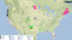
Strong to severe thunderstorms are possible Tuesday across the Southern Plains. Severe thunderstorms are possible across the Southern High Plains. Current NWS Advisories/Watches/Warnings in iMapPro An upper level trough will …
Read Storyby WeatherOps, on May 4, 2015 3:28:22 PM
Strong to severe thunderstorms are possible Tuesday across the Southern Plains. Severe thunderstorms are possible for the Southern High Plains. Southern Plains: A negative tilt shortwave trough is forecast to …
Read Storyby WeatherOps, on May 4, 2015 2:18:05 PM
Severe Thunderstorm and Tornado Watches are in effect for portions of New Mexico and Texas until 8pm CDT. Large Hail, damaging winds, and tornadoes will be possible …
Read Storyby WeatherOps, on May 4, 2015 12:46:06 PM
Showers and thunderstorms have developed across portions of the Central and Southern High Plains. As thunderstorms continue to develop across western portions of Nebraska, Kansas, Oklahoma, and Texas, large hail …
Read Storyby WeatherOps, on May 4, 2015 9:53:06 AM
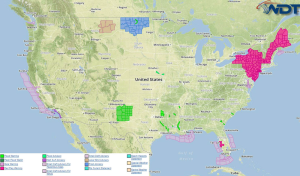
Strong to severe thunderstorms will be possible Monday across the Midwest and Southern Plains. Severe thunderstorms are possible fir the Central Plains, Missouri Valley, and Southern High Plains. Heavy rain …
Read Storyby WeatherOps, on May 1, 2015 3:25:51 PM
Isolated to scattered strong thunderstorms are possible Saturday for the Northern Plains. A cold front will begin to move southward into the Northern Plains resulting in isolated to scattered thunderstorm …
Read Storyby WeatherOps, on May 1, 2015 9:39:10 AM
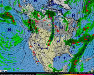
The weather pattern should continue to be relatively quiet across the nation today. Showers and a few thunderstorms will linger over the Mid-Atlantic States but at this time significant severe …
Read Storyby WeatherOps, on Apr 30, 2015 2:57:52 PM
The weather pattern should again be relatively quiet across the nation on Friday. Showers and a few thunderstorms will linger over the Mid-Atlantic States but at this time significant severe …
Read Storyby WeatherOps, on Apr 30, 2015 9:42:48 AM
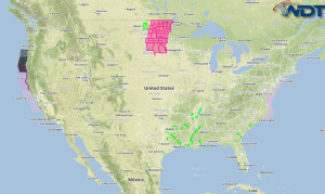
Current NWS Advisories/Watches/Warnings in iMapPro The weather pattern should be relatively quiet across the nation today. An area of low pressure will bring shower and thunderstorm activity to the Mid-Atlantic …
Read Storyby WeatherOps, on Apr 29, 2015 3:24:27 PM
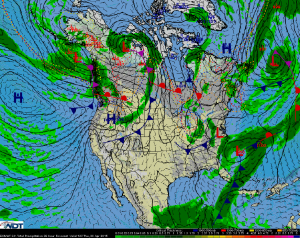
Developing surface high pressure across the Central CONUS will begin to build across the Midwest on Thursday with fair skies anticipated across the Upper Midwest and Great Plains regions. Wednesday’s …
Read Storyby WeatherOps, on Apr 29, 2015 12:36:06 PM
Thunderstorms are beginning to develop across portions of Central Florida ahead of a cold front. As thunderstorms develop, gusty winds to 45 mph will be the main hazard …
Read Storyby WeatherOps, on Apr 29, 2015 9:41:12 AM
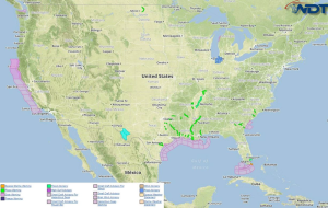
Marginally hazardous thunderstorms are possible Wednesday across Florida. Current NWS Advisories/Watches/Warnings in iMapPro A weak upper level low will progress eastward across the Southeast while a subtropical jet remains situated …
Read Storyby WeatherOps, on Apr 28, 2015 3:13:01 PM
Marginally hazardous thunderstorms are possible Wednesday across portions of Florida. A weakened upper low is forecast to push out of the Southeast on Wednesday with scattered showers and thunderstorms likely …
Read Storyby WeatherOps, on Apr 28, 2015 12:55:00 PM
Showers and thunderstorms have developed across portions of Central and Southern Florida along a stationary front. As thunderstorms continue to develop, damaging winds will be the main concern. A few …
Read Storyby WeatherOps, on Apr 28, 2015 9:49:05 AM
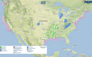
Marginally hazardous thunderstorms are possible Tuesday for Florida and the Central Gulf Coast. Current NWS Advisories/Watches/Warnings in iMapPro Modest instability and the subtropical jet aloft will support scattered showers and …
Read Storyby WeatherOps, on Apr 27, 2015 3:32:52 PM
Isolated strong to severe thunderstorms will be possible Tuesday along the Gulf Coast. The slow moving upper-level low pressure system across the Southern Plains will begin to move eastward, progressing …
Read Storyby WeatherOps, on Apr 27, 2015 12:53:06 PM
Thunderstorms will be possible this afternoon from portions of northern Texas to the northern Gulf Coast ahead of an upper level low. Where clouds have cleared, destabilization will be sufficient …
Read Storyby WeatherOps, on Apr 27, 2015 9:47:09 AM
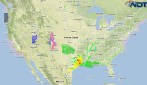
Strong to severe thunderstorms are possible Monday across East Texas and Louisiana. Moderate to heavy rain is likely across the Texas Panhandle, as well as Western and Central Oklahoma. Current …
Read Storyby WeatherOps, on Apr 24, 2015 3:27:06 PM
Isolated strong to severe thunderstorms and moderate to heavy rain is possible Saturday across portions of the Midwest and Southeast. Midwest and Southeast: As low pressure begins to track out …
Read Storyby WeatherOps, on Apr 24, 2015 2:23:30 PM
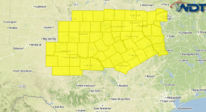
A Tornado Watch is in effect for portions of Western and North Texas until 10pm CDT. Hail to 3", damaging winds to 75 mph, and tornadoes will be possible …
Read Storyby WeatherOps, on Apr 24, 2015 12:37:26 PM
A Tornado Watch is in effect for portions of Southwest Louisiana and Southeast Texas until 6pm CDT. Hail to 2 inches, damaging winds to 70 mph, and tornadoes will be …
Read Storyby WeatherOps, on Apr 24, 2015 9:48:08 AM
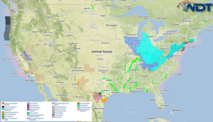
Strong to severe thunderstorms are possible Friday afternoon across the Plains. Current NWS Advisories/Watches/Warnings in iMapPro A strong upper level trough is expected to move across the Southern Plains on …
Read Storyby WeatherOps, on Apr 23, 2015 3:20:47 PM
Isolated strong to severe thunderstorms are possible Friday across the Southern Plains. A strong upper level trough is expected to move across the Southern Plains on Friday as a surface …
Read Storyby WeatherOps, on Apr 23, 2015 12:52:58 PM
Thunderstorms are developing over portions of Southern Louisiana ahead of a cold front. Through the afternoon, thunderstorms will likely become severe with hail and damaging winds becoming the main threats …
Read Storyby WeatherOps, on Apr 23, 2015 9:38:28 AM
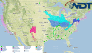
Strong to severe thunderstorms are possible Thursday across the Southern Plains. Current NWS Advisories/Watches/Warnings in iMapPro Continued instability across Texas and an area of low pressure across North Central Texas …
Read Storyby WeatherOps, on Apr 22, 2015 3:37:22 PM
Isolated strong to severe thunderstorms are possible Thursday across portions of the Southern Plains. Continued instability across Texas on Thursday combined with a passing low pressure trough across North Central …
Read Storyby WeatherOps, on Apr 22, 2015 3:31:18 PM
A Tornado Watch is in effect until 10pm CDT for portions of Southwest Oklahoma and West and Western North Texas. Hail to 3 inches, damaging winds to 70 mph, and …
Read Storyby WeatherOps, on Apr 22, 2015 12:47:40 PM
Thunderstorms are possible later this afternoon and evening across portions of North Texas ahead of a cold front and dryline. As thunderstorms develop, large hail and damaging winds will be …
Read Storyby WeatherOps, on Apr 22, 2015 11:26:21 AM
A Tornado Watch is in effect for portions of South Texas until 5pm CDT. Hail to 2 inches, damaging winds to 70 miles per hour, and tornadoes will be possible …
Read Storyby WeatherOps, on Apr 22, 2015 9:43:31 AM
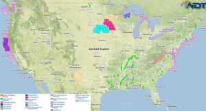
Scattered strong to severe thunderstorms are possible Wednesday for the Southern Plains. Current NWS Advisories/Watches/Warnings in iMapPro Isolated showers and thunderstorms have developed across portions of the Southern Plains as …
Read Storyby WeatherOps, on Apr 21, 2015 3:26:31 PM
Scattered strong to severe thunderstorms are possible Wednesday across the Southern Plains. Confidence continues to increase for the development of strong to severe thunderstorms on Wednesday from Oklahoma through Central …
Read Storyby WeatherOps, on Apr 21, 2015 12:51:13 PM
A few severe thunderstorms will be possible today into tonight across the Southern Plains as an area of low pressure advances out of the lee of the Rockies. As thunderstorms …
Read Storyby WeatherOps, on Apr 21, 2015 9:39:49 AM
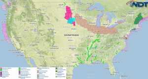
Isolated strong to marginally severe thunderstorms are possible Tuesday across the Southern Plains. Current NWS Advisories/Watches/Warnings in iMapPro A few strong to marginally severe thunderstorms are possible across the Southern …
Read Storyby WeatherOps, on Apr 20, 2015 3:30:20 PM
Isolated strong to severe thunderstorms are possible Tuesday across Northwestern Texas and Southeastern Oklahoma. While much of the country should see little in the way of any convective weather, a …
Read Storyby WeatherOps, on Apr 20, 2015 2:24:06 PM
A Tornado Watch is in effect for portions of Delaware, Maryland, New Jersey, Pennsylvania, Virginia, and West Virginia until 10pm EDT. Hail to 2", damaging winds to 70 mph, and …
Read Storyby WeatherOps, on Apr 20, 2015 2:10:00 PM
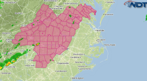
A Severe Thunderstorm Watch is in effect until 10pm EDT for portions of North Carolina and Virginia. Hail to 2", damaging winds to 70 mph, and isolated tornadoes will be …
Read Storyby WeatherOps, on Apr 20, 2015 12:30:43 PM
A Tornado Watch is in effect for portions of Georgia, North Carolina, and South Carolina until 8pm EDT. Hail to 2 inches, damaging winds to 70 mph, and tornadoes will …
Read Storyby WeatherOps, on Apr 20, 2015 12:15:43 PM
A Severe Thunderstorm Watch is in effect for portions of Eastern Florida until 7pm EDT. Hail to 1.5" and damaging winds to 70 mph will be possible …
Read Storyby WeatherOps, on Apr 20, 2015 10:24:37 AM
A Severe Thunderstorm Watch is in effect until 6pm EDT for portions of Southern Georgia and Northern Florida. Hail to 1.5 inches and damaging winds to 70 miles per hour …
Read Storyby WeatherOps, on Apr 20, 2015 9:41:05 AM
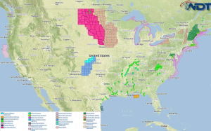
Strong to severe thunderstorms are possible Monday from the Delmarva peninsula into Georgia. Current NWS Advisories/Watches/Warnings in iMapPro A broad trough moving through the Appalachians and into the Eastern Seaboard …
Read Storyby WeatherOps, on Apr 17, 2015 3:26:34 PM
Severe thunderstorms are expected to develop Saturday afternoon across portions of the Southern Plains. An upper level low is forecast to move across the region on Saturday with a deepening …
Read Storyby WeatherOps, on Apr 17, 2015 12:41:54 PM
Thunderstorms are continuing to develop across portions of Texas ahead of a dry line. As thunderstorms continue to develop, large hail, damaging winds, and isolated tornadoes will be possible. By …
Read Storyby WeatherOps, on Apr 17, 2015 12:09:27 PM
A Severe Thunderstorm Watch is in effect until 7pm CDT for portions of Western, North, and Central Texas. Hail to 2 inches, damaging winds to 70 mph, and isolated tornadoes …
Read Storyby WeatherOps, on Apr 17, 2015 9:45:54 AM
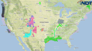
Severe thunderstorms are expected to develop across the Southern Plains Friday afternoon and continue through the evening. Current NWS Advisories/Watches/Warnings in iMapPro A cutoff low over the Four Corners region …
Read Storyby WeatherOps, on Apr 16, 2015 3:39:47 PM
Strong to severe thunderstorms are possible Friday for portions of Southern Texas and Louisiana. Severe thunderstorms are possible for Western Kansas. Southern Texas & Louisiana: A weak front along with …
Read Storyby WeatherOps, on Apr 16, 2015 2:31:04 PM
A Severe Thunderstorm Watch is in effect for portions of Texas until 10pm. Large hail to 2 inches and damaging winds to 70 mph will be possible …
Read Storyby WeatherOps, on Apr 16, 2015 1:57:52 PM
A Tornado Watch is in effect for portions of the Oklahoma and Texas Panhandles until 10pm CDT. Hail to 2", damaging winds to 70 mph, and tornadoes will be possible …
Read Storyby WeatherOps, on Apr 16, 2015 12:52:26 PM
Thunderstorms are developing across portions of Kansas, Oklahoma, and Texas as a lee trough continues to deepen and move eastward. An enhanced risk of severe thunderstorms extends from Southwestern Kansas …
Read Storyby WeatherOps, on Apr 16, 2015 9:48:41 AM
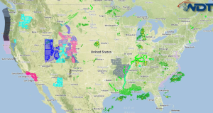
Severe thunderstorms and moderate to heavy rain is possible Thursday for portions of the Southern Plains. Moderate to heavy snow will continue for the Central Rockies. Current NWS Advisories/Watches/Warnings in …
Read Storyby WeatherOps, on Apr 15, 2015 3:27:57 PM
Moderate to heavy rain and severe thunderstorms are possible Thursday for the Southern Plains. Moderate to heavy snow will continue for the Central Rockies. Southern Plains: Showers and thunderstorms are …
Read Storyby WeatherOps, on Apr 15, 2015 9:41:53 AM
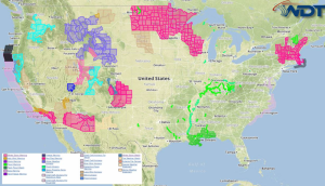
Heavy rain will continue Wednesday across portions of the Southeast. Moderate to heavy snow is likely across the Central Rockies. Strong to severe thunderstorms are possible for portions of Oklahoma …
Read Storyby WeatherOps, on Apr 14, 2015 3:36:52 PM
Heavy rain will continue Wednesday across the Southeast. Moderate to heavy snow is possible across the Central Rockies. Strong to severe thunderstorms are possible across the Southern Plains. Southeast: Conditions …
Read Storyby WeatherOps, on Apr 14, 2015 12:43:50 PM
Heavy rain is continuing along portions of the Northern Gulf Coast ahead of an advancing cold front. As thunderstorms continue, 1-2 inches of rain will be common, but some areas …
Read Storyby WeatherOps, on Apr 14, 2015 9:37:54 AM
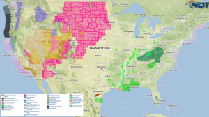
Heavy rain is expected Tuesday across the Gulf Coast and Southeast. Up to 2 inches of rain will be possible. NWS Advisories/Watches/Warnings in iMapPro A series of disturbances will interact …
Read Storyby WeatherOps, on Apr 13, 2015 3:26:41 PM
Heavy rain is likely on Tuesday for the Gulf Coast and the Southeast. A series of passing disturbances will interact with an advancing cold front and abundant Gulf moisture to …
Read Storyby WeatherOps, on Apr 13, 2015 12:55:14 PM
Thunderstorms are developing across Central Texas ahead of a cold front moving across the Southern Plains. As thunderstorms continue to develop, large hail will be the main concern, but damaging …
Read Storyby WeatherOps, on Apr 13, 2015 9:52:43 AM
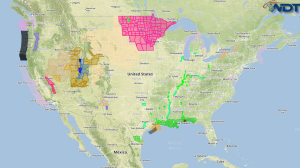
Isolated to scattered strong to severe thunderstorms are possible Monday for Central and South Texas. Heavy rain is possible from Eastern Oklahoma to Western Tennessee and across portions of Southeast …
Read Storyby WeatherOps, on Apr 10, 2015 3:28:50 PM
Isolated strong to severe thunderstorms are possible Saturday for the Southern High Plains. High pressure over the Eastern CONUS will keep a lid on much of the country on Saturday …
Read Storyby WeatherOps, on Apr 10, 2015 12:47:15 PM
Thunderstorms are developing across the Southeast ahead of a cold front and will continue to increase in coverage through the afternoon. With any storms that develop, large hail and damaging …
Read Storyby WeatherOps, on Apr 10, 2015 9:40:11 AM
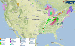
Strong to severe thunderstorms are possible from the Mid Atlantic to the Lower Mississippi Valley and into Texas. Current NWS Advisories, Watches, and Warnings in iMapPro Severe activity will come …
Read Storyby WeatherOps, on Apr 9, 2015 3:24:23 PM
There is a slight risk for thunderstorms Friday for portions of the Mid Atlantic, Southeast, and Gulf Coast. By Friday, the risk for more widespread and significant severe weather should …
Read Storyby WeatherOps, on Apr 9, 2015 3:05:35 PM
A Severe Thunderstorm Watch is in effect for portions of Arkansas, Missouri, and Oklahoma until 10pm CDT. Hail to 2.5", damaging winds to 70 mph, and isolated tornadoes will be …
Read Storyby WeatherOps, on Apr 9, 2015 2:57:00 PM
A Tornado Watch is in effect until 11pm CDT for portions of Illinois, Indiana, and Wisconsin. Hail to 2.5", damaging winds to 80 mph, and tornadoes will be possible …
Read Storyby WeatherOps, on Apr 9, 2015 1:46:52 PM
A Severe Thunderstorm Watch is in effect until 10pm EDT for portions of Kentucky, Ohio, and West Virginia. Hail to 2" and damaging winds to 70 miles per hour will …
Read Storyby WeatherOps, on Apr 9, 2015 1:16:12 PM
A Tornado Watch is in effect until 8pm CDT for portions of Iowa, Illinois, and Missouri. Primary threats include Hail to 2.5", damaging winds to 75 mph, and tornadoes …
Read Storyby WeatherOps, on Apr 9, 2015 12:45:54 PM
Severe thunderstorms are likely today across the Mississippi Valley ahead of an area of low pressure and the attendant cold front. As thunderstorms develop, large hail, damaging winds, and tornadoes …
Read Storyby WeatherOps, on Apr 9, 2015 9:54:07 AM
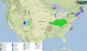
Severe thunderstorms are possible Thursday across the Midwest and Mississippi Valley. Across Upper Michigan, locally heavy snowfall will be possible. A mix of sleet and freezing rain is possible for …
Read Storyby WeatherOps, on Apr 8, 2015 3:27:06 PM
Severe thunderstorms are likely Thursday from the Midwest to the Lower Great Lakes. There is a slight risk for severe thunderstorms from the Southern Plains to the Great Lakes. Moderate …
Read Storyby WeatherOps, on Apr 8, 2015 3:17:44 PM
A Severe Thunderstorm Watch is in effect until 7pm CDT for portions of Arkansas, Kansas, Missouri, and Oklahoma. Hail to 3", damaging winds to 70 miles per hour, and isolated …
Read Storyby WeatherOps, on Apr 8, 2015 1:34:30 PM
A Severe Thunderstorm Watch is in effect until 6pm CDT for portions of Illinois, Indiana, and Missouri. Hail to 2.5", damaging winds to 70 mph, and isolated tornadoes will be …
Read Storyby WeatherOps, on Apr 8, 2015 12:32:35 PM
There is a moderate risk of severe weather today for portions of Kansas, Oklahoma, and Missouri. As thunderstorms begin to develop, they will become severe with the potential for large …
Read Storyby WeatherOps, on Apr 8, 2015 11:53:19 AM
A Severe Thunderstorm Watch is in effect for portions of Kentucky, Ohio, Virginia, and West Virginia until 6pm EDT. Hail to 1.5" and damaging winds to 70 mph will be …
Read Storyby WeatherOps, on Apr 8, 2015 9:50:26 AM
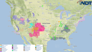
There will be an enhanced to moderate risk for severe thunderstorms Wednesday across the Southern and Central Plains, as well as the Missouri Valley. There is a conditional to slight …
Read Storyby WeatherOps, on Apr 7, 2015 3:30:15 PM
Severe thunderstorms are possible Wednesday for the Southern and Central Plains as well as the Missouri Valley to the Midwest. Moderate snow is likely for the Northern Rockies. Southern/Central Plains: …
Read Storyby WeatherOps, on Apr 7, 2015 12:37:18 PM
Thunderstorms are moving across portions of the Ohio River Valley to the south of a warm front and will continue to move eastward through the afternoon. Large hail and damaging …
Read Storyby WeatherOps, on Apr 7, 2015 9:48:48 AM
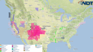
Severe thunderstorms are possible Tuesday across the Central Plains, Midwest, Southern Appalachians, and North Central California. Moderate to heavy snow is likely across the Sierra Nevada. Current NWS Advisories/Watches/Warnings in …
Read Storyby WeatherOps, on Apr 6, 2015 3:47:10 PM
Moderate to heavy snow is likely across the Sierra Nevada on Tuesday. Severe thunderstorms are possible across the Southern Plains. Sierra Nevada: Deepening, but sluggish, trough of low pressure over …
Read Storyby WeatherOps, on Apr 6, 2015 12:44:06 PM
Severe thunderstorms are possible today across portions of the Mississippi Valley as daytime heating and moisture advection contributes to destabilization. Thunderstorms will be possible this afternoon and evening. While coverage …
Read Storyby WeatherOps, on Apr 6, 2015 9:47:59 AM
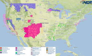
Moderate to heavy snow is likely today across the Northern Rockies, California Cascades, and Upper New England. Strong to severe thunderstorms are possible for West Central Texas and the Del …
Read Storyby WeatherOps, on Apr 3, 2015 3:16:24 PM
The cold front that brought the risk of severe thunderstorms will move into the Northern Gulf and offshore of the Southeastern US on Saturday allowing for the continued chance of …
Read Storyby WeatherOps, on Apr 3, 2015 12:41:37 PM
A Tornado Watch is in effect until 9pm CDT for portions of Arkansas, Illinois, Indiana, Kentucky, Missouri, and Tennessee. Hail to two inches, damaging winds to 80 miles per hour, …
Read Storyby WeatherOps, on Apr 3, 2015 9:47:52 AM
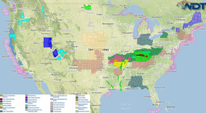
Severe thunderstorms are possible Friday from Eastern Texas to the Ohio Valley. Current NWS Advisories/Watches/Warnings in iMapPro A strong trough will continue to move eastward on Friday allowing for scattered …
Read Storyby WeatherOps, on Apr 2, 2015 3:30:22 PM
Severe thunderstorms are possible Friday from portions of East Texas into the Ohio Valley. Eastern Texas into the Ohio Valley: A trough of low pressure is expected to continue moving …
Read Storyby WeatherOps, on Apr 2, 2015 2:29:25 PM
A Severe Thunderstorm Watch is in effect until 10pm EDT for portions of Indiana and Kentucky. Hail to 2" and damaging winds to 70 mph will be possible …
Read Storyby WeatherOps, on Apr 2, 2015 12:57:26 PM
Thunderstorms are continuing to develop across the Ohio and Mississippi Valleys ahead of an approaching front. As thunderstorms continue to develop, large hail, damaging winds, and isolated tornadoes will be …
Read Storyby WeatherOps, on Apr 2, 2015 10:42:35 AM
Severe thunderstorms are beginning to develop across portions of the Plains and the Mississippi Valley ahead of a cold front. Ahead of the front, moisture advection and daytime heating will …
Read Storyby WeatherOps, on Apr 1, 2015 3:44:48 PM
Severe thunderstorms are possible Wednesday across the Mid Mississippi and Ohio Valleys. Heavy rain and flooding are possible for the Mid-Mississippi Valley. Oklahoma into the Ohio Valley: Low pressure is …
Read Storyby WeatherOps, on Apr 1, 2015 9:51:33 AM
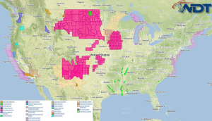
Strong to severe thunderstorms are possible Wednesday across the Central Plains and Upper Midwest and across the Arklatex region. Current NWS Advisories/Watches/Warnings in iMapPro An area of low pressure moving …
Read Storyby WeatherOps, on Mar 31, 2015 3:24:47 PM
Severe thunderstorms are possible Wednesday across the Central Plains. Large hail, damaging winds, and tornadoes are possible. A low pressure system emerging out of the Central Rockies on Wednesday will …
Read Storyby WeatherOps, on Mar 31, 2015 2:04:31 PM
A Severe Thunderstorm Watch is in effect until 7pm CDT for portions of Arkansas and Mississippi. Large hail to 2" and damaging winds will be the main threats …
Read Storyby WeatherOps, on Mar 31, 2015 1:46:31 PM
A Severe Thunderstorm Watch is in effect for portions of Alabama and Georgia until 8pm EDT. Large hail to 2" and damaging winds to 70 mph will be the primary …
Read Storyby WeatherOps, on Mar 31, 2015 12:57:20 PM
Thunderstorms will be possible across the Southeast and Southern Plains this afternoon and tonight ahead of an area of low pressure. Daytime heating will contribute to moderate instability across these …
Read Storyby WeatherOps, on Mar 31, 2015 9:46:41 AM
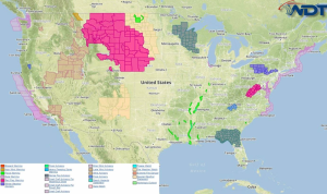
Strong to severe thunderstorms are possible Tuesday across Southwestern Oklahoma and Northwestern Texas. Current NWS Advisories/Watches/Warnings in iMapPro There will be a limited severe weather threat Tuesday afternoon and evening …
Read Storyby WeatherOps, on Mar 30, 2015 3:41:11 PM
Severe thunderstorms are possible Tuesday for portions of the Southern Plains. On Tuesday, a threat for hazardous thunderstorms is forecast across the Southern Plains and into the upper Mississippi Delta …
Read Storyby WeatherOps, on Mar 30, 2015 12:45:38 PM
Thunderstorms are developing across portions of the Southeast ahead of a cold front. As daytime heating increases, more thunderstorms will be likely across portions of Mississippi, Alabama, Florida, and Georgia …
Read Storyby WeatherOps, on Mar 30, 2015 9:49:40 AM
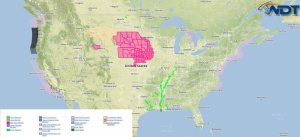
Strong to severe thunderstorms will be possible Monday along the Gulf Coast. Winds greater than 40 miles per hour and hail to 1" will be possible. Current NWS Advisories/Watches/Warnings in …
Read Storyby WeatherOps, on Mar 27, 2015 3:39:56 PM
A rain and snow mix is likely Saturday across the Pacific Northwest and Northern Rockies. Rainfall accumulations of 2 inches will be possible. A frontal boundary will approach the Northwestern …
Read Storyby WeatherOps, on Mar 27, 2015 12:51:44 PM
Thunderstorms are developing across Florida ahead of an area of low pressure. Most of the thunderstorm development will be non severe, but a few thunderstorms may become severe with hail …
Read Storyby WeatherOps, on Mar 27, 2015 9:44:36 AM
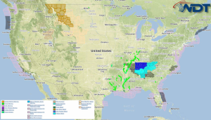
Light snow will continue for portions of the Interior Northeast Friday morning. Severe thunderstorms are possible across Florida. Current NWS Advisories/Watches/Warnings in iMapPro An area of low pressure over the …
Read Storyby WeatherOps, on Mar 26, 2015 3:24:14 PM
Light snow will continue for the Interior Northeast on Friday, ending by afternoon. The Low pressure system across the Northeastern United States will push offshore Friday morning, leaving behind limited …
Read Storyby WeatherOps, on Mar 26, 2015 12:51:09 PM
Heavy rain will continue along the Northern Gulf Coast ahead of an area of low pressure in the northern Gulf of Mexico. Up to 2.5 inches of rain will be …
Read Storyby WeatherOps, on Mar 26, 2015 9:47:58 AM
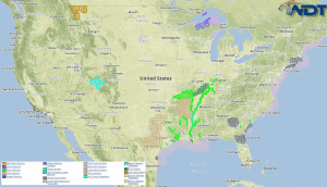
Light to moderate snow will be possible Thursday for the Interior Northeast. Strong to severe thunderstorms are possible across the Mid Atlantic. Moderate to heavy rain is possible along the …
Read Storyby WeatherOps, on Mar 25, 2015 3:30:08 PM
Moderate snow is likely Thursday for portions of the Interior Northeast. Low pressure system is forecast to move eastward from the Southern Canada through the Northeast on Thursday allowing for …
Read Storyby WeatherOps, on Mar 25, 2015 2:36:54 PM
A Severe Thunderstorm Watch is in effect until 10pm CDT for portions of Arkansas, Kansas, Missouri, and Oklahoma. Hail to 2.5", damaging winds to 70 mph, and isolated tornadoes will …
Read Storyby WeatherOps, on Mar 25, 2015 12:44:33 PM
Severe thunderstorms are developing across portions of the Southern Plains ahead of an area of low pressure. Throughout the day, a warm front will continue to move northward and thunderstorms …
Read Storyby WeatherOps, on Mar 25, 2015 9:48:17 AM
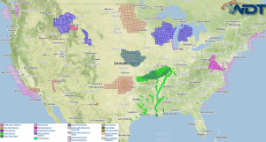
Strong to severe thunderstorms are expected by Tuesday afternoon across the Mississippi Valley and Central Plains. Light to moderate snow will end across the Northern Great Lakes by late morning …
Read Storyby WeatherOps, on Mar 24, 2015 3:33:25 PM
Strong to severe thunderstorms are possible Tuesday for the Mississippi Valley and Southern Plains. Light to moderate snow is possible across the Northern Great Lakes. Mississippi Valley and Southern Plains: …
Read Storyby WeatherOps, on Mar 24, 2015 12:58:42 PM
Thunderstorms are developing across the Central Plains and the Mid Mississippi Valley along a warm front. As thunderstorms begin to develop later this afternoon, hail and damaging winds will be …
Read Storyby WeatherOps, on Mar 24, 2015 9:46:57 AM
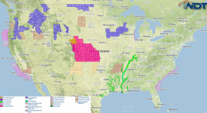
Strong to isolated severe thunderstorms are possible Tuesday across the Mississippi Valley and Central Plains. Light to moderate snow and light icing will be possible for the Northern Great Lakes …
Read Storyby WeatherOps, on Mar 23, 2015 3:33:30 PM
Strong to severe thunderstorms are possible Tuesday across the Mississippi Valley and Southern Plains. Moderate to heavy snow and light icing will be possible for the Northern Plains and Northern …
Read Storyby WeatherOps, on Mar 23, 2015 12:56:40 PM
Thunderstorms are developing across Florida ahead of an area of low pressure and an attendant cold front. As thunderstorms continue to develop through the afternoon, hail and possibly some gusty …
Read Storyby WeatherOps, on Mar 23, 2015 9:48:38 AM
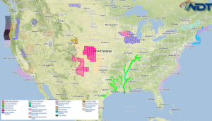
Strong to isolated severe thunderstorms are possible Monday for portions of the Northern Rockies and Central Plains. Light to moderate snow is possible in the higher elevations of the Pacific …
Read Storyby WeatherOps, on Mar 13, 2015 3:13:28 PM
Moderate to heavy snow is possible Saturday for New England. Severe thunderstorms are possible for the Mid Atlantic and Southeast. Heavy rainfall is likely for the Pacific Northwest. New England: …
Read Storyby WeatherOps, on Mar 13, 2015 12:43:55 PM
Thunderstorms will be possible today across portions of the Southeast today ahead of an area of low pressure. A few storms will have the potential to become severe with gusty …
Read Storyby WeatherOps, on Mar 13, 2015 9:41:44 AM
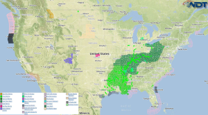
Heavy rainfall will continue today across the Southeast and Midwest. Across the Southeast, there will be a slight risk for thunderstorms. Current NWS Advisories/Watches/Warnings in iMapPro An area of low …
Read Storyby WeatherOps, on Mar 12, 2015 3:29:08 PM
Heavy rainfall will be possible on Friday across portions of the Southeast and the Midwest. A low pressure area will continue lifting northward through western portions of the Southeast on …
Read Storyby WeatherOps, on Mar 12, 2015 12:47:10 PM
Thunderstorms will be possible this afternoon and evening to the north of a warm front. While widespread severe weather is not anticipated, a few thunderstorms could be strong to marginally …
Read Storyby WeatherOps, on Mar 12, 2015 9:51:39 AM
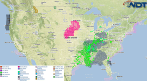
Strong thunderstorms will be possible today across Louisiana and Southwest Mississippi. Heavy rain is likely across the South Central US. Current NWS Advisories/Watches/Warnings in iMapPro An area of low pressure …
Read Storyby WeatherOps, on Mar 10, 2015 12:49:31 PM
Showers and thunderstorms are continuing across the Southeast ahead of an area of low pressure over the Ohio River Valley. Gusty winds and heavy rain will be the main concerns …
Read Storyby WeatherOps, on Mar 10, 2015 9:38:06 AM
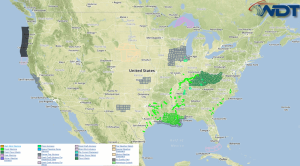
Thunderstorms, some occasionally strong, will be possible Tuesday for portions of Louisiana, Mississippi, and Alabama. Current NWS Advisories/Watches/Warnings in iMapPro An area of low pressure in Louisiana will move northeastward, …
Read Storyby WeatherOps, on Mar 9, 2015 4:00:29 PM
No significant weather hazards are anticipated on Tuesday. Shortwave of low pressure is forecast to lift into the Ohio Valley. Shower and any general thunderstorm activity will also translate across …
Read Storyby WeatherOps, on Mar 9, 2015 12:40:06 PM
An area of heavy rain will continue to move across the Arklatex region today and tonight. 2-4 inches of rain will be possible, contributing to the flooding potential Creeks and …
Read Storyby WeatherOps, on Mar 9, 2015 9:47:48 AM
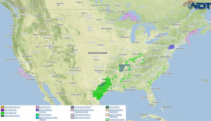
Excessive rainfall is likely Monday across the Arklatex region. Current NWS Advisories/Watches/Warnings in iMapPro A broad trough of low pressure remains in place across the Southern Plains. Ongoing showers and …
Read Storyby WeatherOps, on Mar 6, 2015 3:30:27 PM
Light snow is possible Saturday for Western New York. A weak disturbance will skim through the Great Lakes towards New York on Saturday, allowing for generally light snowfall of around …
Read Storyby WeatherOps, on Mar 6, 2015 9:07:19 AM
No significant weather hazards are anticipated on Friday as much of the country remains under the influence of high pressure. For the weekend, a weak disturbance moving across the Great …
Read Storyby WeatherOps, on Mar 5, 2015 3:28:27 PM
No significant weather hazards are anticipated on Friday as much of the country remains under the influence of high pressure …
Read Storyby WeatherOps, on Mar 5, 2015 12:53:40 PM
Heavy snow is continuing across the Mid Atlantic and will begin to wind down by late afternoon. Where snow is the heaviest, snowfall rates of 1-2 inches per hour will …
Read Storyby WeatherOps, on Mar 5, 2015 9:58:51 AM
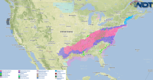
Moderate to heavy snow is likely on Thursday from Tennessee to lower New England. Mixed wintry precipitation is likely from Louisiana through the Virginias. Non severe thunderstorms are possible from …
Read Storyby WeatherOps, on Mar 4, 2015 3:27:38 PM
Light to moderate snow is expected on Thursday from the Tennessee Valley to the Mid Atlantic. Tennessee Valley to New England Coast: Winter weather finally comes to an end on …
Read Storyby WeatherOps, on Mar 4, 2015 12:43:49 PM
A wintry mix of freezing rain, sleet, and snow will continue for portions of the Southern Plains through tonight. Freezing rain will slowly transition to sleet and eventually snow throughout …
Read Storyby WeatherOps, on Mar 4, 2015 9:47:27 AM
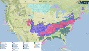
A light to moderate mix of freezing rain, sleet, and snow is expected Wednesday from the Southern Plains to the Northeast. Light to moderate snow will be possible across the …
Read Storyby WeatherOps, on Mar 3, 2015 3:37:07 PM
Light to moderate freezing rain, sleet, and snow is possible Wednesday from the Southern Plains to Ohio Valley. Light to moderate snow is possible across the Central and Southern Rockies …
Read Storyby WeatherOps, on Mar 3, 2015 12:56:07 PM
Wintry precipitation will continue across the Northeast ahead of an area of low pressure. Snow, sleet, and freezing rain will all be possible. Heavy snow with snowfall rates of one …
Read Storyby WeatherOps, on Mar 3, 2015 9:51:36 AM
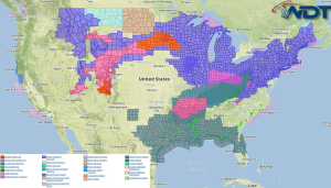
Moderate to heavy snow is likely across the Upper Midwest and Great Lakes on Tuesday. Light to moderate snow will be possible across the Central Rockies and the Colorado Front …
Read Storyby WeatherOps, on Mar 2, 2015 3:37:20 PM
Moderate to heavy snow is possible Tuesday for the Central Rockies and from the Great Lakes to the Northeast. Moderate to heavy freezing rain and sleet is possible from the …
Read Storyby WeatherOps, on Mar 2, 2015 12:52:20 PM
Snow will continue through tomorrow ahead an area of low pressure for portions of the Southern Rockies. Heavy snow will be possible at times with as much as 2 feet …
Read Storyby WeatherOps, on Mar 2, 2015 9:49:28 AM
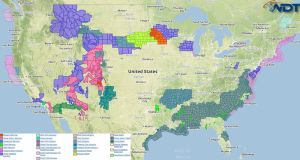
Moderate to heavy snow is likely Monday across the Four Corners region and Southern Rockies. Current NWS Advisories/Watches/Warnings in iMapPro Snow showers and moderate to heavy snow will be likely …
Read Storyby WeatherOps, on Feb 27, 2015 3:34:14 PM
Light to moderate snow will continue for the Central Plains on Saturday. Some light icing will be possible. Light to moderate snow is possible for the Four Corners and Southern …
Read Storyby WeatherOps, on Feb 27, 2015 12:50:06 PM
Light snow will continue across Oklahoma and North Texas through the afternoon. Up to 4 inches of snow will be possible. Roads may be slick, especially bridges and overpasses. Winter …
Read Storyby WeatherOps, on Feb 27, 2015 9:42:11 AM
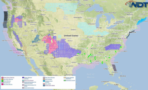
Light to moderate snow is possible Friday from the Southern Rockies to the Southern Plains; locally heavy accumulations possible. Scattered rain and snow showers are possible across the Western US; …
Read Storyby WeatherOps, on Feb 26, 2015 3:37:11 PM
Light to moderate snow is possible Friday from the Southern Rockies to the Southern Plains. Scattered rain and snow showers are possible across the Western US; light to moderate snow …
Read Storyby WeatherOps, on Feb 26, 2015 12:54:16 PM
Light snow will continue across portions of Northwest Texas through this afternoon. 1-3 inches of snow is likely between Abilene and Wichita Falls. Slick roads will be the main concern, …
Read Storyby WeatherOps, on Feb 26, 2015 9:42:36 AM
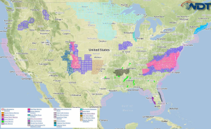
Light to moderate snow is possible Thursday across the Southern Rockies. Current NWS Advisories/Watches/Warnings in iMapPro A weak area of low pressure will move across the Four Corners region on …
Read Storyby WeatherOps, on Feb 25, 2015 3:58:43 PM
Light to moderate snow is possible Thursday across the Southern Rockies. Another weak low pressure system will move across the Four Corners region toward the Southern Plains on Thursday allowing …
Read Storyby WeatherOps, on Feb 25, 2015 12:35:36 PM
A wintry mix of precipitation will continue across portions of the Mid South and Southeast through tonight. Snow, sleet, and freezing rain will continue through tonight with as much as …
Read Storyby WeatherOps, on Feb 24, 2015 9:48:46 AM
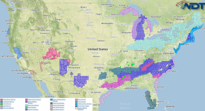
Light to moderate snow will continue Tuesday for the Four Corners region. Light snow will be possible through midday from Northern Georgia to North Carolina. Current NWS Advisories/Watches/Warnings in iMapPro …
Read Storyby WeatherOps, on Feb 23, 2015 3:35:53 PM
Moderate to heavy snow will continue on Tuesday for the Four Corners region. Four Corners: Snow will continue through the region through the overnight hours and into the day on …
Read Storyby WeatherOps, on Feb 23, 2015 12:51:13 PM
Wintry precipitation will continue through tonight across portions of Arkansas, Louisiana, Oklahoma, and Texas. 1-3 inches of snow will be possible for portions of Arkansas and Oklahoma. Across northern portions …
Read Storyby WeatherOps, on Feb 23, 2015 9:54:25 AM
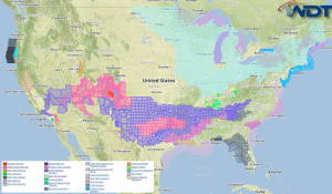
Moderate to heavy snow continues Monday across the Four Corners region. Light to moderate snow will be possible across the Southern Plains. Current NWS Advisories/Watches/Warnings in iMapPro Lingering snow across …
Read Storyby WeatherOps, on Feb 20, 2015 3:45:59 PM
Moderate snow is likely and icing is possible Saturday from the Midwest to the Northeast. Moderate to heavy snow is likely across the Central Rockies. Central Rockies:Low pressure will exit …
Read Storyby WeatherOps, on Feb 20, 2015 12:51:40 PM
Wintry precipitation will continue today through tomorrow morning across portions of the Midsouth and Ohio River Valley. Freezing rain, sleet, and snow is possible for much of the region. Up …
Read Storyby WeatherOps, on Feb 20, 2015 9:49:39 AM
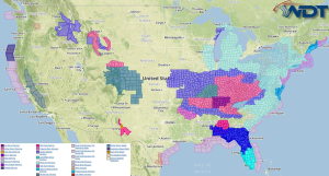
Light to moderate icing and light snow is possible Friday across the Midwest. Light snow is also expected across the Great Lakes. Moderate snow is likely across the Northern and …
Read Storyby WeatherOps, on Feb 19, 2015 8:22:14 AM
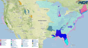
Moderate to heavy snow and below zero wind chills are expected Thursday across the Northeast. Current NWS Advisories/Watches/Warnings in iMapPro An area of low pressure moving through the Northeast will …
Read Storyby WeatherOps, on Feb 18, 2015 3:39:22 PM
Moderate to heavy snowfall and below zero wind chills will be possible Thursday across the Northeast. Into Thursday, the low moving through the Northeast will deepen and produce additional snow …
Read Storyby WeatherOps, on Feb 18, 2015 12:47:25 PM
Snow will continue across portions of the Appalachians ahead of an area of low pressure. 4-8 inches of snow, in addition to high winds, be possible through tonight. Blowing snow, …
Read Storyby WeatherOps, on Feb 18, 2015 9:38:32 AM
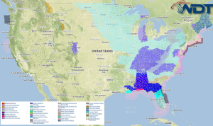
Light to moderate snow, as well as low to below zero wind chills are possible Wednesday from the Great Lakes into the Northeast. Current NWS Advisories/Watches./Warnings in iMapPro Light to …
Read Storyby WeatherOps, on Feb 17, 2015 3:44:30 PM
Light to moderate snow is expected on Wednesday for the Great Lakes and Northeast. Great Lakes through Northeastern US:Light to occasionally moderate snowfall will be possible on Wednesday as another …
Read Storyby WeatherOps, on Feb 17, 2015 12:56:07 PM
Snow will continue for portions of Northeastern Kansas and Southeastern Nebraska along a stationary front. Up to 4 inches of snow will be possible through tonight. In addition, winds to …
Read Storyby WeatherOps, on Feb 17, 2015 9:46:35 AM
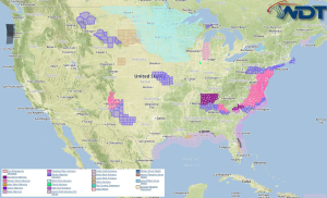
Moderate to heavy snow and mixed winter precipitation will continue through Tuesday morning. Light snow will continue across portions of New Mexico and West Texas. Current NWS Advisories/Watches/Warnings in ImapPro …
Read Storyby WeatherOps, on Feb 16, 2015 3:24:17 PM
Moderate to heavy snow and mixed wintry precipitation is expected Tuesday from the Central Atlantic through the Northeast. Central Atlantic through Northeast:Mixed winter precipitation in association with a low pressure …
Read Storyby WeatherOps, on Feb 16, 2015 12:59:55 PM
Heavy snow is continuing across the Ohio River Valley ahead of an area of low pressure. As snow continues, the intensity will likely increase through the afternoon with snowfall rates …
Read Storyby WeatherOps, on Feb 16, 2015 9:41:14 AM
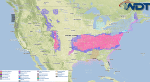
Moderate to heavy snow and light to heavy precipitation is expected Monday for the Midwest, Deep South, and Southern Mid Atlantic. Current NWS Advisories/Watches/Warnings in iMapPro Winter precipitation will transition …
Read Storyby WeatherOps, on Feb 13, 2015 3:36:50 PM
Moderate to heavy snow is likely Saturday across the Northeast. Light to moderate snow is possible across the Northern Plains. Northeast:Low pressure will deepen across the Mid-Atlantic region on Saturday …
Read Storyby WeatherOps, on Feb 13, 2015 12:49:48 PM
Blizzard conditions will be possible for portions of the Great Lakes from this afternoon through Saturday evening ahead of a shortwave trough. Snow amounts will be as much as 6 …
Read Storyby WeatherOps, on Feb 13, 2015 9:30:19 AM
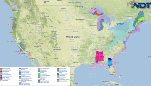
Light to moderate snow will continue Friday for the Great Lakes and Michigan. Current NWS Advisories/Watches/Warnings in iMapPro An upper level low will dig across Manitoba and into the Upper …
Read Storyby WeatherOps, on Feb 12, 2015 3:31:17 PM
No significant weather hazards are expected across the country on Friday. Low pressure over the Great Lakes region will contribute to perhaps an extended period of light snow for parts …
Read Storyby WeatherOps, on Feb 12, 2015 12:44:33 PM
Snow is continuing across portions of the Northeast and Appalachians ahead of a shortwave trough. While most areas will receive 2-4 inches of snow, some areas may pick up as …
Read Storyby WeatherOps, on Feb 12, 2015 9:48:45 AM
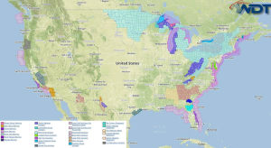
Lake effect snow will continue Thursday for the Upper Peninsula of Michigan. Light to moderate snow is possible across much of West Virginia. Current NWS Advisories/Watches/Warnings in iMapPro Ongoing lake …
Read Storyby WeatherOps, on Feb 11, 2015 3:28:51 PM
Light to moderate snow is possible Thursday across the Central Atlantic through the Northeast. Low pressure system will be moving out of the Great Lakes and through the Northeast on …
Read Storyby WeatherOps, on Feb 11, 2015 12:50:12 PM
Light snow is continuing across the Great Lakes and Northeast ahead of a shortwave trough. 1-2 inches of snow will be possible across portions of the region. In addition, low …
Read Storyby WeatherOps, on Feb 11, 2015 9:36:49 AM
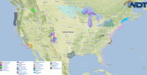
Light to moderate snow is likely Wednesday across the Great Lakes. Current NWS Advisories/Watches/Warnings in iMapPro An area of low pressure will bring a chance of snow to portions of …
Read Storyby WeatherOps, on Feb 10, 2015 3:30:35 PM
Light to moderate snow is possible Wednesday across the Great Lakes. A potent low pressure system will just be taking shape across the Upper Midwest late on Wednesday. Developing light …
Read Storyby WeatherOps, on Feb 10, 2015 12:51:21 PM
Snow is continuing across portions of Minnesota and Wisconsin ahead of a shortwave trough. 3-5 inches of additional snow will be possible in some areas, but strong winds will allow …
Read Storyby WeatherOps, on Feb 10, 2015 9:43:26 AM
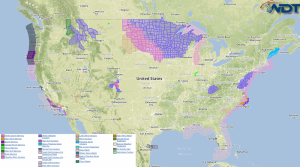
Light to moderate snow is likely Tuesday across the Northern Plains, Western Great Lakes, and Rockies. Current NWS Advisories/Watches/Warnings in iMapPro A fast moving clipper system will cross through the …
Read Storyby WeatherOps, on Feb 9, 2015 3:47:04 PM
Light to moderate snow will be possible Tuesday across the Upper Midwest and Northern Rockies. Northern Rockies: Several upper disturbances will overspread the Northern Rockies on Tuesday with moderate to …
Read Storyby WeatherOps, on Feb 9, 2015 12:51:23 PM
Snow is continuing across New England as an area of low pressure continues to exit the region. Many areas will see storm totals as high as 6-12 inches of snow …
Read Storyby WeatherOps, on Feb 9, 2015 9:44:31 AM
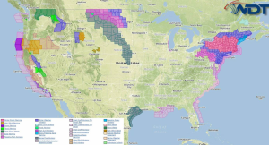
Light to moderate snow will be possible Monday across the Northeast. Scattered showers will continue for the Pacific Northwest. Thunderstorms will be possible across Northern Florida. Current NWS Advisories/Watches/Warnings in …
Read Storyby WeatherOps, on Feb 6, 2015 3:50:09 PM
Heavy rain and the flooding threat continues Saturday for the West Coast. Moderate snowfall possible for Northern Minnesota and the Northern Great Lakes. West Coast: Rain will continue across the …
Read Storyby WeatherOps, on Feb 6, 2015 12:55:43 PM
Rain is continuing along the West Coast ahead of an upper level system over the Pacific. Ahead of this system, moisture is streaming into the region, allowing for very heavy …
Read Storyby WeatherOps, on Feb 6, 2015 9:47:06 AM
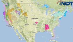
Heavy to excessive rainfall and flash flooding will continue Friday along the West Coast. Current NWS Advisories/Watches/Warnings in iMapPro A series of low pressure systems moving into the Western US …
Read Storyby WeatherOps, on Feb 5, 2015 3:36:17 PM
Heavy to excessive rainfall and flash flooding is likely Friday along the West Coast. West Coast: The ongoing rain event will intensify considerably across the region on Friday. A widespread …
Read Storyby WeatherOps, on Feb 5, 2015 12:51:18 PM
Heavy rain is beginning along the west coast ahead of an area of low pressure moving onshore. .75 to 2 inches of rain will be possible in most areas, in …
Read Storyby WeatherOps, on Feb 5, 2015 9:42:55 AM
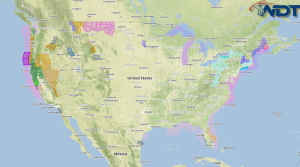
Heavy rain is likely Thursday along the West Coast. Heavy rain and thunderstorms will be likely across Florida. Moderate snow will continue for eastern Maine through the morning. Current NWS …
Read Storyby WeatherOps, on Feb 4, 2015 3:30:44 PM
Heavy rain and flash flooding are likely on Thursday along the coast of the Pacific Northwest. Pacific Northwest Coast: Another low pressure system will begin overspreading the Pacific Northwest Coast …
Read Storyby WeatherOps, on Feb 4, 2015 12:40:42 PM
Snow will continue across portions of the Plains and Midwest from portions of Kansas to Northern Ohio. 2-5 inches will be possible in some areas. Snow intensity will be heavy …
Read Storyby WeatherOps, on Feb 4, 2015 9:36:57 AM
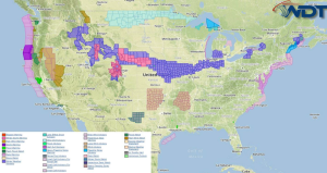
Isolated moderate to heavy snow is possible Tuesday across the Intermountain West. Light to moderate snow is possible for the Midwest and Northeast. Showers and isolated strong thunderstorms will continue …
Read Storyby WeatherOps, on Feb 3, 2015 3:54:29 PM
Light to moderate snow will be possible Wednesday from the Central Plains to the Missouri Valley, as well as portions of the Midwest and Northeast. Showers and isolated strong thunderstorms …
Read Storyby WeatherOps, on Feb 3, 2015 12:31:45 PM
Snow is continuing across the Upper Midwest ahead of an area of low pressure moving across the Northern Plains. Most areas will see 1-3 inches of snow, but areas of …
Read Storyby WeatherOps, on Feb 3, 2015 9:37:53 AM
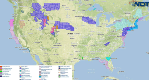
Moderate snowfall is expected Tuesday across the high terrain of the Northern Rockies. Current NWS Advisories/Watches/Warnings in iMapPro An area of low pressure will overspread the Intermountain West, increasing snow …
Read Storyby WeatherOps, on Feb 2, 2015 3:41:39 PM
Moderate snowfall is possible Tuesday across the higher terrain of the Northern Rockies. Northern Rockies: Low pressure will very slowly move eastward across the Northern Rockies toward the Northern Plains …
Read Storyby WeatherOps, on Feb 2, 2015 12:47:11 PM
Snow is continuing across much of New England ahead of an area of low pressure. Up to a foot of snow will be possible in some areas. In addition to …
Read Storyby WeatherOps, on Feb 2, 2015 9:42:35 AM
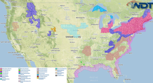
Moderate to heavy snowfall is expected across the Northeast on Monday; near blizzard conditions will be possible. Moderate snowfall will be likely for the higher elevations of the Pacific Northwest …
Read Storyby WeatherOps, on Jan 30, 2015 3:33:23 PM
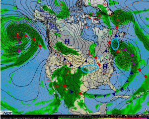
Moderate to heavy snowfall will be possible on Saturday across Maine and New Brunswick. Moderate snow is expected from the Lower Missouri Valley to Central Indiana. Maine into New Brunswick: …
Read Storyby WeatherOps, on Jan 30, 2015 12:52:15 PM
Snow is continuing to fall across portions of New Mexico ahead of an area of low pressure moving into the Desert Southwest. In the lower elevations, up to 5 inches …
Read Storyby WeatherOps, on Jan 30, 2015 9:47:27 AM
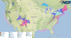
Moderate to heavy snow will be likely Friday across New England. Moderate snow is expected from Central New Mexico into Southern Utah. Moderate to heavy rainfall will be possible across …
Read Storyby WeatherOps, on Jan 29, 2015 3:38:23 PM
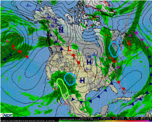
Moderate to heavy snow is expected Friday across New England, especially across Maine. Moderate snow is possible for New Mexico into Southern Colorado. Across Central and Southern Arizona, moderate to …
Read Storyby WeatherOps, on Jan 29, 2015 12:49:07 PM
Snow is continuing across the Northeast ahead of an area of low pressure. 4-6 inches of snow will be possible across much of the region, but up to a foot …
Read Storyby WeatherOps, on Jan 29, 2015 9:38:27 AM
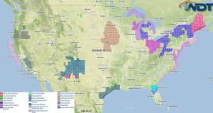
Light to moderate snow will continue on Thursday across the Eastern Great Lakes and into the Northeast. Current NWS Advisories/Watches/Warnings in iMapPro A pair of low pressure systems will move …
Read Storyby WeatherOps, on Jan 28, 2015 3:36:06 PM
A clipper system moving through the Ohio Valley into the Northeast on Thursday will allow for light to moderate snow from Michigan to Western Maine. 3-6 inches of snow will …
Read Storyby WeatherOps, on Jan 28, 2015 12:45:43 PM
Snow will continue through the evening and overnight hours across the Great Lakes. 1-2 inches of snow will be possible. Some light ice will be possible …
Read Storyby WeatherOps, on Jan 28, 2015 9:32:22 AM
No significant threats are expected on Wednesday across the country. The snow storm on the East Coast will move into the Canadian Maritime provinces. Some light snow may linger across …
Read Storyby WeatherOps, on Jan 27, 2015 3:45:20 PM
No significant regional threats expected on Wednesday. The coastal snow storm will depart toward the Canadian Maritime provinces and will quickly weaken on Wednesday. Some light to moderate snowfall may …
Read Storyby WeatherOps, on Jan 27, 2015 12:41:56 PM
The winter storm affecting the Northeast is winding down as the main area of low pressure moves away from the region. Up to 16 inches of snow will be possible …
Read Storyby WeatherOps, on Jan 27, 2015 9:28:07 AM
The winter storm across New England will continue today, but will wind down gradually later tonight. Strong coastal low is expected to strengthen fairly quickly and slow its forward progress …
Read Storyby WeatherOps, on Jan 26, 2015 3:40:58 PM
The ongoing winter storm will continue for the New England region on Tuesday, but will begin to wind down Tuesday night. Coastal Mid-Atlantic through Maine: The coastal low pressure system …
Read Storyby WeatherOps, on Jan 26, 2015 12:57:04 PM
An area of low pressure will continue to move off the coast of New England over the remainder of the day. As it moves offshore, it will begin to intensify …
Read Storyby WeatherOps, on Jan 26, 2015 9:21:04 AM
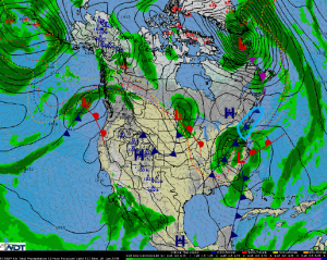
Mid-Atlantic to southern New England: The forecast for the coastal low pressure system now presents a slightly less intense snowfall than was depicted in the Winter Weather Warnings posted yesterday …
Read Storyby WeatherOps, on Jan 23, 2015 4:05:02 PM
Moderate to heavy snowfall will be possible across portions of the Mid Atlantic, Northeast, and New England regions along the I-95 corridor on Saturday; light freezing rain and sleet will …
Read Storyby WeatherOps, on Jan 23, 2015 12:45:41 PM
A few severe thunderstorms are possible today for portions of Florida, Georgia, and the Carolinas ahead of an area of low pressure moving across the Gulf of Mexico and into …
Read Storyby WeatherOps, on Jan 23, 2015 9:44:30 AM
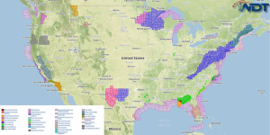
Showers and thunderstorms with heavy rainfall are likely Friday along the Gulf Coast and Southeast; flash flooding will be possible. Across the Southeast coast and into the Florida Panhandle, a …
Read Storyby WeatherOps, on Jan 22, 2015 3:28:27 PM
Heavy rain and flash flooding is expected Friday with thunderstorms along the Gulf Coast and into the southeast. Moderate to heavy snow is expected from the Tennessee Valley into the …
Read Storyby WeatherOps, on Jan 22, 2015 12:38:07 PM
Heavy rain and high winds will continue through tonight across portions of Texas and Louisiana ahead of an upper level trough. As the system continues to move eastward, 1-3 inches …
Read Storyby WeatherOps, on Jan 22, 2015 9:36:16 AM
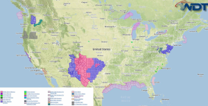
Widespread heavy rainfall and thunderstorms will continue Thursday for South Texas and the Northern Gulf of Mexico. Moderate to heavy snow is likely from Eastern New Mexico into West Texas …
Read Storyby WeatherOps, on Jan 21, 2015 3:25:34 PM
Widespread heavy rain and isolated to scattered thunderstorms are likely on Thursday across the Gulf Coast and Northern Gulf. Moderate snowfall will be possible from Southeast New Mexico and West …
Read Storyby WeatherOps, on Jan 21, 2015 12:41:33 PM
Snow is continuing across portions of the Southern Rockies and High Plains ahead of an upper level trough. Up to 8 inches of snow, with locally higher amounts will be …
Read Storyby WeatherOps, on Jan 21, 2015 9:42:48 AM

Moderate to heavy snow is expected on Wednesday across the Southern Rockies and High Plains. Light to moderate snowfall is expected across the Mid Atlantic; mainly from West Virginia and …
Read Storyby WeatherOps, on Jan 20, 2015 3:17:32 PM
Moderate to heavy snowfall is expected on Wednesday across portions of the Southern Rockies and High Plains. Light to moderate snowfall is possible for the Mid Atlantic, specifically from West …
Read Storyby WeatherOps, on Jan 20, 2015 12:36:04 PM
Light snow is continuing across portions of the Northern Plains and Great Lakes ahead of a fast moving clipper system. Snow accumulations will be light where snow is currently falling; …
Read Storyby WeatherOps, on Jan 20, 2015 9:35:11 AM
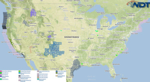
No significant weather hazards are expected on Tuesday. NWS Watches/Warnings/Advisories in iMapPro A weak clipper system will move from the Dakotas into the Southern Great Lakes and Ohio River Valley …
Read Storyby WeatherOps, on Jan 19, 2015 3:18:42 PM
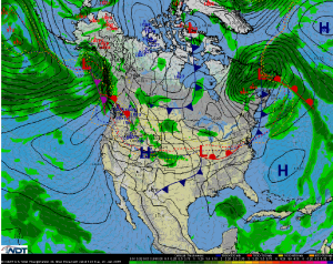
Very light snowfall will be possible from the Dakotas to Western Pennsylvania as a fast moving clipper system dives eastward. Accumulations will average 1 to 3 inches in most locations …
Read Storyby WeatherOps, on Jan 19, 2015 12:38:56 PM
Light snow will be likely ahead of a fast moving clipper system. No significant impacts are expected, but up to an inch of snow will be possible across portions of …
Read Storyby WeatherOps, on Jan 19, 2015 9:19:54 AM
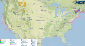
No significant weather hazards are expected for Monday. NWS Advisories/Watches/Warnings in iMapPro Snowfall is beginning to taper off across the Northeast as an area of low pressure lifts northeastward. 1-2 …
Read Storyby WeatherOps, on Jan 16, 2015 3:47:13 PM
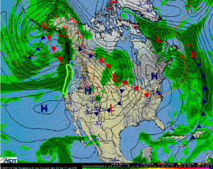
Moderate to heavy snow will continue across the Pacific Northwest on Saturday; some light icing will be possible. Heavy rain will be possible along the coastal areas along the Pacific …
Read Storyby WeatherOps, on Jan 16, 2015 12:43:23 PM
Snow is continuing across portions of the Northern Rockies through the early evening. 2-4 inches of snow will be possible in the lower elevations and 4-8 inches in the highest …
Read Storyby WeatherOps, on Jan 16, 2015 9:30:24 AM
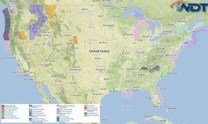
Moderate to heavy snow, as well as light icing. is likely Friday for portions of the Pacific Northwest and Northern Rockies. Current NWS Advisories/Watches/Warnings in iMapPro A strong area of …
Read Storyby WeatherOps, on Jan 15, 2015 3:41:05 PM
Moderate to heavy snow is likely Friday across the Pacific Northwest and Northern Rockies; light icing will be possible. Pacific Northwest & Northern Rockies: Strong low pressure and cold front …
Read Storyby WeatherOps, on Jan 15, 2015 12:45:30 PM
Snow and sleet will continue for portions of Northern Alabama and Southeastern Tennessee through early evening. Less than half an inch of accumulation is expected, however, some slick spots on …
Read Storyby WeatherOps, on Jan 15, 2015 9:44:53 AM
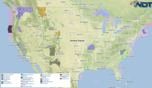
Moderate to heavy snow is expected Thursday across the Pacific Northwest; a light wintry mix possible early on. Current NWS Advisories/Watches/Warnings in iMapPro An approaching area of low pressure will …
Read Storyby WeatherOps, on Jan 14, 2015 3:40:04 PM
Moderate to heavy snow will be possible Thursday across the Pacific Northwest. A light wintry mix is possible early. Strong low pressure and cold front will slowly move into the …
Read Storyby WeatherOps, on Jan 14, 2015 12:42:20 PM
Light snow is continuing across North Dakota and will continue through the afternoon. Accumulations should be less than half an inch. Gusty winds to 25 miles per hour and temperatures …
Read Storyby WeatherOps, on Jan 14, 2015 9:45:39 AM
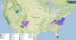
A wintry mix will continue for the Mid Atlantic into the morning on Wednesday; light icing will be possible. Current NWS Advisories/Watches/Warnings in iMapPro A weak area of low pressure …
Read Storyby WeatherOps, on Jan 13, 2015 3:49:40 PM
A mix of wintry precipitation will continue into Wednesday morning. Light icing will be possible. Mid-Atlantic: A weak low pressure trough is expected to develop and lift across the Mid-Atlantic …
Read Storyby WeatherOps, on Jan 13, 2015 12:50:44 PM
Snow will continue for portions of Colorado and New Mexico ahead of an upper level trough through tomorrow. 12-16 inches of snow will be possible for much of the region …
Read Storyby WeatherOps, on Jan 13, 2015 9:43:11 AM
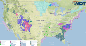
Light to moderate snow will be possible Tuesday across the Four Corners region. A wintry mix is possible overnight into Wednesday morning across the Southern Appalachians and into the Mid …
Read Storyby WeatherOps, on Jan 12, 2015 4:00:20 PM
Light to moderate snow will be possible Tuesday across the Southern Plains. Across the Southern Plains and Appalachians, a wintry mix is possible through the morning; light icing is also …
Read Storyby WeatherOps, on Jan 12, 2015 12:37:50 PM
Snow will continue for portions of the Central and Southern Rockies tonight into tomorrow ahead of an upper level system. Up to 15 inches of snow will be possible through …
Read Storyby WeatherOps, on Jan 12, 2015 9:46:12 AM

Light to moderate snow will be possible Monday across the Great Basin and Southern Rockies; heavy accumulations expected in the higher elevations. Light to moderate snow will be possible across …
Read Storyby WeatherOps, on Jan 9, 2015 4:03:11 PM
Freezing rain is likely on Saturday for portions of the Plains; up to a quarter inch of ice is possible. Light to moderate snow will be possible across the Great …
Read Storyby WeatherOps, on Jan 9, 2015 9:52:36 AM
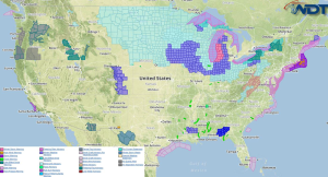
Light to moderate snow with localized heavy lake effect snow will be possible Friday across portions of the Great Lakes and Northeast. Freezing rain will develop late Friday evening into …
Read Storyby WeatherOps, on Jan 8, 2015 4:14:12 PM
Light to moderate snow will be possible Friday for the Great Lakes and Northeast; localized heavy lake effect snow is possible. Across Central Texas, freezing rain will be possible late …
Read Storyby WeatherOps, on Jan 8, 2015 12:55:21 PM
Snow is continuing across portions of Michigan and Wisconsin. Across areas of eastern Wisconsin, an additional 1-3 inches of snow will be possible through this afternoon. For western portions of …
Read Storyby WeatherOps, on Jan 8, 2015 9:39:59 AM
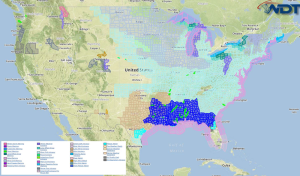
Light to moderate snow is expected Thursday across the Great Lakes and Northeast; localized lake effect snow will be possible. Current NWS Advisories/Watches/Warnnings in iMapPro Another frontal boundary will advance …
Read Storyby WeatherOps, on Jan 7, 2015 3:33:54 PM
Light to moderate snow with localized heavy lake effect snow will be likely across the Great Lakes and Northeast on Thursday. Across the Northern Rockies and Northern High Plains, moderate …
Read Storyby WeatherOps, on Jan 7, 2015 12:37:24 PM
Snowfall will continue through the afternoon across the Lower Peninsula of Michigan. Across the southern portions of the lower peninsula, heavy snow with snowfall rates of one inch per hour …
Read Storyby WeatherOps, on Jan 7, 2015 9:33:12 AM
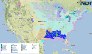
Light to moderate snow will continue Wednesday across the Great Lakes and Northeast. Lake effect snow with heavy snow accumulations will be possible in some areas. Current NWS Advisories/Watches/Warnings in …
Read Storyby WeatherOps, on Jan 6, 2015 3:30:44 PM
Light to moderate snow will continue for the Great Lakes and Northeast on Wednesday. Great Lakes and Northeast: Brisk northwest winds across the Great Lakes region on Wednesday will allow …
Read Storyby WeatherOps, on Jan 6, 2015 1:03:14 PM
Heavy snow is continuing across the Northern Rockies ahead of an upper level trough. 1-3 inches will be possible in the lower elevations and 3-5 in the higher elevations of …
Read Storyby WeatherOps, on Jan 6, 2015 9:45:06 AM
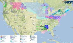
Moderate snow will continue on Tuesday across the Northern Rockies. Light to moderate snow will also continue across the Great Lakes and Northeast. Up to a foot of snow will …
Read Storyby WeatherOps, on Jan 5, 2015 3:45:27 PM
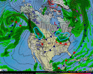
Moderate snow is possible on Tuesday across the Northern Rockies. Light to moderate snow, with some accumulations up to a foot of snow, will be possible across the Great Lakes …
Read Storyby WeatherOps, on Jan 5, 2015 12:42:33 PM
Heavy snow is continuing across portions of the Plains with the heaviest of the snow across portions of South Dakota, Minnesota, Iowa, and Illinois. Snowfall rates of 1-1.5 inches per …
Read Storyby WeatherOps, on Jan 5, 2015 9:45:42 AM
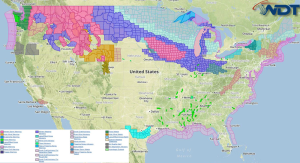
Moderate to heavy snow is likely from the Northern Rockies into the Great Lakes; light icing is possible across the Northern Rockies. Current NWS Advisories/Watches/Warnings in iMapPro An area of …
Read Storyby WeatherOps, on Jan 2, 2015 3:58:45 PM
Freezing rain and sleet is likely Saturday across the Central Plains and into the Missouri Valley; significant icing is possible. Moderate to heavy snow is likely for the Northern Rockies …
Read Storyby WeatherOps, on Jan 2, 2015 12:51:04 PM
Freezing rain, sleet, and, snow will continue for portions of West Texas and Southwest Oklahoma. 1-2 inches of snow and a quarter of an inch of ice will be possible …
Read Storyby WeatherOps, on Jan 2, 2015 10:00:41 AM
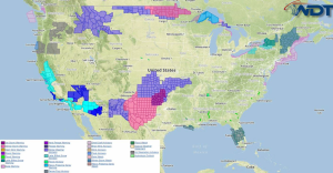
Another round of freezing rain and sleet is likely Friday for the Southern Plains and into Missouri. Snow showers will develop late in the day across the Upper Midwest. Isolated …
Read Storyby WeatherOps, on Jan 1, 2015 3:55:30 PM
Freezing rain and sleet, with significant icing, is possible Friday across the Southern Plains. Across the Lower Mississippi Valley, isolated strong thunderstorms will be possible. Southern Plains: Just as winter …
Read Storyby WeatherOps, on Jan 1, 2015 12:37:59 PM
Freezing rain is continuing across portions of Southern Oklahoma and Northern Texas. In some areas, temperatures may warm slightly above freezing, allowing for a transition to rain. Overall, little warming …
Read Storyby WeatherOps, on Jan 1, 2015 9:51:01 AM
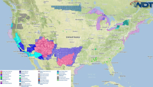
Freezing rain, sleet, and snow is possible today across the Southern Plains. Light to moderate snow will continue for the Four Corners region. Current NWS Advisories/Watches/Warnings in iMapPro A mix …
Read Storyby WeatherOps, on Dec 31, 2014 4:00:17 PM
Rain and thunderstorms will be possible New Year's Day for the South Central US. Light to moderate freezing rain and sleet is likely from the Southern Plains through the Midwest …
Read Storyby WeatherOps, on Dec 31, 2014 12:37:30 PM
Snow continues for portions of the Desert Southwest in association with an upper level trough moving over the Western US. Up to 16 inches of snow will be possible across …
Read Storyby WeatherOps, on Dec 31, 2014 9:47:09 AM
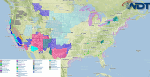
Moderate to heavy snow will be likely Wednesday in the higher elevations of the Southwest through the Four Corners. Light freezing rain and sleet is possible for portions of Central …
Read Storyby WeatherOps, on Dec 30, 2014 3:56:18 PM
Moderate to heavy snow will be possible Wednesday for the Southwest US through the Four Corners region. Across Central to Northern Texas, light freezing rain and sleet is possible. Southwest …
Read Storyby WeatherOps, on Dec 30, 2014 12:43:47 PM
A storm system moving onto the West Coast will bring snow to much of the Rockies. Heavy snow will be possible through Thursday from portions of Colorado to California. Up …
Read Storyby WeatherOps, on Dec 30, 2014 9:48:50 AM
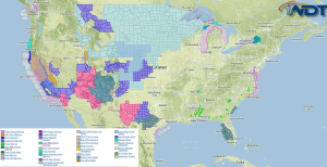
Light to moderate snowfall will be possible Tuesday for the High, Central, and Southern Plains. Across the Great Lakes, lake effect snow is expected. Current NWS Advisories/Watches/Warnings in iMapPro A …
Read Storyby WeatherOps, on Dec 29, 2014 3:59:53 PM
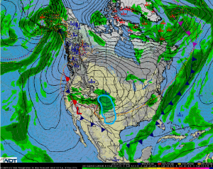
Light to moderate snow will continue on Tuesday across the Central Rockies and High Plains. A strong area of high pressure across the Central US will push a cold front …
Read Storyby WeatherOps, on Dec 29, 2014 12:52:05 PM
Snow is continuing across portions of Eastern Colorado ahead of an upper level trough. 4-6 inches of snow will be possible through Tuesday afternoon. In addition to the snow, winds …
Read Storyby WeatherOps, on Dec 29, 2014 9:46:41 AM
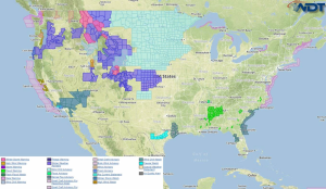
Moderate to heavy snow will be possible today across the Intermountain West and Central High Plains. Current NWS Advisories/Watches/Warnings in iMapPro Another round of snow is likely today across the …
Read Storyby WeatherOps, on Dec 24, 2014 3:47:23 PM
Heavy snow and strong winds will be possible Thursday for portions of the Northern and Central Rockies. Heavy snow will linger over the Cascades. Northern Rockies and Central Rockies: Low …
Read Storyby WeatherOps, on Dec 24, 2014 3:40:28 PM
A Severe Thunderstorm Watch is in effect until 10pm EST for portions of Ohio, Pennsylvania, and West Virginia. Damaging winds to 70 mph will be the main threat …
Read Storyby WeatherOps, on Dec 24, 2014 12:48:13 PM
Thunderstorms will continue across the Southeast ahead of an area of low pressure and attendant cold front. Some additional thunderstorms may develop to the north of the main line into …
Read Storyby WeatherOps, on Dec 24, 2014 9:56:53 AM
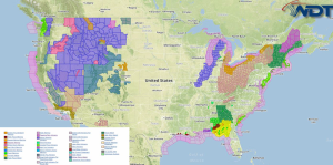
Strong to severe thunderstorms with damaging winds and tornadoes will be possible Wednesday for portions of Northern/Central Florida and Southeast Georgia. Strong to severe thunderstorms will be possible for the …
Read Storyby WeatherOps, on Dec 23, 2014 3:50:51 PM
Severe thunderstorms are possible across Florida on Wednesday with a marginal threat across the Southeast. Heavy rain is possible across Northern Florida and the Southeast. Heavy snow and gusty winds …
Read Storyby WeatherOps, on Dec 23, 2014 1:07:20 PM
A Tornado Watch is in effect for portions of Alabama, Florida, and Georgia until 11pm CST. Hail to 1", damaging winds to 75 miles per hour, and tornadoes will be …
Read Storyby WeatherOps, on Dec 23, 2014 12:39:58 PM
Thunderstorms are continuing across Louisiana and Mississippi. As thunderstorms continue to move to the east, large hail, damaging winds, and tornadoes will be possible. A Tornado Watch continues for portions …
Read Storyby WeatherOps, on Dec 23, 2014 10:44:15 AM
A Tornado Watch is in effect until 6pm for portions of Alabama, Louisiana, Mississippi, and Texas until 6pm CST. Hail to 2", damaging winds to 70 mph, and tornadoes will …
Read Storyby WeatherOps, on Dec 23, 2014 9:52:09 AM
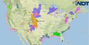
Strong to severe thunderstorms are possible Tuesday along the Gulf Coast; damaging winds and tornadoes will be possible in addition to heavy rain and flash flooding. Moderate to heavy snow …
Read Storyby WeatherOps, on Dec 22, 2014 2:34:20 PM
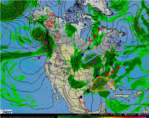
Light to moderate snow will be likely Tuesday across the Upper Great Lakes. Severe thunderstorms with heavy rain are possible across the Florida Panhandle and Southern Georgia; up to 4 …
Read Storyby WeatherOps, on Dec 22, 2014 12:52:56 PM
Showers and thunderstorms will continue across the Northern Gulf Coast along a stationary front. Throughout the day, this front will lift northward and allow additional moisture to move northward. This …
Read Storyby WeatherOps, on Dec 22, 2014 9:51:13 AM
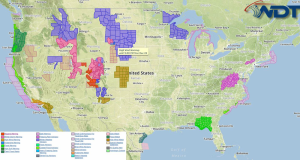
Moderate to heavy snow is likely Monday across the Central Rockies, Northern Plains, and Upper Great Lakes. Isolated strong to severe thunderstorms are possible along the Central Gulf Coast. Current …
Read Storyby WeatherOps, on Dec 19, 2014 3:45:00 PM
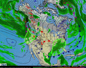
Moderate to heavy snow is possible Saturday for the Pacific Northwest and Rockies. Heavy rain and flooding is possible along the coastal areas of the Pacific Northwest and across the …
Read Storyby WeatherOps, on Dec 19, 2014 12:45:50 PM
Heavy rain and thunderstorms will continue for the Lower Mississippi Valley ahead of an upper level trough. While widespread severe weather is not expected, a few isolated severe thunderstorms will …
Read Storyby WeatherOps, on Dec 19, 2014 9:55:48 AM
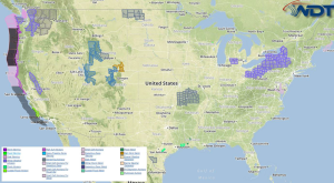
Showers and thunderstorms, with some isolated severe thunderstorms, will be possible Friday for portions of the Gulf Coast. Across Texas and the Southeast, heavy rain will be possible. Moderate to …
Read Storyby WeatherOps, on Dec 18, 2014 3:43:56 PM
Showers and thunderstorms, with some severe thunderstorms, will be possible Friday for the Gulf Coast. Heavy rain is possible for portions of Texas and the Southeast. Moderate to heavy snow, …
Read Storyby WeatherOps, on Dec 18, 2014 12:46:04 PM
Showers and thunderstorms will be possible today across eastern Texas and Louisiana ahead of a shortwave trough tracking from Mexico into Texas later today. While severe weather is not anticipated, …
Read Storyby WeatherOps, on Dec 18, 2014 9:48:13 AM

Light to moderate snow will begin to taper off across the Northeast. Thunderstorms will develop late this afternoon and evening across Texas. Moderate to heavy rain is likely across the …
Read Storyby WeatherOps, on Dec 17, 2014 4:01:43 PM
Snow falling across the Northeast will begin to taper off on Thursday. Thunderstorms will develop in the afternoon or evening for portions of Texas. Moderate to heavy rainfall is likely …
Read Storyby WeatherOps, on Dec 17, 2014 12:48:18 PM
Light snow is likely this afternoon and tonight as an upper level trough continues to move eastward into the Plains. The areas of greatest concern will be Eastern Kansas and …
Read Storyby WeatherOps, on Dec 17, 2014 9:50:27 AM
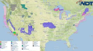
Light to moderate snow will fall across the Great Lakes and Northeast with heavy snow over Northern Maine, Light snow will develop late this afternoon and evening over the Central …
Read Storyby WeatherOps, on Dec 16, 2014 3:58:43 PM
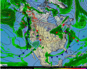
Light to moderate snow will be possible Wednesday across the Northeast with the heaviest snow over Northern Maine. Light to moderate snowfall will spread eastward across the Rockies. Northeast: A …
Read Storyby WeatherOps, on Dec 16, 2014 12:43:28 PM
Lake effect snow will continue across Northern Michigan through tonight as an area of low pressure continues to move eastward across the Great Lakes, 1-3 inches of snow will be …
Read Storyby WeatherOps, on Dec 16, 2014 9:51:53 AM
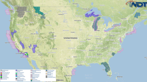
Light to moderate snow will continue across Northern Michigan; lake effect enhancement is possible along the southern shore of Lake Superior. Moderate snowfall will continue for the California mountains. Continued …
Read Storyby WeatherOps, on Dec 15, 2014 4:07:57 PM
Light to moderate snow is likely Tuesday for the Upper Peninsula of Michigan; lake effect enhancement is possible along the south shore of Lake Superior. Snowfall will continue for the …
Read Storyby WeatherOps, on Dec 15, 2014 12:44:56 PM
Rain and snow will continue across the Northern Plains and Upper Midwest as an area of low pressure continues to move northeast across the Plains.2-4 inches of snow, in addition …
Read Storyby WeatherOps, on Dec 15, 2014 9:45:06 AM
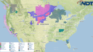
Moderate to heavy snow is expected across the Central Plains on Monday with lighter amounts across the Upper Midwest. Moderate snow is likely for the California and Oregon Mountains with …
Read Storyby WeatherOps, on Dec 12, 2014 3:38:53 PM
Heavy rain and isolated strong thunderstorms will be possible Saturday from the Intermountain West to Western Texas. Moderate snowfall is likely across portions of the Central Rockies. Intermountain West & …
Read Storyby WeatherOps, on Dec 12, 2014 12:44:59 PM
Rain and snow are continuing for portions of California and Nevada as an area of low pressure continues to move onshore. Up to 2 feet of snow is possible for …
Read Storyby WeatherOps, on Dec 12, 2014 9:36:42 AM
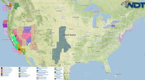
Heavy rain, high winds, isolated thunderstorms, and flash flooding will continue Friday across portions of Central and Southern California. Blizzard conditions will continue for the Sierra Nevada above 5000 feet, …
Read Storyby WeatherOps, on Dec 11, 2014 4:00:57 PM
Heavy rain, high winds, and isolated thunderstorms will continue for Northern and Central California on Friday. Blizzard conditions are expected for the Sierra Nevada above 5000 feet. Central and Southern …
Read Storyby WeatherOps, on Dec 11, 2014 12:42:05 PM
Rain and higher elevation snow is beginning along the west coast. As the activity begins to move further inland, rain will begin to change over to snow in the higher …
Read Storyby WeatherOps, on Dec 11, 2014 9:50:21 AM
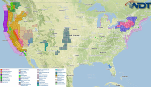
Heavy to excessive rainfall, high winds, and isolated thunderstorms are likely Thursday for Northern and Central California. Across Central California, isolated strong to severe thunderstorms will be possible. Blizzard conditions …
Read Storyby WeatherOps, on Dec 10, 2014 3:56:49 PM
Heavy to excessive rainfall, high winds, and thunderstorms will be possible Thursday for Northern and Central California. Blizzard conditions will be likely for the Sierra Nevada above 6000 feet. Across …
Read Storyby WeatherOps, on Dec 10, 2014 12:21:56 PM
A strong storm system will bring heavy snow and blizzard conditions to portions of California. 2-3 feet of snow will be possible in the highest elevations of Northeastern and North …
Read Storyby WeatherOps, on Dec 10, 2014 9:49:19 AM
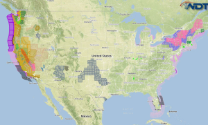
The winter storm over New England will continue Wednesday with additional snow and ice accumulation. Heavy rain and strong winds will be possible across the Pacific Northwest and Northern California …
Read Storyby WeatherOps, on Dec 9, 2014 3:48:30 PM
Wintry precipitation will continue on Wednesday from the Appalachians through the Upper Northeast. Heavy rain and flooding will continue for the coast of Maine and the Pacific Northwest. Appalachians through …
Read Storyby WeatherOps, on Dec 9, 2014 12:47:57 PM
Rain and snow is continuing across the New England region as an area of low pressure continues to move northward. Heaviest snow will be inland where snow rates could be …
Read Storyby WeatherOps, on Dec 9, 2014 9:49:38 AM
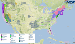
Freezing rain, sleet, and snow will continue today for portions of the Appalachians through the Upper Northeast. Moderate to heavy rainfall and flooding will be likely for the coast line …
Read Storyby WeatherOps, on Dec 8, 2014 3:29:03 PM
Freezing rain, sleet, and snow will be possible Tuesday from the Appalachians through the Upper Northeast. Moderate to heavy rainfall, as well as some flooding will be possible for the …
Read Storyby WeatherOps, on Dec 8, 2014 12:43:59 PM
Winter Storm Watches are in effect for a large portion of New England from tonight through Tuesday evening. A system over the Great Lakes will continue to advance eastward and …
Read Storyby WeatherOps, on Dec 8, 2014 9:54:53 AM
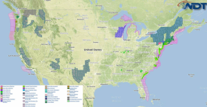
Light to moderate snow will continue Monday across the Great Lakes; some light icing will be possible. Freezing rain, sleet, and snow will be possible from the Appalachians through New …
Read Storyby WeatherOps, on Dec 5, 2014 3:58:32 PM
Moderate to heavy snow is likely Saturday for portions of the Upper Northeast. High pressure will build into the Great Lakes region by Saturday. Showers and general thunderstorms will shift …
Read Storyby WeatherOps, on Dec 5, 2014 12:42:57 PM
A few thunderstorms will be possible this afternoon and evening for portions of Arkansas, and extreme western portions of Mississippi and Tennessee. This potential is ahead of an area of …
Read Storyby WeatherOps, on Dec 5, 2014 9:53:10 AM
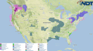
General thunderstorms and isolated strong thunderstorms will be possible for the Middle Mississippi Valley on Friday. Across the Northeast, rain, freezing rain, sleet, and heavy snow will be possible for …
Read Storyby WeatherOps, on Dec 4, 2014 3:54:16 PM
Scattered showers and locally heavy rain are possible Friday for portions of the Pacific Northwest, as well as the Middle Mississippi and Ohio Valleys. Pacific Northwest Coast: Low pressure will …
Read Storyby WeatherOps, on Dec 4, 2014 12:43:31 PM
Rain is currently falling across portions of Southern Washington and will increase in coverage through the evening. As temperatures cool, rain will turn to freezing rain and allow for some …
Read Storyby WeatherOps, on Dec 4, 2014 9:43:49 AM
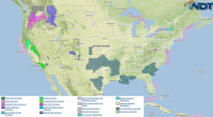
Light freezing rain is likely Thursday along the Washington and Oregon border. Current NWS Advisories/Watches/Warnings in iMapPro: Two areas of low pressure over the Western US will allow for isolated …
Read Storyby WeatherOps, on Dec 3, 2014 2:28:03 PM
Isolated moderate to heavy snow is likely Thursday for the higher elevations of the Rockies and Pacific Northwest; some icing will also be possible. Rockies and Pacific Northwest:Snow chances are …
Read Storyby WeatherOps, on Dec 3, 2014 12:43:04 PM
Heavy rain will continue for portions of Northern California ahead of an area of low pressure through tonight. Flash Flood Watches are in effect through tonight where rainfall rates will …
Read Storyby WeatherOps, on Dec 3, 2014 9:48:49 AM
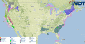
Heavy rain and flooding will continue today for California. Light snow across Northern Main will transition to light ice and then rain. Moderate to heavy snow is likely for the …
Read Storyby WeatherOps, on Dec 2, 2014 4:03:49 PM
Moderate to heavy high elevation snow is possible Wednesday for portions of the Central and Northern Rockies. Early morning snow and ice is possible for portions of Maine. Northern and …
Read Storyby WeatherOps, on Dec 2, 2014 12:45:21 PM
Heavy rain and snow is falling across portions of California. Across Northeastern and East Central Calfornia, 12-18 inches of snow is possible with some areas picking up as much as …
Read Storyby WeatherOps, on Dec 2, 2014 9:45:55 AM
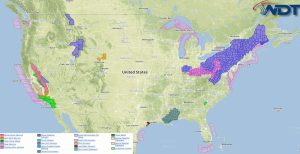
Scattered showers and possibly some heavy rain is possible for portions of California on Tuesday. Light freezing rain, sleet, and snow will be possible across the Central Appalachians and Northeast …
Read Storyby WeatherOps, on Dec 1, 2014 4:01:16 PM
Scattered showers, with the potential for heavy rain, is possible Tuesday for Southern California. Light freezing rain and sleet is possible for portions of the Central Appalachians and Mid Atlantic …
Read Storyby WeatherOps, on Dec 1, 2014 12:55:56 PM
A mixed bag of precipitation is continuing for portions of the Ohio River Valley through tonight. Later tonight, some freezing rain will be likely for portions of Pennsylvania, West Virginia, …
Read Storyby WeatherOps, on Dec 1, 2014 9:50:58 AM
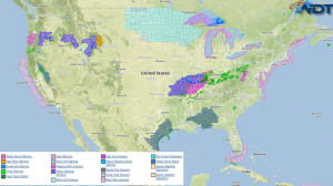
Light freezing rain, sleet, and snow is likely from portions of Eastern Oklahoma to Southern Illinois. Freezing rain and sleet is expected for portions of Oregon with heavy snow in …
Read Storyby WeatherOps, on Nov 26, 2014 3:28:12 PM
Moderate to heavy snow will continue through Thursday morning for far northeastern New England. Moderate to heavy lake effect snow will continue for the Great Lakes. Moderate to heavy snow …
Read Storyby WeatherOps, on Nov 26, 2014 12:50:40 PM
Heavy snow is continuing across the Northeast and most of the rain that was along the coastal areas has changed over to snow. Snowfall rates will be near 1 inch …
Read Storyby WeatherOps, on Nov 26, 2014 9:51:18 AM
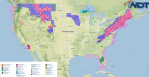
Heavy snow will continue Wednesday for the Mid Atlantic, Interior Northeast, and New England. A rain/snow mix is expected along the coast. Heavy snow is expected in the higher elevations …
Read Storyby WeatherOps, on Nov 25, 2014 3:55:11 PM
Showers and thunderstorms are possible Wednesday for portions of Central and Northern Florida. Rain will change to snow across the Mid Atlantic, Northeast, and New England. Light to moderate snow …
Read Storyby WeatherOps, on Nov 25, 2014 12:46:05 PM
Thunderstorms are moving across portions of Northern and Central Florida ahead of a cold front. Any thunderstorms that develop will have the potential for damaging winds and possibly some isolated …
Read Storyby WeatherOps, on Nov 25, 2014 9:48:55 AM
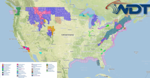
Marginally severe thunderstorms are possible Tuesday for portions of Central and Northern Florida. Moderate to heavy snow is possible for the Rockies and Pacific Northwest. Light to moderate snowfall will …
Read Storyby WeatherOps, on Nov 24, 2014 3:57:52 PM
Strong to severe thunderstorms are possible Tuesday for Central Florida. Across Northern Florida, showers and thunderstorms will produce heavy rain. Heavy snowfall will be possible for portions of the Rocky …
Read Storyby WeatherOps, on Nov 24, 2014 1:00:05 PM
Snow is continuing for portions of Michigan and Wisconsin as an area of low pressure continues to move to the east. Snow intensity will likely be heaviest this afternoon into …
Read Storyby WeatherOps, on Nov 24, 2014 9:39:23 AM
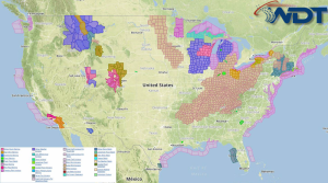
Strong to severe thunderstorms are possible Monday for portions of the Southeast and the Mid Atlantic. Moderate snowfall is possible over the Midwest and Great Lakes. Snow will continue for …
Read Storyby WeatherOps, on Nov 21, 2014 3:56:12 PM
Moderate to heavy snow is likely Saturday for portions of the Pacific Northwest. Severe thunderstorms are possible for portions of the Southern Plains and Gulf Coast. Pacific Northwest: A low …
Read Storyby WeatherOps, on Nov 21, 2014 12:37:25 PM
There is a marginal risk for thunderstorms tonight across portions of Texas as an upper level trough moves across the Southern Rockies. Thunderstorms will likely develop tonight as the low …
Read Storyby WeatherOps, on Nov 21, 2014 9:45:59 AM
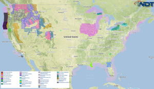
Heavy rain and strong winds are likely across the Pacific Northwest on Friday; moderate to heavy snow will be likely across the Coastal Range. Moderate to heavy lake effect snow …
Read Storyby WeatherOps, on Nov 20, 2014 4:14:20 PM
Moderate to heavy lake effect snow will continue Friday for portions of the Great Lakes. Severe thunderstorms are possible for portions of Texas during the evening hours. Great Lakes: Lake …
Read Storyby WeatherOps, on Nov 20, 2014 12:56:53 PM
Snow is continuing across portions of the Great Lakes and will continue through tomorrow morning. Across the Lower Peninsula of Michigan, 1-4 inches of snow will be possible. Lake effect …
Read Storyby WeatherOps, on Nov 20, 2014 10:41:50 AM
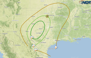
Thunderstorm chances will increase on Friday across portions of Texas as an upper level system moves into the region. Southerly winds and a developing low level jet on Friday will …
Read Storyby WeatherOps, on Nov 20, 2014 9:32:22 AM
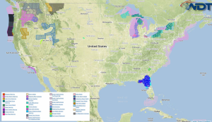
Moderate to heavy lake effect snow will continue Thursday for the Great Lakes. Current NWS Advisories/Watches/Warnings in iMapPro: An area of low pressure advancing through the Great Lakes will continue …
Read Storyby WeatherOps, on Nov 19, 2014 3:52:07 PM
Moderate to heavy lake effect snow will develop across the Great Lakes Thursday morning. Lake effect snow will begin across the Great Lakes early Thursday morning as another low pressure …
Read Storyby WeatherOps, on Nov 19, 2014 12:49:26 PM
Lake Effect Snow will continue for portions of the Eastern Great Lakes through tomorrow morning. There will be a brief reprieve, but another round will move across the region and …
Read Storyby WeatherOps, on Nov 19, 2014 9:46:27 AM
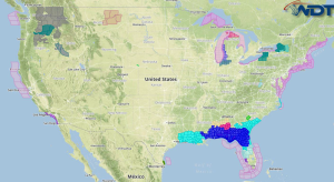
Moderate to heavy lake effect snow will continue for the Great Lakes on Wednesday, ending by midday. Current NWS Advisories/Watches/Warnings in iMapPro: Additional moderate to heavy snow will continue on …
Read Storyby WeatherOps, on Nov 18, 2014 4:05:16 PM
Moderate to heavy snow will continue on Wednesday across the Great Lakes. Great Lakes: Additional moderate to heavy snowfall will continue on Wednesday as another disturbance accompanied by more arctic …
Read Storyby WeatherOps, on Nov 18, 2014 12:44:13 PM
Lake effect snow is continuing off the shores of Lake Erie and Lake Ontario and will continue through Wednesday morning. Snowfall rates will be 2-4 inches per hour with total …
Read Storyby WeatherOps, on Nov 18, 2014 9:50:49 AM
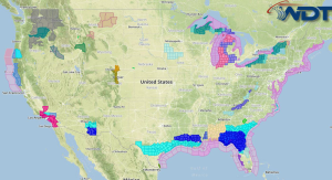
Moderate to heavy snow will continue Tuesday across the Great Lakes. Current NWS Advisories/Watches/Warnings in iMapPro: Lake effect snow will continue across the Great Lakes as Arctic air continues to …
Read Storyby WeatherOps, on Nov 17, 2014 3:52:28 PM
Moderate snowfall is possible on Tuesday across the Great Lakes. Great Lakes: An impressive lake effect snow event will be underway on Tuesday. Artic air will continue to move across …
Read Storyby WeatherOps, on Nov 17, 2014 12:43:42 PM
Severe thunderstorms are continuing across portions of Florida and Georgia where Tornado Watches are currently in effect. Tornado Watches are in effect for portions of Florida until 8pm EST. Damaging …
Read Storyby WeatherOps, on Nov 17, 2014 11:43:27 AM
A Tornado Watch is in effect for portions of Western, Northern, and Central Florida until 8pm EST. Damaging winds to 70 mph and tornadoes will be possible …
Read Storyby WeatherOps, on Nov 17, 2014 10:33:32 AM
A Tornado Watch is in effect for portions of Florida, Georgia, and South Carolina until 6pm EST. Damaging winds to 70 mph and tornadoes will be possible …
Read Storyby WeatherOps, on Nov 17, 2014 9:45:50 AM
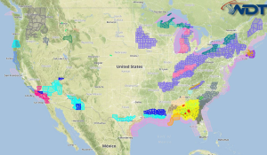
A major lake effect snow is likely Monday across the Great Lakes. Moderate snow is likely for portions of the Ohio Valley into Southeastern Canada. Strong thunderstorms are possible for …
Read Storyby WeatherOps, on Nov 14, 2014 3:53:59 PM
Light snow is possible Saturday for portions of the Central Rockies and Plains. A weak upper level trough and cold front will transition from the Central Rockies into the Central …
Read Storyby WeatherOps, on Nov 14, 2014 12:39:18 PM
Snow is continuing across the Rockies and will begin to subside tomorrow. 1-2 inches of snow is possible through this afternoon and an additional 3-5 inches will be possible tonight …
Read Storyby WeatherOps, on Nov 14, 2014 9:41:18 AM
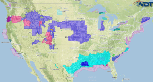
Moderate to heavy snow is possible Friday across the Great Basin and Rockies. Some minor icing is possible. Current NWS Advisories/Watches/Warnings in iMapPro: A frontal boundary will begin to develop …
Read Storyby WeatherOps, on Nov 13, 2014 3:57:36 PM
Moderate to heavy snow is possible Friday across the Great Basin and Rockies. Some light icing will also be possible. Great Basin/Rockies: A secondary frontal boundary will begin to develop …
Read Storyby WeatherOps, on Nov 13, 2014 2:35:42 PM
Lake effect snow will continue across portions of Western New York through tomorrow morning. 4-6 inches to a foot of snow with some areas receiving up to a foot will …
Read Storyby WeatherOps, on Nov 13, 2014 12:39:00 PM
Snow is continuing across portions of the Northern and Central Rockies and will continue through tomorrow. Up to 6 inches of snow will be possible in most areas, but 8-15 …
Read Storyby WeatherOps, on Nov 13, 2014 9:48:05 AM
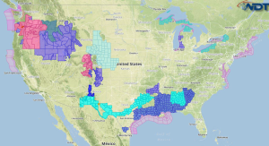
Moderate to heavy snow is likely Thursday for portions of the Coastal Range, Great Basin, and Rockies. Some icing is possible along and east of the Coastal Range. Current NWS …
Read Storyby WeatherOps, on Nov 12, 2014 3:52:16 PM
Moderate to heavy snow is possible Thursday across the Coastal Range, Great Basin, and Rockies. Some icing may be possible along and east of the Coastal Range. Coastal Range and …
Read Storyby WeatherOps, on Nov 12, 2014 12:44:51 PM
Light snow is continuing across portions of Colorado and Kansas and will continue through early Thursday morning. 2-6 inches will be possible through tomorrow morning with higher amounts possible in …
Read Storyby WeatherOps, on Nov 12, 2014 9:37:59 AM
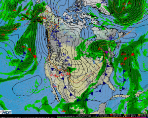
Light to moderate snow may linger over the Northern Plains and Great Lakes from a frontal boundary moving eastward. As the front moves across the western Gulf of Mexico, showers …
Read Storyby WeatherOps, on Nov 11, 2014 3:55:26 PM
Some light to moderate snowfall may linger over the Northern Plains and Great Lakes as wrap around from the passing frontal boundary continues to translate eastward. The front is anticipated …
Read Storyby WeatherOps, on Nov 11, 2014 12:45:24 PM
Showers and thunderstorms have developed across portions of the Ohio River Valley and Great Lakes ahead of a cold front. More activity will be possible later this afternoon across the …
Read Storyby WeatherOps, on Nov 11, 2014 9:47:19 AM
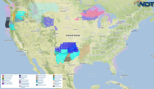
Heavy snow will continue through the early morning hours across the Upper Great Lakes on Tuesday, but will taper off by evening. Current NWS Advisories/Watches/Warnings in iMapPro: A strong frontal …
Read Storyby WeatherOps, on Nov 10, 2014 3:58:08 PM
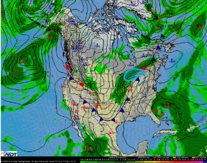
Heavy snow will continue for the Upper Great Lakes late into the morning on Tuesday. The Low will push across the northern Great Lakes and into Ontario on Tuesday, and …
Read Storyby WeatherOps, on Nov 10, 2014 12:40:21 PM
Snow is continuing across the Northern Plains and Great Lakes to the north of a warm front. Snow may be heavy at times with snowfall rates approaching 1 inch per …
Read Storyby WeatherOps, on Nov 10, 2014 9:50:16 AM
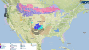
Moderate to heavy snow will continue Monday across the Northern Rockies, as well as from the Dakotas to Wisconsin. Current NWS Advisories/Watches/Warnings in iMapPro: Moderate to heavy snow will continue …
Read Storyby WeatherOps, on Nov 7, 2014 3:27:13 PM
Any lingering rain or snow activity should come to a full stop on Saturday as high pressure temporarily expands across the Central CONUS. An area of low pressure across Mexico …
Read Storyby WeatherOps, on Nov 7, 2014 12:43:39 PM
Snow is ending across portions of Maine and will continue to diminish through the afternoon. Up to a foot of snow will be possible in some areas. In addition, winds …
Read Storyby WeatherOps, on Nov 7, 2014 9:48:33 AM
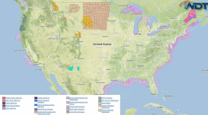
Moderate to heavy snow is likely Friday for Northern Maine. Heavy rain will continue for portions of South Texas. Current NWS Advisories/Watches/Warnings in iMapPro: Moisture continues to stream into Southern …
Read Storyby WeatherOps, on Nov 6, 2014 3:37:56 PM
Moderate to heavy snow is likely Friday for portions of Northern Maine. Upper Northeast: The bulk of any significant winter weather over the next few days is expected on Friday …
Read Storyby WeatherOps, on Nov 6, 2014 12:40:11 PM
Showers and thunderstorms are developing across portions of the Mid Atlantic and Northeast ahead of a cold front and will continue to develop through the afternoon. While no widespread severe …
Read Storyby WeatherOps, on Nov 6, 2014 9:42:41 AM
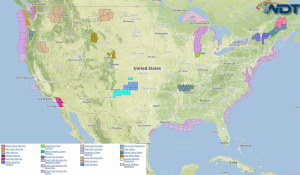
Showers and thunderstorms will be possible Thursday for portions of the Mid Atlantic. Light to moderate snow will be possible for portions of the Upper Northeast. Heavy rain will continue …
Read Storyby WeatherOps, on Nov 5, 2014 3:25:17 PM
Showers and heavy rain will continue Thursday across the Northeast. Heavy rainfall will continue for portions of Southern Texas. Light to moderate snow will continue for the Upper Northeast. Northeast …
Read Storyby WeatherOps, on Nov 5, 2014 12:47:13 PM
A Flash Flood Watch continues for portions of Central and Southern Texas until 6pm tonight. 2-4 inches of additional rainfall will be possible, in addition to flooding, especially in low …
Read Storyby WeatherOps, on Nov 5, 2014 9:51:33 AM
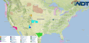
Showers and heavy rain will continue Wednesday from Southern Texas through the Ohio River Valley. Current NWS Advisories/Watches/Warnings in iMapPro: A front will begin to slow and stall across the …
Read Storyby WeatherOps, on Nov 4, 2014 3:48:00 PM
Showers and heavy rain are possible Wednesday from Southern Texas through the Ohio River Valley. Southern Texas up through Ohio River Valley: Front will continue producing showers and thunderstorms on …
Read Storyby WeatherOps, on Nov 4, 2014 12:49:57 PM
A Flash Flood Watch is in effect for portions of South Central Texas tonight through tomorrow morning. 2-4 inches of rain will be possible with isolated amounts to 7 inches …
Read Storyby WeatherOps, on Nov 4, 2014 9:50:27 AM
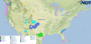
Thunderstorms (and possibly a strong thunderstorm) will be possible for portions of Southern Oklahoma and Texas. Showers and heavy rain will continue from Texas through the Mid Mississippi Valley. Current …
Read Storyby WeatherOps, on Nov 3, 2014 3:20:28 PM
Isolated strong to severe thunderstorms are possible Tuesday for Southern Oklahoma and Texas. Showers and heavy rain are possible for portions of Texas through the Mid Mississippi Valley. Southern Oklahoma …
Read Storyby WeatherOps, on Nov 3, 2014 12:40:07 PM
Rain and snow will continue across portions of the Plains this afternoon and evening ahead of a cold front. A few thunderstorms will be possible, but the severe weather potential …
Read Storyby WeatherOps, on Nov 3, 2014 9:46:59 AM
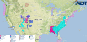
Isolated strong to severe thunderstorms are possible Monday for portions of the Southern Plains, in addition to some heavy rain for portions of the Southern and Central Plains. Heavy rain …
Read Storyby WeatherOps, on Oct 29, 2014 3:24:39 PM
Showers and thunderstorms with heavy rain will be possible Thursday for portions of the Pacific Northwest. Moderate rainfall for the Pacific Northwest is expected on Thursday as a strong jet …
Read Storyby WeatherOps, on Oct 29, 2014 12:50:24 PM
Showers and thunderstorms will continue to move across the Northeast ahead of a cold front. No severe thunderstorms are expected, but a few strong storms will be possible …
Read Storyby WeatherOps, on Oct 29, 2014 9:49:07 AM
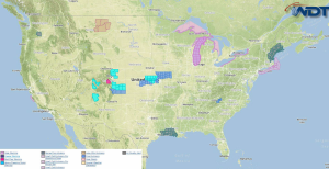
Showers and thunderstorms will be possible today from the Mid Atlantic to the Tennessee Valley. Current NWS Advisories/Watches/Warnings in iMapPro: Scattered showers will continue with a cold front moving south …
Read Storyby WeatherOps, on Oct 28, 2014 3:28:47 PM
Showers and thunderstorms are possible Wednesday from the Mid Atlantic to the Tennessee Valley; isolated strong to severe thunderstorms will be possible. Mid-Atlantic to Tennessee Valley: Isolated to scattered shower …
Read Storyby WeatherOps, on Oct 28, 2014 12:33:28 PM
Showers and thunderstorms are developing across portions of the Great Lakes, Ohio Valley, and Southeast ahead of a cold front. While widespread severe weather is not expected, some isolated strong …
Read Storyby WeatherOps, on Oct 28, 2014 9:51:17 AM
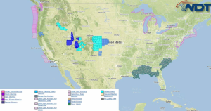
Isolated severe thunderstorms are possible today from the Ohio/Pennsylvania border to Arkansas. Showers and thunderstorms with isolated strong thunderstorms will be possible from the Ohio Valley into the Arklatex region …
Read Storyby WeatherOps, on Oct 27, 2014 3:33:13 PM
Showers and thunderstorms with isolated strong to severe storms will be possible for portions of the Ohio River Valley and Northeast. Heavy rain and flash flooding will be possible for …
Read Storyby WeatherOps, on Oct 27, 2014 12:37:00 PM
Thunderstorms are developing across the Plains ahead of a cold front and will continue well into the evening. Overall, most thunderstorm activity will not be severe, but a few thunderstorms …
Read Storyby WeatherOps, on Oct 27, 2014 9:45:58 AM
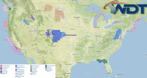
Showers and thunderstorms (isolated strong to severe) will be possible today for portions of Oklahoma. Current NWS Advisories/Watches/Warnings in iMapPro: An upper level trough and cold front pushing eastward across …
Read Storyby WeatherOps, on Oct 24, 2014 3:32:57 PM
Severe thunderstorms and localized flooding is possible Saturday for portions of the Pacific Northwest. Another area of low pressure will approach the Pacific Northwest with additional rain showers and thunderstorms …
Read Storyby WeatherOps, on Oct 24, 2014 12:47:00 PM
Showers and thunderstorms are moving away from Florida as a front continues to stall. No significant impacts expected …
Read Storyby WeatherOps, on Oct 24, 2014 9:39:44 AM
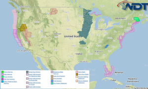
Heavy rain will continue today for Southern Florida and the Bahamas. Current NWS Advisories/Watches/Warnings in iMapPro: Spotty showers and thunderstorms will be possible across portions of Southern Florida and the …
Read Storyby WeatherOps, on Oct 23, 2014 3:08:20 PM
Showers will be coming to an end across the Northeast on Friday with rainfall amounts expected under half an inch. A frontal boundary will advance through the Central Plains and …
Read Storyby WeatherOps, on Oct 23, 2014 12:54:05 PM
Rain is continuing across the Plains and Northeast ahead of an area of low pressure. No severe weather is anticipated, but some flooding will be possible, especially across portions of …
Read Storyby WeatherOps, on Oct 23, 2014 9:38:12 AM
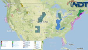
Heavy rain and flooding will continue today for portions of the Pacific Northwest and New England. Current NWS Advisories/Watches/Warnings in iMapPro: An area of low pressure slowly lifting over the …
Read Storyby WeatherOps, on Oct 22, 2014 3:13:23 PM
General showers and thunderstorms are possible Thursday for portions of the Midwest. Heavy rain and flash flooding will continue for the Northeast. Midwest: A weakening front will allow for isolated …
Read Storyby WeatherOps, on Oct 22, 2014 12:48:18 PM
Thunderstorms have developed across the Central Plains ahead of a cold front. While widespread severe weather is not expected, some isolated severe thunderstorms with damaging winds are possible …
Read Storyby WeatherOps, on Oct 22, 2014 9:55:05 AM
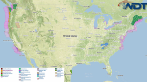
General showers and thunderstorms are possible today for the Central Plains. Heavy rain and flash flooding will continue for the Pacific Northwest and New England. Current NWS Advisories/Watches/Warnings in iMapPro: …
Read Storyby WeatherOps, on Oct 21, 2014 3:19:36 PM
General showers and thunderstorms are possible Wednesday for portions of the Central Plains. Heavy rain and flash flooding will be possible for portions of the Pacific Northwest and New England …
Read Storyby WeatherOps, on Oct 21, 2014 12:45:13 PM
Snow will continue across portions of Northern Idaho and Western Montana. A Winter Weather Advisory continues for this area until 6am MDT Wednesday. Up to 2 inches of snow will …
Read Storyby WeatherOps, on Oct 21, 2014 9:58:40 AM
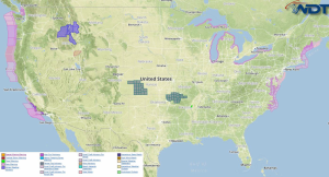
General showers and thunderstorms are possible today from the Four Corners region to Texas. Heavy rain and flooding will continue for the Pacific Northwest. Current NWS Advisories/Watches/Warnings in iMapPro: The …
Read Storyby WeatherOps, on Oct 20, 2014 3:30:41 PM
General showers and thunderstorms are possible Tuesday from the Four Corners region to portions of Texas. Heavy rain and flash flooding will continue for portions of the Pacific Northwest. Four …
Read Storyby WeatherOps, on Oct 20, 2014 12:38:12 PM
Showers and thunderstorms are continuing across portion of Indiana and Ohio. None of this activity is severe, nor is it expected to be. However, some of the stronger thunderstorms will …
Read Storyby WeatherOps, on Oct 20, 2014 9:35:05 AM
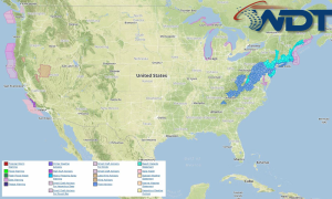
General thunderstorms are possible today for New Mexico and Southwestern Texas. Heavy rain and flash flooding will continue for the Pacific Northwest. Current NWS Advisories/Watches/Warnings in iMapPro: Showers and thunderstorms …
Read Storyby WeatherOps, on Oct 17, 2014 3:08:22 PM
General thunderstorms are possible Saturday across South Texas. A surge of moisture will spread northward into South Texas on Saturday, with a few thunderstorms expected to develop across the region …
Read Storyby WeatherOps, on Oct 17, 2014 12:22:47 PM
Hurricane Gonzalo currently has maximum sustained winds of 110 knots with gusts to 135 knots and is moving north-northeast at 14 knots. Gonzalo is expected to slowly weaken and shift …
Read Storyby WeatherOps, on Oct 17, 2014 9:37:25 AM
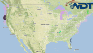
Heavy rain is possible today for portions of Maine and the Pacific Northwest. Current NWS Advisories/Watches/Warnings in iMapPro: A strong area of low pressure will move into western Canada while …
Read Storyby WeatherOps, on Oct 16, 2014 3:30:00 PM
Heavy rain is possible Friday for portions of Maine and the Pacific Northwest. Pacific Northwest: A strong low pressure area will move northeast into westward Canada on Friday while an …
Read Storyby WeatherOps, on Oct 16, 2014 12:40:39 PM
Hurricane Gonzalo has increased over the past day and the tropical storm force wind field has increased. Very high seas are expected in the Western Atlantic. Gonzalo is expected to …
Read Storyby WeatherOps, on Oct 16, 2014 9:38:35 AM
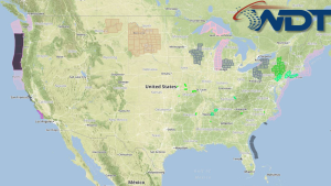
Isolated strong to marginally severe thunderstorms are possible today for the Northeast. Some areas of the Northeast will have some localized flooding due to heavy rain. Current NWS Advisories/Watches/Warnings in …
Read Storyby WeatherOps, on Oct 15, 2014 3:12:59 PM
There will be a slight risk for severe thunderstorms tomorrow across Southeastern New England. For the entire New England region, heavy rain is likely. Southeastern New England: Showers and thunderstorms …
Read Storyby WeatherOps, on Oct 15, 2014 12:32:42 PM
Thunderstorms are currently moving through the Washington DC area and approaching Baltimore. Tornado Warnings are currently in effect for the area. Damaging winds and some embedded tornadoes will be possible …
Read Storyby WeatherOps, on Oct 15, 2014 11:05:46 AM
Hurricane Gonzalo is a Category 4 Hurricane with maximum sustained winds of 130 miles per hour. Current movement is toward the northwest at 12 mph, but is expected to turn …
Read Storyby WeatherOps, on Oct 15, 2014 9:23:47 AM
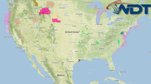
Isolated severe thunderstorms, heavy rain, and localized flooding are possible today for portions of the Mid Atlantic and Carolinas. Current NWS Advisories/Watches/Warnings in iMapPro: Showers and thunderstorms will continue to …
Read Storyby WeatherOps, on Oct 14, 2014 3:16:47 PM
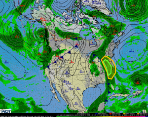
Isolated severe thunderstorms, heavy rain, and flooding will be possible on Wednesday for portions of the Mid Atlantic and the Carolinas. Thunderstorms will move east across the Mid Atlantic and …
Read Storyby WeatherOps, on Oct 14, 2014 1:26:34 PM
A Tornado Watch is in effect until 10pm EDT for portions of Georgia, North Carolina, South Carolina, and Virginia. Damaging winds to 70 miles per hour and tornadoes will be …
Read Storyby WeatherOps, on Oct 14, 2014 12:49:13 PM
Thunderstorms are continuing across portions of Florida and Georgia. As thunderstorms continue to move toward the east, damaging winds and isolated tornadoes will be possible. Some additional development to the …
Read Storyby WeatherOps, on Oct 14, 2014 11:02:42 AM
A Severe Thunderstorm Watch is in effect for portions of Northern Florida and Southern Georgia until 7pm EDT. Damaging winds to 70 mph and isolated tornadoes will be possible …
Read Storyby WeatherOps, on Oct 14, 2014 9:29:28 AM
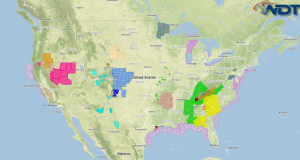
Severe thunderstorms, in addition to heavy rain and localized flooding, are possible today from the Mid Ohio Valley and Central Appalachians to Northern Florida. Scattered strong to severe thunderstorms are …
Read Storyby WeatherOps, on Oct 13, 2014 3:16:16 PM
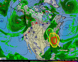
Severe thunderstorms are possible Tuesday for portions of the Southern Appalachians southward to the Florida Panhandle. Strong to severe thunderstorms are possible from the Ohio River Valley to the Atlantic …
Read Storyby WeatherOps, on Oct 13, 2014 2:01:12 PM
A Tornado Watch is in effect until 10pm CDT for portions of Southeast Louisiana and Southern Mississippi until 10pm CDT. Hail to 1", damaging winds to 70 miles per hour, …
Read Storyby WeatherOps, on Oct 13, 2014 1:53:33 PM
A Tornado Watch is in effect for portions of Arkansas, Louisiana, Missouri, Mississippi, and Tennessee. Large hail to 1.5", damaging winds to 75 mph, and tornadoes will be possible …
Read Storyby WeatherOps, on Oct 13, 2014 12:31:16 PM
Storms are continuing across the Lower Mississippi Valley as a cold front continues to move eastward. As thunderstorms continue, hail, damaging winds, and tornadoes will be possible. Some embedded tornadoes …
Read Storyby WeatherOps, on Oct 13, 2014 11:10:46 AM
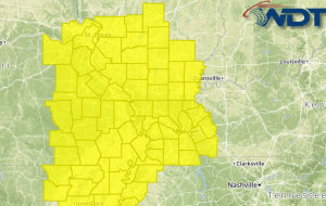
A Tornado Watch is in effect for portions of Illinois, Kentucky, and Missouri until 7pm CDT. Damaging winds to 70 miles per hour and tornadoes will be possible. Tornado Watch …
Read Storyby WeatherOps, on Oct 13, 2014 9:55:33 AM
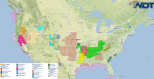
Severe thunderstorms with the potential for damaging winds and tornadoes will be possible today for portions of the Mid and Southern Mississippi Valley. Severe thunderstorms are likely from Illinois and …
Read Storyby WeatherOps, on Oct 10, 2014 3:00:32 PM
Isolated strong storms are possible Saturday from portions of South Central Texas into Southern Arkansas. Scattered showers and perhaps a few weak thunderstorms will be ongoing during the morning hours …
Read Storyby WeatherOps, on Oct 10, 2014 12:40:57 PM
Thunderstorms are developing along a cold front across portions of Oklahoma and Texas. While thunderstorms are beginning to develop, further development is likely across portions of Southern Oklahoma and Northern …
Read Storyby WeatherOps, on Oct 10, 2014 9:26:21 AM
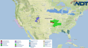
Isolated strong thunderstorms are possible today for portions of the Arklatex into the Tennessee Valley. Heavy rain is possible from the Missouri/Arkansas border into West Central Texas. Current NWS Advisories/Watches/Warnings …
Read Storyby WeatherOps, on Oct 8, 2014 3:14:15 PM
Thunderstorms are possible Thursday for portions of the Central and Southern Plains into Illinois. Central and Southern Plains into Illinois: A cold front now moving back to the Southern Plains …
Read Storyby WeatherOps, on Oct 8, 2014 12:41:02 PM
It's a pretty quiet day across the US with a few thunderstorms across the New England region and the Southwest. The activity across the New England region will continue to …
Read Storyby WeatherOps, on Oct 8, 2014 9:37:33 AM
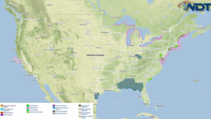
Strong thunderstorms are expected across the Upper Northeast through the morning. Isolated strong thunderstorms are also possible for portions of the Central Plains and Southeast. Heavy showers and thunderstorms will …
Read Storyby WeatherOps, on Oct 7, 2014 3:21:50 PM
Isolated strong storms will be possible Wednesday morning across portions of New England. Isolated strong storms will be possible for the Central Plains. Heavy showers and thunderstorms are expected across …
Read Storyby WeatherOps, on Oct 7, 2014 1:17:05 PM
A Tornado Watch is in effect until 9pm EDT for portions of Indiana, Kentucky, Ohio, and West Virginia. Hail to 2", damaging winds to 70 mph, and tornadoes will be …
Read Storyby WeatherOps, on Oct 7, 2014 12:38:24 PM
Severe thunderstorms are continuing to move across the Ohio Valley ahead of an upper level trough across the Mid Mississippi Valley. While cloud cover will inhibit destabilization, forcing from the …
Read Storyby WeatherOps, on Oct 7, 2014 9:44:50 AM
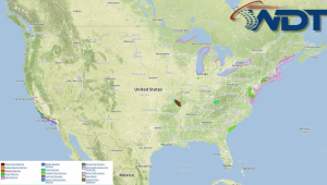
Severe thunderstorms are possible Tuesday for portions of the Northern Mid Atlantic and Lower New England. Isolated strong thunderstorms are possible for portions of the Ohio and Tennessee Valleys into …
Read Storyby WeatherOps, on Oct 6, 2014 3:07:33 PM
Isolated strong thunderstorms are possible for portions of the Mid-Mississippi Valley and Lower New England. Ohio and Tennessee Valleys: A lesser risk for hazardous thunderstorms will exist on Tuesday as …
Read Storyby WeatherOps, on Oct 6, 2014 12:45:19 PM
Thunderstorms are developing from the Ohio Valley to the Texas Gulf Coast ahead of a broad upper level system. Within this region, the area with the greatest potential for severe …
Read Storyby WeatherOps, on Oct 6, 2014 9:44:56 AM
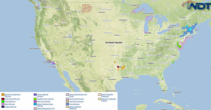
Strong to severe thunderstorms are possible today from the Lower Mississippi Valley to the Ohio Valley. Current NWS Advisories/Watches/Warnings in iMapPro: A large scale trough persists across the eastern US …
Read Storyby WeatherOps, on Oct 3, 2014 2:25:30 PM
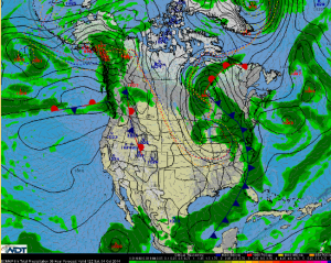
The upper-level low will continue pushing eastward over the upper Great Lakes region going through the day. Thunderstorms will be possible across the Florida Peninsula and along the Mid-Atlantic coast …
Read Storyby WeatherOps, on Oct 3, 2014 12:35:20 PM
Thunderstorms are continuing to move across the Southeast ahead of a cold front. While no widespread severe weather is expected due to limited instability, some storms may produce some heavy …
Read Storyby WeatherOps, on Oct 3, 2014 9:40:55 AM
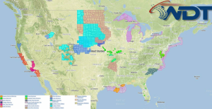
Strong to severe thunderstorms are possible today from the Ohio Valley through the Gulf Coast. Current NWS Advisories/Watches/Warnings in iMapPro: An upper level trough will push over the eastern half …
Read Storyby WeatherOps, on Oct 2, 2014 2:32:38 PM
Heavy rain and thunderstorms will be possible Thursday for portions of the Upper Great Lakes. Heavy rainfall will be possible mostly for the Upper Great Lakes as low pressure lifts …
Read Storyby WeatherOps, on Oct 2, 2014 2:10:12 PM
A Severe Thunderstorm Watch is in effect for portions of Oklahoma and Texas until 9pm CDT. Hail to 2" and damaging winds to 70 mph will be possible …
Read Storyby WeatherOps, on Oct 2, 2014 1:38:57 PM
A Severe Thunderstorm Watch is in effect until 9pm CDT for portions of Illinois and Missouri. Hail to 1.5" and damaging winds to 70 miles per hour will be possible …
Read Storyby WeatherOps, on Oct 2, 2014 12:38:41 PM
A Severe Thunderstorm Watch is in effect for portions of Arkansas, Kansas, Missouri, and Oklahoma as a cold front moves through the Plains. Ahead of the front, thunderstorms capable of …
Read Storyby WeatherOps, on Oct 2, 2014 9:45:51 AM
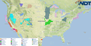
Severe thunderstorms are possible today from the Midwest to the Southern Plains. Strong to borderline severe thunderstorms are possible from the Lower Great Lakes to Southern Texas. Heavy rain and …
Read Storyby WeatherOps, on Oct 1, 2014 2:54:09 PM
A Tornado Watch is in effect for portions of Kansas, Missouri, and Oklahoma until 10pm CDT. Hail to 2", damaging winds to 70 mph, and tornadoes will be possible …
Read Storyby WeatherOps, on Oct 1, 2014 12:37:47 PM
Thunderstorms are beginning to develop ahead of a cold front across the Central Plains. Additional thunderstorms are likely as moisture advection and daytime heating continue through the afternoon. As thunderstorms …
Read Storyby WeatherOps, on Oct 1, 2014 9:45:08 AM
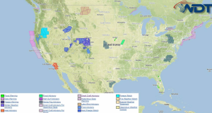
Severe thunderstorms are possible Thursday for portions of the Missouri Valley and Central Plains. Strong to severe thunderstorms will be possible from the Upper Midwest to Oklahoma. Heavy rain is …
Read Storyby WeatherOps, on Sep 30, 2014 4:09:59 PM
Severe thunderstorms are possible Wednesday for portions of the Missouri Valley and Central Plains. Strong to severe storms are possible for portions of the Central and Northern Plains. Heavy rain …
Read Storyby WeatherOps, on Sep 30, 2014 12:37:48 PM
There is a slight risk of severe thunderstorms for portions of South Dakota ahead of an upper level trough moving out of the Rockies. Ahead of the trough, daytime heating …
Read Storyby WeatherOps, on Sep 30, 2014 9:45:24 AM
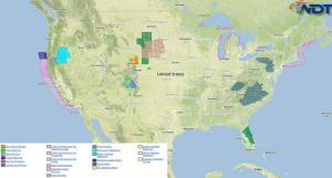
Severe thunderstorms are possible today for portions of the Central Plains with strong storms further south across the Southern Plains. Isolated showers and strong thunderstorms will be possible for portions …
Read Storyby WeatherOps, on Sep 29, 2014 3:59:55 PM
Strong to severe thunderstorms are possible Tuesday for portions of the Central and Northern Plains. Heavy rain and thunderstorms possible for the Northern High Plains. Central/Northern Plains: The Low will …
Read Storyby WeatherOps, on Sep 29, 2014 3:19:13 PM
A Tornado Watch is in effect for portions of Colorado, Kansas, Nebraska, and Wyoming until 9pm MDT. Hail to 1.5", damaging winds to 70 mph, and tornadoes will be possible …
Read Storyby WeatherOps, on Sep 29, 2014 3:06:45 PM
A Severe Thunderstorm Watch is in effect for portions of Colorado, New Mexico, Oklahoma, and Texas until 9pm MDT. Hail to 1", damaging winds to 70 mph, and isolated tornadoes …
Read Storyby WeatherOps, on Sep 29, 2014 12:35:52 PM
Thunderstorms are possible for portions of the High Plains ahead of an upper level trough moving across the Rockies. Daytime heating, upslope flow, strong shear, and moisture advection will allow …
Read Storyby WeatherOps, on Sep 29, 2014 9:51:02 AM
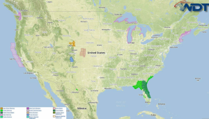
Strong thunderstorms are possible today for portions of the Central High Plains. A few thunderstorms across Eastern Colorado and Western Nebraska may become severe with large hail and tornadoes will …
Read Storyby WeatherOps, on Sep 26, 2014 3:52:06 PM
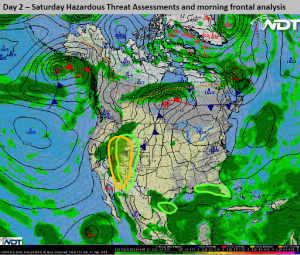
There is a slight risk for strong to isolated severe thunderstorms Saturday for the Four Corners region. Heavy rain will continue for the Great Basin. Heavy rain will be possible …
Read Storyby WeatherOps, on Sep 26, 2014 12:38:09 PM
Severe thunderstorms are possible today for portions of Arizona ahead of an upper level trough moving onto the California coast. Strong shear and sufficient instability will allow for the development …
Read Storyby WeatherOps, on Sep 25, 2014 4:04:03 PM
Strong to isolated severe thunderstorms will be possible Friday afternoon and evening across portions of the Great Basin and Desert Southwest. Heavy rain will continue across South Texas. Great Basin …
Read Storyby WeatherOps, on Sep 25, 2014 12:34:19 PM
Thunderstorms are developing over Eastern New Mexico and Western Texas as daytime heating continues to destabilize the atmosphere. While thunderstorms will likely remain isolated, hail and some gusty winds will …
Read Storyby WeatherOps, on Sep 24, 2014 4:08:58 PM
Heavy rain continues along the coastal areas of the Mid Atlantic and Northeast, as well as just offshore. Moderate to heavy rain will continue for portions of the Southern and …
Read Storyby WeatherOps, on Sep 24, 2014 1:24:19 PM
Severe thunderstorms are moving southward across the Texas Panhandle. As thunderstorms continue, large hail and damaging winds will be the main concerns. Further development to the south is likely along …
Read Storyby WeatherOps, on Sep 24, 2014 12:28:17 PM
Thunderstorms will develop across portions of the High Plains this afternoon and tonight ahead of a weak disturbance. Storms will be rather disorganized due to the lack of vertical shear …
Read Storyby WeatherOps, on Sep 24, 2014 9:53:51 AM
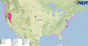
There is a slight risk for strong afternoon storms for portions of the Southern and Central High Plains. Heavy rain will continue off the coast of the Carolinas and Mid …
Read Storyby WeatherOps, on Sep 23, 2014 3:53:33 PM
Heavy rain is possible Wednesday along the coastal areas of the Carolinas and the Mid Atlantic. Across the Southern High Plains, there is a slight right for strong afternoon or …
Read Storyby WeatherOps, on Sep 23, 2014 12:28:24 PM
Showers and thunderstorms will expand in coverage this afternoon and evening across the Plains ahead of an upper level trough. Strong lift ahead of the trough will allow for thunderstorms …
Read Storyby WeatherOps, on Sep 23, 2014 9:54:22 AM
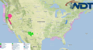
Isolated showers with some strong storms will be possible today across portions of the Central Plains this afternoon and evening. Scattered to widespread rain will be possible from the Central …
Read Storyby WeatherOps, on Sep 22, 2014 3:58:40 PM
Isolated to scattered showers and thunderstorms will be possible Tuesday for portions of the Gulf and Southeast Coasts. Across the Central Plains, isolated showers will be possible. Scattered showers will …
Read Storyby WeatherOps, on Sep 22, 2014 12:37:00 PM
Thunderstorms will be possible across portions of the Central Rockies and High Plains ahead of an upper level trough. Where breaks in the clouds have occurred, destabilization will allow for …
Read Storyby WeatherOps, on Sep 22, 2014 9:47:00 AM
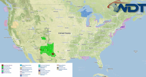
Isolated to scattered showers and thunderstorms will be possible on Monday across the Gulf and Southeast coasts. Showers, thunderstorms, and heavy rainfall will be possible across portions of the Intermountain …
Read Storyby WeatherOps, on Sep 19, 2014 4:16:33 PM
Strong to isolated severe thunderstorms are possible Saturday for portions of the Central Plains, Upper Mississippi Valley, and Great Lakes. Moderate to heavy rain across the Southwest and western portions …
Read Storyby WeatherOps, on Sep 19, 2014 12:42:05 PM
Flooding continues for portions of Western and Southeastern Texas as the remnants of Tropical Storm Odile continue to move eastward. Flash Flood Watches and Warnings continue for much of Western …
Read Storyby WeatherOps, on Sep 19, 2014 9:48:53 AM
General thunderstorms, with some isolated strong storms, will be possible for portions of the Central Plains and Upper Mississippi Valley on Friday. Flooding will continue from the Southwest into West …
Read Storyby WeatherOps, on Sep 18, 2014 3:55:56 PM
General thunderstorms with isolated strong thunderstorms will be possible on Friday for portions of the Central Plains and Upper Mississippi Valley. Moderate to heavy rain, as well as flooding potential, …
Read Storyby WeatherOps, on Sep 18, 2014 12:41:15 PM
Flash Flood Watches and Areal Flood Watches are in effect for portions of Central and Southeast Texas through early evening. 1-3 inches of rain, with 5-6 inches in isolated areas, …
Read Storyby WeatherOps, on Sep 18, 2014 9:54:34 AM
General thunderstorms with small hail and strong winds will be possible Thursday from portions of the Central Plains to the Gulf Coast. Strong to severe thunderstorms will be possible for …
Read Storyby WeatherOps, on Sep 17, 2014 3:50:14 PM
General thunderstorms and isolated strong wind gusts are possible Thursday for portions of the Central Plains, Southeast, and Carolinas. For the Northern Plains, strong to severe thunderstorms with hail and …
Read Storyby WeatherOps, on Sep 17, 2014 12:39:31 PM
Flash flooding will continue for portions of Southern Missouri as thunderstorms continue to track over the region. Flash Flood Watches are in effect through mid afternoon where an additional 1-2 …
Read Storyby WeatherOps, on Sep 17, 2014 9:50:00 AM
General thunderstorms are possible today for portions of Texas, the Gulf Coast, and the Carolinas. For the Central Plains and Midwest, general thunderstorms will be possible with some isolated severe …
Read Storyby WeatherOps, on Sep 16, 2014 3:58:03 PM
General thunderstorms are possible Wednesday for portions of Texas, the Gulf Coast, and the Carolinas. Across the Central Plains and Midwest, general thunderstorms with some isolated severe thunderstorms with hail …
Read Storyby WeatherOps, on Sep 16, 2014 12:45:11 PM
Hurricane Odile is moving northward across Baja California and is bringing a potential for flooding across portions of the Desert Southwest. Flash Flood Watches are in effect for portions of …
Read Storyby WeatherOps, on Sep 16, 2014 9:49:37 AM
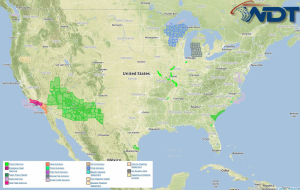
General thunderstorms are possible on Tuesday for portions of the Southern Plains through the Ozarks, as well as the Gulf Coast through the Mid Atlantic; locally heavy rainfall will be …
Read Storyby WeatherOps, on Sep 15, 2014 4:06:35 PM
General thunderstorms are possible Tuesday for portions of Texas, Gulf Coast, and the Carolinas. No significant weather is anticipated on Tuesday. High pressure will progress into the Mid-Mississippi Valley while …
Read Storyby WeatherOps, on Sep 15, 2014 12:44:33 PM
Thunderstorms have developed across the Midwest and Ohio River Valley ahead of an upper level trough. Further development is possible through the day, but due to limited instability, no severe …
Read Storyby WeatherOps, on Sep 15, 2014 9:44:45 AM
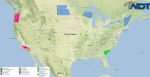
General thunderstorms will be possible today for portions of the Southern Plains and Ozarks, as well as the Gulf Coast into the Mid Atlantic. Current NWS Advisories/Watches/Warnings in iMapPro: A …
Read Storyby WeatherOps, on Sep 12, 2014 4:07:29 PM
Showers and thunderstorms will be possible on Saturday for the Northeast, Eastern Seaboard, and Southwestern Texas. High pressure builds eastward and over the Midwest on Saturday with a cold front …
Read Storyby WeatherOps, on Sep 12, 2014 9:56:39 AM
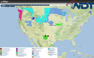
Showers and thunderstorms will be possible on Friday for portions of the Southern Plains and Southeast. Scattered showers will be possible for the Central Plains and Upper Midwest. Current NWS …
Read Storyby WeatherOps, on Sep 11, 2014 3:56:38 PM
Showers and general thunderstorms are possible Friday for portions of the Southern Plains and Southeast. Across the Upper Midwest, scattered showers are possible. By Friday, surface high pressure should expand …
Read Storyby WeatherOps, on Sep 11, 2014 12:43:20 PM
Thunderstorms are developing across the Mid South ahead of a cold front. While no severe weather is expected, some storms could produce some heavy rain. Flash Flood Watches remain in …
Read Storyby WeatherOps, on Sep 11, 2014 9:47:40 AM
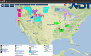
Showers and thunderstorms, some severe, will be possible for portions of the Mid Atlantic. In the Central and Northern High Plains, rain and snow will continue. Showers and thunderstorms will …
Read Storyby WeatherOps, on Sep 10, 2014 4:00:51 PM
Severe thunderstorms are possible Thursday for portions of the Central Appalachians and the Central Atlantic. Isolated severe thunderstorms are possible for portions of the Colorado Rockies. Clusters of thunderstorms moving …
Read Storyby WeatherOps, on Sep 10, 2014 3:45:59 PM
A Severe Thunderstorm Watch is in effect for portions of Illinois, Indiana, and Missouri until 8pm CDT. Hail to 1", damaging winds to 70 mph, and isolated tornadoes will be …
Read Storyby WeatherOps, on Sep 10, 2014 1:17:22 PM
A Tornado Watch is in effect for portions of Indiana, Michigan, and Ohio until 9pm EDT. Damaging winds to 70 mph and a few tornadoes will be possible …
Read Storyby WeatherOps, on Sep 10, 2014 12:54:55 PM
Thunderstorms are developing ahead of an upper level trough moving into the Upper Mississippi Valley. The increase in moisture and the ascent from this trough will allow for further thunderstorm …
Read Storyby WeatherOps, on Sep 10, 2014 11:16:43 AM
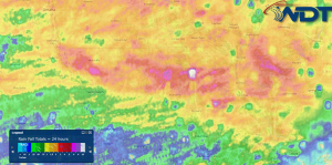
Heavy rain has fallen across portions of Northern Missouri over the past 24 hours. Up to 6 inches of rain have fallen across portions of Northern Missouri and into Western …
Read Storyby WeatherOps, on Sep 9, 2014 4:04:07 PM
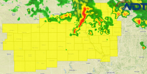
A Tornado Watch is in effect for portions of Iowa, Kansas, Nebraska, and Missouri until midnight CDT. Hail to 2 inches, damaging winds to 75 miles per hour, and tornadoes …
Read Storyby WeatherOps, on Sep 9, 2014 3:52:15 PM
Severe thunderstorms will be possible on Wednesday for portions of the Great Lakes and Midwest. Showers and thunderstorms are possible for portions of the Northern Rockies. A strong low pressure …
Read Storyby WeatherOps, on Sep 9, 2014 3:22:09 PM
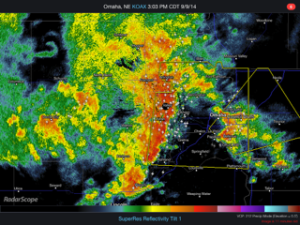
Thunderstorms are currently approaching the Omaha area. As thunderstorms continue to approach, hail and damaging winds to 60 mph will be possible. Radar …
Read Storyby WeatherOps, on Sep 9, 2014 9:44:18 AM
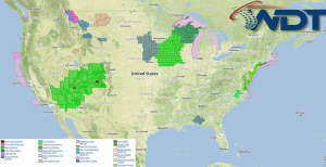
Severe thunderstorms are possible today across the Central Plains and Upper Midwest. Showers and thunderstorms are possible across the Southeast coast. Scattered showers are possible for the Four Corners region …
Read Storyby WeatherOps, on Sep 8, 2014 4:03:17 PM
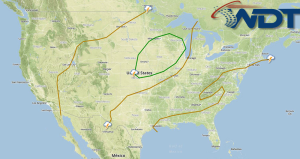
Severe thunderstorms are possible Tuesday across the Central Plains and Upper Midwest. Showers and thunderstorms are possible for the Southeast and the Four Corners region. Scattered showers are possible for …
Read Storyby WeatherOps, on Sep 8, 2014 12:50:15 PM
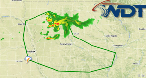
Ongoing thunderstorm activity across Iowa will continue through the afternoon, but additional development will be possible ahead of outflow boundaries. Plentiful moisture to the east of a lee trough will …
Read Storyby WeatherOps, on Sep 8, 2014 11:38:14 AM
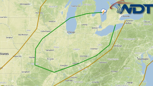
There areas of severe weather potential for portions of the Plains, Midwest, and Great Lakes for Tuesday and Wednesday. An upper level trough over southern portions of Canada will dig …
Read Storyby WeatherOps, on Sep 8, 2014 9:48:57 AM
Severe thunderstorms are possible today for the Central Plains. Showers and thunderstorms are possible for portions of the Great Basin/Four Corners region and across the Southeast. Current NWS Advisories/Watches/Warnings in …
Read Storyby WeatherOps, on Sep 5, 2014 4:00:54 PM
Severe thunderstorms are possible Saturday across the Upper Northeast. General thunderstorms are possible for portions of the Northeast through the Southern Plains. Heavy rain and thunderstorms are possible for portions …
Read Storyby WeatherOps, on Sep 5, 2014 2:27:48 PM
A Severe Thunderstorm Watch is in effect until 9pm for portions of Illinois, Indiana, Michigan, and Ohio. Hail to 1.5" and damaging winds to 70 mph will be possible. Watch …
Read Storyby WeatherOps, on Sep 5, 2014 12:35:42 PM

There is a slight risk of severe thunderstorms across portions of the Great Lakes and Midwest ahead of a cold front across the Midwest and Plains. As thunderstorms develop, hail …
Read Storyby WeatherOps, on Sep 5, 2014 9:37:10 AM
Severe thunderstorms are possible today across the Lower Great Lakes and Midwest. General thunderstorms are possible for portions of the Great Lakes into the Plains and the Four Corners region …
Read Storyby WeatherOps, on Sep 4, 2014 3:59:38 PM
General thunderstorms will be possible Friday from portions of the Great Lakes into the Central and Southern Plains. Scattered showers and thunderstorms will be possible for portions of the Southeast …
Read Storyby WeatherOps, on Sep 4, 2014 12:41:09 PM
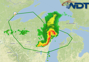
A bow echo over Eastern Wisconsin will track over Lake Michigan and Lower Michigan. As it continues to move east, damaging winds, lightning, and heavy rain will be the main …
Read Storyby WeatherOps, on Sep 4, 2014 11:18:21 AM
A bow echo has developed and is moving across Wisconsin. As this activity continues to move east, damaging winds and frequent lightning will be the main concerns, but large hail …
Read Storyby WeatherOps, on Sep 4, 2014 9:49:01 AM
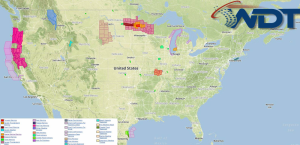
Severe thunderstorms will continue today across Wisconsin and the Upper Peninsula of Michigan. Scattered showers and thunderstorms are possible for portions of the Southeast and Mid Atlantic. Isolated showers and …
Read Storyby WeatherOps, on Sep 3, 2014 4:00:48 PM
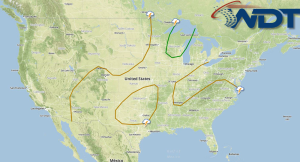
Severe thunderstorms are possible Thursday for portions of Wisconsin and the Upper Peninsula of Michigan. Scattered showers and thunderstorms will be possible for portions of the Southeast and Mid Atlantic …
Read Storyby WeatherOps, on Sep 3, 2014 12:35:17 PM
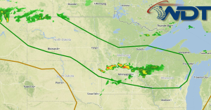
Thunderstorms are developing over portions of the Northern Plains and Midwest ahead of an upper level trough. As daytime heating and moisture advection increases, instability will increase and lead to …
Read Storyby WeatherOps, on Sep 3, 2014 9:46:44 AM
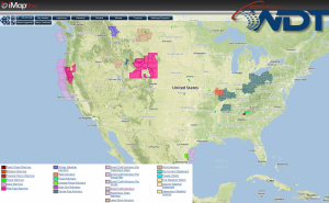
Severe thunderstorms are likely today across the Upper Midwest while scattered showers and thunderstorms are likely across the Southeast. Current NWS Advisories/Watches/Warnings in iMapPro Severe weather will be possible for …
Read Storyby WeatherOps, on Sep 2, 2014 3:59:56 PM
Scattered showers and thunderstorms will be possible on Wednesday for portions of the Upper Midwest; some may be severe. Isolated showers and thunderstorms will be possible across the Southeast. While …
Read Storyby WeatherOps, on Sep 2, 2014 12:42:05 PM
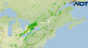
There is a slight risk for severe thunderstorms today ahead of a shortwave trough moving across Eastern Canada. Strong daytime heating will contribute to further destabilization and thus the development …
Read Storyby WeatherOps, on Sep 2, 2014 11:21:15 AM
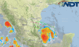
Tropical Storm Dolly will make Landfall in Mexico later today. A Tropical Storm Warning is in effect from Cabo Rojo to Barra El Mezquital, Mexico. Maximum sustained winds are near …
Read Storyby WeatherOps, on Sep 2, 2014 9:55:04 AM
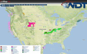
Showers and thunderstorms will be possible Tuesday for portions of the Ohio River Valley to Upstate New York; some thunderstorms may be severe. Isolated showers and thunderstorms will be possible …
Read Storyby WeatherOps, on Aug 29, 2014 3:54:37 PM

Showers and thunderstorms will continue Saturday for portions of the Midwest, Great Lakes, and Northeast. Across the Northern Plains, afternoon showers and thunderstorms will be possible for portions of the …
Read Storyby WeatherOps, on Aug 29, 2014 12:26:58 PM
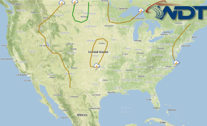
Thunderstorms are developing across portions of the Plains and Midwest ahead of an upper level system. Thunderstorms will continue to develop through the afternoon and evening, but will dissipate after …
Read Storyby WeatherOps, on Aug 29, 2014 9:58:45 AM
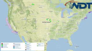
Showers and thunderstorms will continue Friday for portions of the Midwest and Great Lakes; hail, damaging winds, and isolated tornadoes will be possible. Thunderstorms will be possible across the Northern …
Read Storyby WeatherOps, on Aug 28, 2014 4:20:13 PM
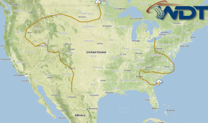
Showers and thunderstorms will continue for portions of the Midwest and Great Lakes on Friday. Thunderstorms will develop across the Northern Plains ahead of a front. Thunderstorms and heavy rain …
Read Storyby WeatherOps, on Aug 28, 2014 2:34:18 PM
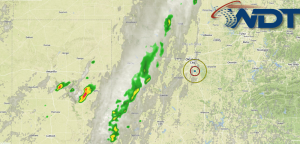
Thunderstorms are developing across western portions of Oklahoma and Texas ahead of a cold front associated with an upper level trough moving out of the Rockies. Thunderstorms will continue to …
Read Storyby WeatherOps, on Aug 28, 2014 12:45:20 PM
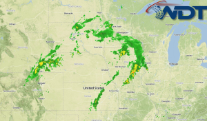
Showers and thunderstorms have developed across the Plains and Midwest along a cold front situated across portions of Kansas and Nebraska. More thunderstorms will be possible through the afternoon as …
Read Storyby WeatherOps, on Aug 28, 2014 9:53:36 AM
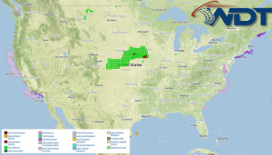
Showers and thunderstorms (some strong) will be possible today for portions of the Central Plains and Midwest. Scattered showers and thunderstorms will be possible for portions of the Southeast and …
Read Storyby WeatherOps, on Aug 27, 2014 4:06:25 PM
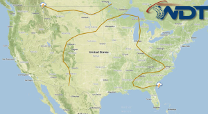
Showers and thunderstorms, with isolated strong thunderstorms, will be possible for portions of the Central Plains and Midwest. Scattered showers and thunderstorms will be possible for portions of the Southeast …
Read Storyby WeatherOps, on Aug 27, 2014 2:51:00 PM
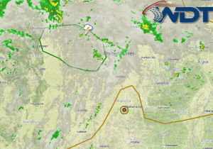
Thunderstorms are developing across the Plains ahead of an upper level trough. As thunderstorms develop, hail and damaging winds will be the main threats, but an isolated tornado cannot be …
Read Storyby WeatherOps, on Aug 27, 2014 12:45:36 PM
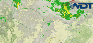
There is a slight risk for severe thunderstorms this afternoon across the Central High Plains. Daytime heating and moisture advection will contribute to destabilization. The forcing for thunderstorms will come …
Read Storyby WeatherOps, on Aug 27, 2014 9:54:55 AM
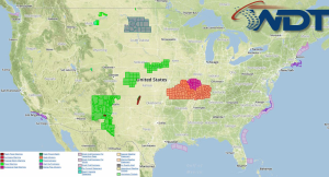
Showers and thunderstorms (isolated severe) will be possible for portions of the Central Plains and Midwest. Scattered thunderstorms will be possible for portions of the Southeast and Gulf Coast. Isolated …
Read Storyby WeatherOps, on Aug 26, 2014 4:12:36 PM
Showers and thunderstorms, with some strong to isolated severe thunderstorms, will be possible Wednesday across the Central Plains and Midwest. Scattered showers and general thunderstorms will be possible for portions …
Read Storyby WeatherOps, on Aug 26, 2014 3:36:03 PM
Severe thunderstorms are approaching the Detroit metro area. The line of storms are moving east at 45 miles per hour. Damaging winds will be the primary concern with these storms …
Read Storyby WeatherOps, on Aug 26, 2014 12:40:55 PM
Hurricane Cristobol continues to move toward the north at 12 miles per hour and is expected to continue on this track through tonight. A turn to the northeast is expected …
Read Storyby WeatherOps, on Aug 26, 2014 11:13:00 AM
A line of thunderstorms is approaching the Chicago area. As these storms continue to move toward the east, small hail, damaging winds to 60 miles per hour, and lightning will …
Read Storyby WeatherOps, on Aug 26, 2014 9:54:47 AM
Showers and thunderstorms will be possible for portions of the Central Plains and Midwest; isolated storms may be strong to severe. Isolated thunderstorms will be possible for the Great Basin …
Read Storyby WeatherOps, on Aug 25, 2014 4:04:55 PM
Showers and thunderstorms will be possible Tuesday across portions of the Central Plains and Midwest; some severe thunderstorms possible. Showers and general thunderstorms will be possible for the Great Basin/Four …
Read Storyby WeatherOps, on Aug 25, 2014 2:18:20 PM
Severe thunderstorms are moving through the Chicago area and Northwestern Indiana. As the thunderstorms progress, damaging winds to 60 miles per hour and small hail will be possible. Radar …
Read Storyby WeatherOps, on Aug 25, 2014 12:30:11 PM
Tropical Strom Cristobol is continuing to produce heavy rain for the Turks and Caicos Islands while slowly moving to the north northeast at 2 miles per hour. 4-8 inches of …
Read Storyby WeatherOps, on Aug 25, 2014 9:48:05 AM
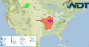
Isolated severe thunderstorms will be possible for portions of the Central Plains and Great Lakes. Scattered showers and thunderstorms with isolated severe thunderstorms will be possible for the Four Corners …
Read Storyby WeatherOps, on Aug 22, 2014 3:55:50 PM
Isolated severe thunderstorms will be possible for portions of the Northern Plains. Showers and thunderstorms, with periods of heavy rain, will be possible for portions of the Northern Rockies and …
Read Storyby WeatherOps, on Aug 22, 2014 12:52:26 PM
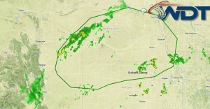
Showers and thunderstorms will continue for portions of the Plains as an upper level trough moves out of the Rockies. Daytime heating and low level moisture advection will allow for …
Read Storyby WeatherOps, on Aug 22, 2014 9:53:49 AM
Widespread showers and thunderstorms will be possible today for the Great Lakes and Northeast. Scattered showers and isolated thunderstorms will be possible from portions of the Pacific Northwest to the …
Read Storyby WeatherOps, on Aug 21, 2014 4:18:06 PM

Widespread showers and thunderstorms are possible tomorrow for portions of the Great Lakes and Northeast. Scattered showers and thunderstorms will be possible for the Pacific Northwest and Northern Rockies. Thunderstorms …
Read Storyby WeatherOps, on Aug 21, 2014 12:52:31 PM
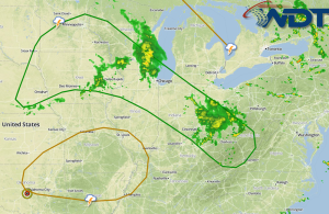
Thunderstorms will continue to develop across portions of the Midwest and Ohio River Valley this afternoon ahead of a shortwave trough. Daytime heating will allow for destabilization and thunderstorm development …
Read Storyby WeatherOps, on Aug 21, 2014 12:03:15 PM
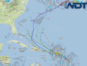
Showers and thunderstorms have developed east of the Lesser Antilles. This area could become a tropical depression over the next day as it continues to move to the west northwest …
Read Storyby WeatherOps, on Aug 21, 2014 9:42:21 AM
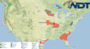
Isolated severe thunderstorms will be possible today for portions of the Midwest and Ohio River Valley; hail and damaging winds will be the main threats. Across the Northeast, scattered showers …
Read Storyby WeatherOps, on Aug 20, 2014 3:42:45 PM
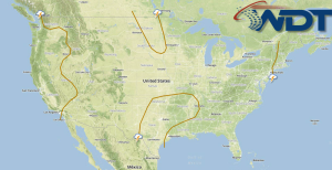
Strong to severe thunderstorms will be possible on Thursday for portions of the Ohio River Valley and the Northeast, as well as for portions of the Northern Plains and Midwest …
Read Storyby WeatherOps, on Aug 20, 2014 3:13:52 PM
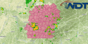
A Severe Thunderstorm Watch is in effect for portions of Kentucky, North Carolina, and Tennessee until 10pm CDT. Hail to 1 inch and damaging winds to 70 mph will be …
Read Storyby WeatherOps, on Aug 20, 2014 12:48:47 PM
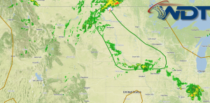
Thunderstorms are beginning to develop across the Northern Plains ahead of a shortwave trough. Daytime heating and weak warm air advection will allow for further destabilization and thus the development …
Read Storyby WeatherOps, on Aug 20, 2014 9:55:41 AM
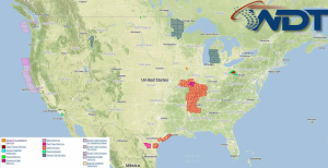
Severe thunderstorms are possible today for portions of the Ohio River Valley. Severe thunderstorms with the potential for large hail, damaging winds, and isolated tornadoes will be possible across the …
Read Storyby WeatherOps, on Aug 19, 2014 4:17:04 PM
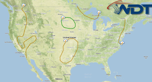
Thunderstorms will be possible on Wednesday for portions of the lower Ohio River Valley. Across the High and Northern Plains, severe thunderstorms with the potential for large hail, damaging winds, …
Read Storyby WeatherOps, on Aug 19, 2014 1:50:37 PM
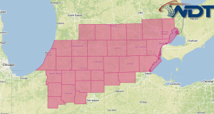
A Severe Thunderstorm Watch is in effect for portions of Indiana, Michigan, and Ohio until 9pm EDT. Hail to 1" and damaging winds to 70 mph will be possible. Watch …
Read Storyby WeatherOps, on Aug 19, 2014 12:08:46 PM
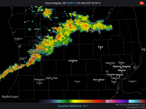
A line of storms is moving through the Lower Peninsula of Michigan. As they continue to move east, small hail, damaging winds, and frequent lightning will be possible. Further development …
Read Storyby WeatherOps, on Aug 19, 2014 9:48:39 AM
Severe thunderstorms are possible today for portions of the Ohio and Mississippi Valleys. Thunderstorms with locally heavy rainfall are possible for portions of the Southeast; some storms may be severe …
Read Storyby WeatherOps, on Aug 18, 2014 4:11:33 PM
Thunderstorms, some severe, are possible Tuesday for portions of the Ohio River Valley. Scattered thunderstorms will be possible for portions of the High and Northern Plains. Surface cold front moving …
Read Storyby WeatherOps, on Aug 18, 2014 1:47:47 PM
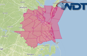
A Severe Thunderstorm Watch is in effect for portions of Northeast North Carolina and Southeast Virginia until 7pm EDT. Hail to 1.5" and damaging winds to 70 mph will be …
Read Storyby WeatherOps, on Aug 18, 2014 12:22:55 PM
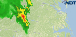
Thunderstorms are developing across portions of Southeastern Virginia and Northeastern Virginia. As thunderstorms develop, they will eventually merge into a squall line and pose a damaging wind risk. Frequent lightning …
Read Storyby WeatherOps, on Aug 18, 2014 9:36:13 AM
Severe thunderstorms are possible today for portions of the Upper Mississippi Valley. Current NWS Advisories/Watches/Warnings in iMapPro: The severe weather in the Northern Plains will shift into the Upper Mississippi …
Read Storyby WeatherOps, on Aug 15, 2014 4:03:35 PM
Severe thunderstorms are possible on Saturday for portions of Missouri. General thunderstorms are possible for portions of the Dakotas, Upper Midwest, Great Lakes, Southern High Plains, and Gulf Coast. By …
Read Storyby WeatherOps, on Aug 15, 2014 1:50:20 PM
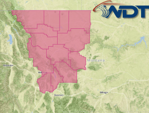
A Severe Thunderstorm Watch is in effect for portions of Western and Central Montana until 8pm MDT. Hail to 1.5" and damaging winds to 70 mph will be possible. Watch …
Read Storyby WeatherOps, on Aug 15, 2014 12:37:38 PM
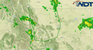
There is a slight risk of severe thunderstorms this afternoon across portions of Montana. Daytime heating and low level moisture advection, as well as ascent from an upper level trough …
Read Storyby WeatherOps, on Aug 15, 2014 9:41:04 AM
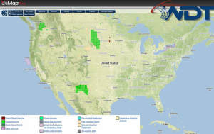
No severe thunderstorms are anticipated today, but general thunderstorms are possible today for portions of the Pacific Northwest, Central and Northern Plains, the Southern Rockies, and the Southeast coast. Current …
Read Storyby WeatherOps, on Aug 14, 2014 3:52:58 PM
Thunderstorms will be possible for portions of the Northern High Plains and Upper Midwest, as well as the Southern High Plains and the Gulf Coast to New England. Showers and …
Read Storyby WeatherOps, on Aug 14, 2014 12:37:59 PM
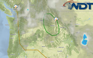
Showers and thunderstorms are developing over the Northern Rockies ahead of an upper level trough across the Pacific Northwest. Thunderstorms will likely increase through the afternoon with the presence of …
Read Storyby WeatherOps, on Aug 14, 2014 9:43:52 AM
Thunderstorms and heavy rain are possible today for portions of the Pacific Northwest and Rockies. General thunderstorms will be possible for portions of the Gulf Coast, Ohio River Valley, and …
Read Storyby WeatherOps, on Aug 13, 2014 4:23:56 PM
There is a slight risk for severe thunderstorms on Thursday across the Northern Rockies. Across the High Plains, general thunderstorms are possible. The risk for severe thunderstorms across the northern …
Read Storyby WeatherOps, on Aug 13, 2014 12:35:49 PM
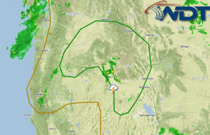
Thunderstorms will continue to develop across portions of the Pacific Northwest through the afternoon as an upper level trough approaches the region. Daytime heating and ascent due to the trough …
Read Storyby WeatherOps, on Aug 13, 2014 9:43:33 AM
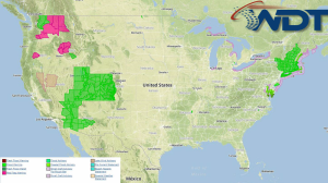
There will be a slight risk of severe thunderstorms across portions of the Pacific Northwest and Northern Rockies today. Across the Southwest, High Plains, and Northeast, general thunderstorms and heavy …
Read Storyby WeatherOps, on Aug 12, 2014 4:01:11 PM
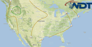
Heavy rainfall and flooding will be possible for portions of the Upper Northeast on Wednesday. Across the Pacific Northwest, severe thunderstorms will be possible. By Wednesday, much of the Central …
Read Storyby WeatherOps, on Aug 12, 2014 12:46:51 PM
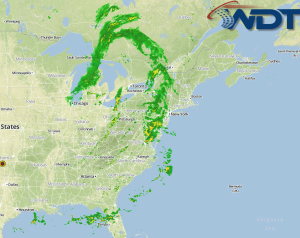
Showers and thunderstorms are developing across portions of the Northeast and Appalachians ahead of a midlevel trough. With the presence of daytime heating, low level moisture, and ascent, further thunderstorms …
Read Storyby WeatherOps, on Aug 12, 2014 9:48:24 AM
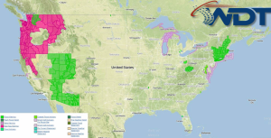
Severe thunderstorms and heavy rain will be possible for portions of the Northeast today. Severe thunderstorms will be likely for portions of the Pacific Northwest. Showers and general thunderstorms will …
Read Storyby WeatherOps, on Aug 11, 2014 4:15:30 PM
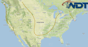
Showers and thunderstorms are possible Tuesday for portions of the Ohio Valley/Mid Atlantic, Gulf Coast to the Carolinas, and the western US. An upper level low will move into the …
Read Storyby WeatherOps, on Aug 11, 2014 12:34:23 PM
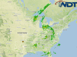
Showers and thunderstorms will continue across the Eastern US in association with an area of low pressure over the Ohio River Valley. While no widespread severe weather is anticipated, a …
Read Storyby WeatherOps, on Aug 11, 2014 9:50:30 AM
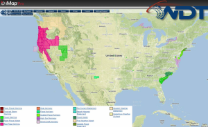
Scattered showers and thunderstorms will be possible for the Eastern US. Showers and thunderstorms will be possible for portions of the Southeast and across the Great Basin and Four Corners …
Read Storyby WeatherOps, on Aug 8, 2014 4:28:03 PM
There is a slight risk for severe thunderstorms on Saturday for portions of the High Plains. Showers and thunderstorms will be possible for portions of the Tennessee Valley and Mid …
Read Storyby WeatherOps, on Aug 8, 2014 12:21:43 PM
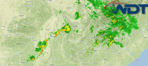
Showers and thunderstorms are developing across the Southeast along a stationary front. While no widespread severe weather is expected, a few storms may produce some small hail and gusty winds …
Read Storyby WeatherOps, on Aug 8, 2014 9:53:20 AM
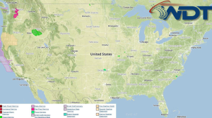
Showers and thunderstorms will be possible for portions of the Tennessee Valley and Mid Atlantic; heavy rain and isolated severe thunderstorms will be possible. Thunderstorms, with some isolated severe thunderstorms, …
Read Storyby Steve Miller, on Aug 7, 2014 8:29:36 PM
Hurricane Iselle continues to weaken as it approaches the Hawaiian islands with estimated winds at the surface actually below Hurricane criteria at this time. Still, sustained winds of 70mph and …
Read Storyby WeatherOps, on Aug 7, 2014 4:28:00 PM
Scattered thunderstorms and heavy rain are possible Friday for the Midwest and points eastward to the Atlantic Coast. Isolated showers and thunderstorms are possible for portions of the High Plains …
Read Storyby WeatherOps, on Aug 7, 2014 3:18:17 PM
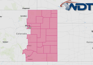
A Severe Thunderstorm Watch is in effect for portions of Eastern Colorado until 7pm MDT. Hail to 1.5" and damaging winds to 70 mph will be possible. Watch Outline …
Read Storyby WeatherOps, on Aug 7, 2014 12:40:29 PM
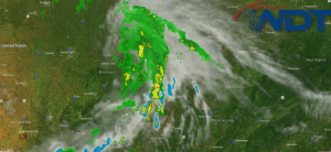
Thunderstorms are developing across the Mid Mississippi Valley in portions of Eastern Missouri and Western Illinois. This activity is to the north of a stationary front. While no severe weather …
Read Storyby WeatherOps, on Aug 7, 2014 11:01:40 AM
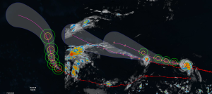
Hurricane Julio continues to move toward the Hawaiian islands. It has intensified slightly overnight and now has sustained winds of 105 miles per hour. Little strengthening is expected over the …
Read Storyby WeatherOps, on Aug 7, 2014 10:06:05 AM
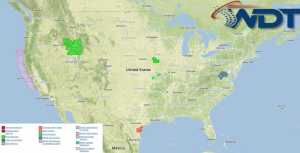
Scattered thunderstorms and heavy rain are likely today for the Central Plains, Missouri Valley, and Midwest. Isolated showers and thunderstorms are possible for the Intermountain West and High Plains. Current …
Read Storyby WeatherOps, on Aug 6, 2014 2:39:40 PM
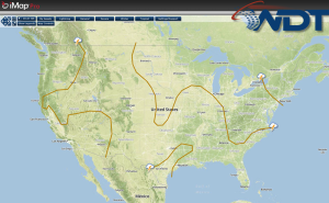
Scattered thunderstorms and heavy rain are likely tomorrow from the Upper Midwest to the Ohio River Valley. Across the Intermountain West and High Plains, isolated showers and thunderstorms are possible …
Read Storyby WeatherOps, on Aug 6, 2014 12:39:12 PM
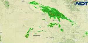
Thunderstorms are developing across portions of the Mid Mississippi Valley and will continue to develop through the afternoon. While widespread severe weather is not expected, a few thunderstorms will have …
Read Storyby WeatherOps, on Aug 6, 2014 9:38:50 AM
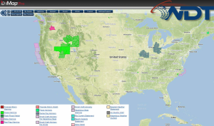
Showers and thunderstorms will be possible today for portions of the Central Plains into the Missouri Valley; isolated severe thunderstorms and heavy rain will be possible. Across the Intermountain West, …
Read Storyby WeatherOps, on Aug 5, 2014 4:22:31 PM
Scattered thunderstorms will be possible on Wednesday across portions of the Central Plains and Upper Midwest; some may be severe. Isolated showers and thunderstorms will be possible across portions of …
Read Storyby WeatherOps, on Aug 5, 2014 12:49:30 PM
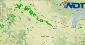
Thunderstorms are developing across portions of the Plains along a stationary front. As thunderstorms continue to develop with daytime heating, gusty winds and possibly some small hail will be the …
Read Storyby WeatherOps, on Aug 5, 2014 9:56:34 AM
Isolated scattered showers and thunderstorms will be possible from portions of the Central Plains to the Mid Mississippi Valley to the New England region. Isolated showers and thunderstorms will be …
Read Storyby WeatherOps, on Aug 4, 2014 4:22:52 PM
Scattered showers and isolated thunderstorms will continue from New England to the Gulf Coast. Isolated thunderstorms will be possible for portions of the Midwest and Ohio Valley. Severe weather is …
Read Storyby WeatherOps, on Aug 4, 2014 12:41:18 PM
Thunderstorms are developing across the Midwest along a stationary front. Daytime heating and ascent will allow for the development for thunderstorms. Some storms may have the potential to become severe …
Read Storyby WeatherOps, on Aug 4, 2014 9:49:00 AM
Scattered and isolated thunderstorms will be possible today from portions of the Northeast to the Gulf Coast. Isolated showers and thunderstorms will be possible for portions of the Great Lakes …
Read Storyby WeatherOps, on Jul 31, 2014 4:01:10 PM
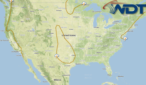
Showers and thunderstorms will continue through the Northeast on Friday. Heavy rain is possible through the Mid Atlantic. Showers and thunderstorms will continue for portions of the Northern Gulf along …
Read Storyby WeatherOps, on Jul 31, 2014 12:24:34 PM
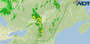
Thunderstorms are developing across portions of the Northeast ahead of a cold front. At the current time, portions of Eastern New York through Western Maine are being monitored for a …
Read Storyby WeatherOps, on Jul 31, 2014 9:47:06 AM
Isolated showers and thunderstorms will be possible today across the Northeast; small hail and gusty winds will be possible. Heavy rain will continue from Southeastern Oklahoma into the Arklatex region …
Read Storyby WeatherOps, on Jul 30, 2014 4:19:14 PM
Isolated showers and thunderstorms will be possible Thursday for portions of the Northeast. Heavy rain will continue from portions of Southeastern Oklahoma into the Arklatex region. No widespread severe weather …
Read Storyby WeatherOps, on Jul 30, 2014 2:52:34 PM
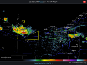
Thunderstorms are developing in Northern Ohio ahead of a cold front. As thunderstorms develop, hail, gusty winds, and lightning will be possible. Radar …
Read Storyby WeatherOps, on Jul 30, 2014 12:44:32 PM
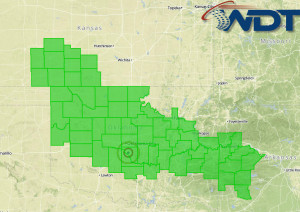
Heavy rain continues for portions of the Plains and Flash Flood Watches remain in effect through 7AM CDT Thursday. Flood Watches Up to 4 inches of rain will be possible …
Read Storyby WeatherOps, on Jul 30, 2014 9:45:00 AM
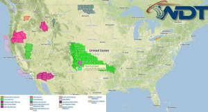
Isolated severe thunderstorms and heavy rain will continue today for portions of the Southern Plains. Scattered thunderstorms and isolated thunderstorms are possible for portions of the Ohio River Valley and …
Read Storyby WeatherOps, on Jul 29, 2014 12:34:24 PM
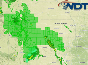
Flooding is possible today and tomorrow for portions of the Rockies. As a result, Flash Flood Watches are in effect for portions of the Rockies through noon MDT Wednesday and …
Read Storyby WeatherOps, on Jul 28, 2014 4:26:37 PM
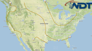
General thunderstorms, with isolated severe thunderstorms, will be possible on Tuesday for portions of the Western Great Lakes. Isolated severe thunderstorms and heavy rain will be possible for portions of …
Read Storyby WeatherOps, on Jul 28, 2014 2:53:52 PM
A Severe Thunderstorm Watch is in effect until 9pm EDT for portions of the Carolinas and Georgia. Hail to 1.5" and damaging winds to 70 mph will be possible. Watch …
Read Storyby WeatherOps, on Jul 28, 2014 1:38:31 PM
A Severe Thunderstorm Watch is in effect until 8pm EDT for portions of Connecticut, Massachusetts, Maine, New Hampshire, New York, Rhode Island, and Vermont. Hail to 2", damaging winds to …
Read Storyby WeatherOps, on Jul 28, 2014 12:45:23 PM
Flood Watches are in effect for portions of the Western US through tonight ahead of an upper level system. While the rainfall amounts won't be especially high, slow moving storms …
Read Storyby WeatherOps, on Jul 28, 2014 9:55:39 AM
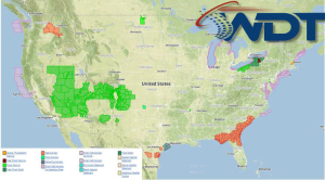
Isolated severe thunderstorms are possible today for portions of the Eastern US and Gulf Coast. Heavy rain and flooding will be possible for portions of the Western US. Current NWS …
Read Storyby WeatherOps, on Jul 25, 2014 4:23:56 PM
Widespread strong to severe thunderstorms will be possible for portions of the Central Plains and Great Lakes. Heavy rain, damaging winds, and tornadoes will be possible. Some thunderstorms will be …
Read Storyby WeatherOps, on Jul 25, 2014 9:43:07 AM
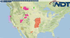
The low pressure over the western U.S. has dampened a significant amount in the past 24 hours with a ridge pushing over the central U.S. states and a trough pushes …
Read Storyby WeatherOps, on Jul 24, 2014 4:26:17 PM
Strong to severe thunderstorms are possible Friday for portions of the Upper Midwest and Western Great Lakes; hail and damaging winds will be possible. Showers and thunderstorms will be possible …
Read Storyby WeatherOps, on Jul 24, 2014 9:55:54 AM
Strong to severe thunderstorms with the potential for hail and damaging winds will be possible today across the Northern Rockies and Plains. Strong storms capable of producing hail and strong …
Read Storyby WeatherOps, on Jul 23, 2014 4:30:04 PM
Strong to severe thunderstorms with the potential for large hail and damaging winds will be possible for portions of the Northern Rockies tomorrow. Strong thunderstorms will be possible tomorrow for …
Read Storyby WeatherOps, on Jul 23, 2014 1:48:26 PM
A Severe Thunderstorm Watch is in effect until 10pm EDT for portions of Connecticut, Massachusetts. Maine, New Hampshire. New York, Pennsylvania, and Vermont. Hail to 1.5 inches and damaging winds …
Read Storyby WeatherOps, on Jul 23, 2014 1:12:03 PM
A Severe Thunderstorm Watch is in effect for portions of Arkansas and Oklahoma until 8pm CDT. Hail to 2 inches and damaging winds to 80 mph will be possible. Watch …
Read Storyby WeatherOps, on Jul 23, 2014 12:41:38 PM
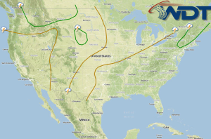
Thunderstorms are developing across the Plains along a stationary front. Daytime heating will continue to destabilize the atmosphere, allowing thunderstorm development. As thunderstorms develop, large hail and damaging winds will …
Read Storyby WeatherOps, on Jul 23, 2014 9:47:13 AM
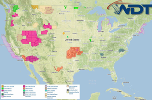
Showers and thunderstorms with hail and damaging winds will be possible for portions of the Ohio River Valley and Northeast ahead of a cold front. Afternoon thunderstorms are possible across …
Read Storyby WeatherOps, on Jul 22, 2014 4:12:16 PM
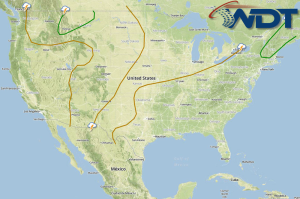
Thunderstorms with the potential for hail and damaging winds will be possible Wednesday across portions of the Ohio Valley and New England region. Afternoon thunderstorms with hail and damaging winds …
Read Storyby WeatherOps, on Jul 22, 2014 12:31:16 PM
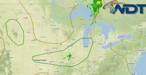
Thunderstorms are developing across portions of the Midwest and Central Plains ahead of a cold front. Additional development is likely through the afternoon. Initially, hail and damaging winds will be …
Read Storyby WeatherOps, on Jul 22, 2014 9:51:41 AM
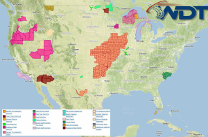
Showers and thunderstorms will be possible today for the Great Lakes and Ohio River Valley; severe thunderstorms possible this afternoon and evening. Thunderstorms with the potential for hail and damaging …
Read Storyby WeatherOps, on Jul 21, 2014 3:18:16 PM
There is a slight risk for severe thunderstorms Tuesday across the Southwestern Great Lakes. A cold front will move slowly southeastward toward the southwestern Great Lakes, bringing a slight risk …
Read Storyby WeatherOps, on Jul 21, 2014 1:22:39 PM
A Tornado Watch is in effect for portions of North Dakota until 7pm CDT. Hail to 3", damaging winds to 70 mph, and tornadoes will be possible. Watch Outline …
Read Storyby WeatherOps, on Jul 21, 2014 12:46:45 PM

A shortwave trough over the Northern Rockies will move into the Plains today. Ahead of the trough, moisture advection and daytime heating will allow for destabilization and the development of …
Read Storyby WeatherOps, on Jul 21, 2014 9:55:24 AM
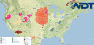
Severe thunderstorms are possible today for portions of the Northern Plains and the Upper Midwest. Showers and thunderstorms, as well as heavy rain will continue across the Southeast. NWS Advisories/Watches/Warnings …
Read Storyby WeatherOps, on Jul 18, 2014 12:56:07 PM
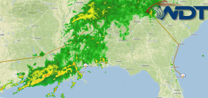
A few severe thunderstorms will be possible across portions of the Lower Mississippi River Valley. While severe thunderstorms will be isolated, any that are able to form will have the …
Read Storyby WeatherOps, on Jul 18, 2014 9:49:34 AM
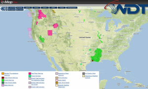
Heavy rain and flooding is possible today for portions of the Lower Mississippi River Valley. Isolated severe thunderstorms will be possible for the Central High Plains. A line of thunderstorms …
Read Storyby WeatherOps, on Jul 17, 2014 4:27:15 PM
Heavy rain and a flooding potential will continue on Friday for portions of Arkansas, Texas, and Louisiana. The severe weather potential will be low across the US as cooler temperatures …
Read Storyby WeatherOps, on Jul 17, 2014 12:30:14 PM
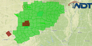
Flooding continues across portions of Arkansas, Oklahoma and Texas. A Flash Flood Watch remains in effect through early tomorrow afternoon. Current Flood Watches/Warnings Some areas near the Dallas, Texas area …
Read Storyby WeatherOps, on Jul 17, 2014 9:51:14 AM
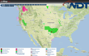
Heavy rain with isolated severe thunderstorms and flooding will be possible today for portions of the Southern Plains. Current NWS Advisories/Watches/Warnings in iMapPro: An area of high pressure will build …
Read Storyby WeatherOps, on Jul 16, 2014 3:58:52 PM
A Severe Thunderstorm Watch is in effect for portions of New Mexico, Oklahoma, and Texas until 8pm MDT. Hail to 1.5" and damaging winds to 70 mph will be possible …
Read Storyby WeatherOps, on Jul 16, 2014 12:40:14 PM
Rain is beginning across portions of Oklahoma and will continue through Friday. Flash Flood Watches are in effect for portions of Oklahoma and Texas through Friday morning. Watch Outline Heavy …
Read Storyby WeatherOps, on Jul 16, 2014 9:51:32 AM
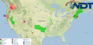
Severe thunderstorms are possible today for portions of the Central Rockies through the Southern Plains. Heavy rain and flooding is likely for the Texas Panhandle through Oklahoma. Current NWS Advisories/Watches/Warnings …
Read Storyby WeatherOps, on Jul 15, 2014 4:18:15 PM
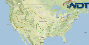
Severe thunderstorms are possible Wednesday for portions of the Oklahoma and Texas Panhandles. Heavy rain and flooding possible for portions of Central Oklahoma. A weak area of low pressure and …
Read Storyby WeatherOps, on Jul 15, 2014 1:10:00 PM
A Severe Thunderstorm Watch is in effect until 9pm EDT for portions of Connecticut, Delaware, Maryland, North Carolina, New Jersey, New York, Pennsylvania, Virginia, and West Virginia. Hail to 15 …
Read Storyby WeatherOps, on Jul 15, 2014 12:35:30 PM
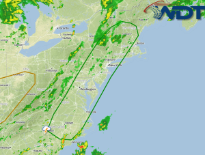
Thunderstorms are developing across portions of the Northeast and Mid Atlantic ahead of a cold front. As thunderstorms develop, large hail and damaging winds will be the main concerns. Storms …
Read Storyby WeatherOps, on Jul 15, 2014 9:54:42 AM
Severe thunderstorms are possible today for portions of the Central High Plains and Mid Atlantic. Current NWS Advisories/Watches/Warnings in iMapPro: A strong jet will move into the Northeastern US, allowing …
Read Storyby WeatherOps, on Jul 14, 2014 4:21:26 PM
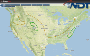
Severe thunderstorms are possible on Tuesday across portions of the Central High Plains and Mid Atlantic. The risk, however, is expected to diminish substantially as a longwave trough shows signs …
Read Storyby WeatherOps, on Jul 14, 2014 2:11:08 PM
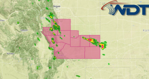
A Severe Thunderstorm Watch is in effect for portions of Colorado until 7pm MDT. Hail to 1.5" and damaging winds to 70 mph will be the main concerns. Watch Outline …
Read Storyby WeatherOps, on Jul 14, 2014 1:55:09 PM
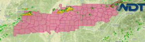
A Severe Thunderstorm Watch for portions of Arkansas, Missouri, Mississippi, and Tennessee until 8pm CDT. Hail to 70 mph and damaging winds to 70 mph will be possible. Watch Outline …
Read Storyby WeatherOps, on Jul 14, 2014 12:38:20 PM
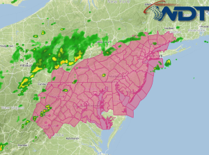
A Severe Thunderstorm Watch is in effect for portions of Connecticut, Delaware, Maryland, New Jersey, New York, Pennsylvania, Virginia, and West Virginia until 8pm EDT. Hail to 1.5", damaging winds …
Read Storyby WeatherOps, on Jul 14, 2014 11:55:20 AM
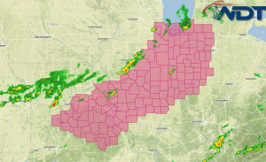
A Severe Thunderstorm Watch is in effect for portions of Illinois, Indiana, Michigan, and Missouri until 6pm CDT. Large hail to 1.5" and damaging winds to 70 miles per hour …
Read Storyby WeatherOps, on Jul 14, 2014 9:42:40 AM
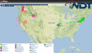
Showers and thunderstorms will be possible today across portions of the Southern Plains, Midwest, and Mid Atlantic; some thunderstorms may become severe. Isolated severe thunderstorms will be possible for portions …
Read Storyby WeatherOps, on Jul 11, 2014 4:16:12 PM
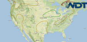
Severe thunderstorms are possible Saturday for portions of the Northern Plains and Great Lakes. The strong low in Canada will continue to spin a trough through the central and eastern …
Read Storyby WeatherOps, on Jul 11, 2014 12:55:46 PM
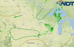
Thunderstorms are developing across the Northern Plains ahead of a cold front. As thunderstorms continue to develop due to daytime heating, large hail and damaging winds will be possible. Thunderstorms …
Read Storyby WeatherOps, on Jul 11, 2014 9:49:26 AM
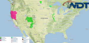
Severe thunderstorms are possible today across portions of the Rockies and into the Northern and Central Plains. Current NWS Advisories/Watches/Warnings in iMapPro: A front lingering over the Central and Northern …
Read Storyby WeatherOps, on Jul 10, 2014 4:26:04 PM
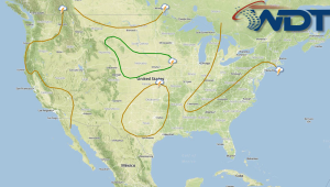
Severe thunderstorms are possible Friday for portions of the Rockies and Northern and Central Plains. A front lingering over portions of the Plains in combination with a strengthening jet stream …
Read Storyby WeatherOps, on Jul 10, 2014 1:09:07 PM
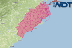
A Severe Thunderstorm Watch is in effect for portions of the Carolinas and Virginia until 9pm EDT. Hail to 2" and damaging winds will be the main threats. Watch Outline …
Read Storyby WeatherOps, on Jul 10, 2014 9:52:14 AM
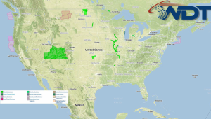
Isolated severe thunderstorms are possible today for portions of the Central High Plains. General showers and thunderstorms will be possible across portions of the Southeast. Current NWS Advisories/Watches/Warnings in iMapPro: …
Read Storyby WeatherOps, on Jul 9, 2014 4:18:07 PM
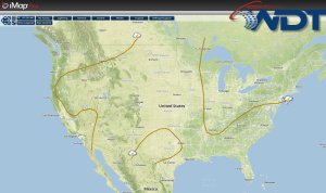
Scattered showers will be possible on Thursday for portions of the Central and Southern Rockies. General thunderstorms will be possible for portions of the Southeast and Mid Atlantic. A weak …
Read Storyby WeatherOps, on Jul 9, 2014 3:39:02 PM
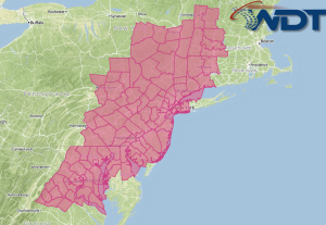
A Severe Thunderstorm Watch is in effect for portions of the Northeast and Mid Atlantic until 10pm EDT. Hail to 1 inch and damaging winds to 70 mph will be …
Read Storyby WeatherOps, on Jul 9, 2014 12:45:18 PM
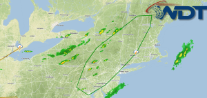
Showers and thunderstorms are developing across the Northeast ahead of a cold front. Low level moisture advection and daytime heating will allow for the development of thunderstorms. As thunderstorms develop, …
Read Storyby WeatherOps, on Jul 9, 2014 9:47:09 AM
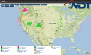
Isolated severe thunderstorms are possible for portions of the Central High Plains today. Showers and thunderstorms are possible for portions of the Southeast. Current NWS Advisories/Watches/Warnings: High pressure will build …
Read Storyby WeatherOps, on Jul 8, 2014 4:16:56 PM
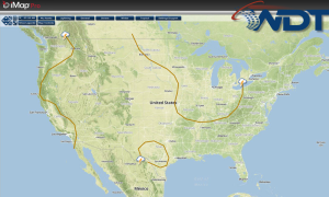
Scattered showers and isolated severe thunderstorms will be possible on Wednesday for portions of the High Plains, as well as the Lower Mississippi River Valley to the Mid Atlantic. High …
Read Storyby WeatherOps, on Jul 8, 2014 9:41:16 AM
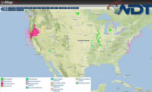
Scattered severe thunderstorms will be possible today across portions of the Mid Mississippi Valley to the Northeast. Current NWS Advisories/Watches/Warnings in iMapPro An area of low pressure over the Upper …
Read Storyby WeatherOps, on Jul 7, 2014 3:47:52 PM
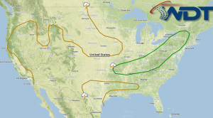
Scattered showers and thunderstorms will be possible tomorrow across portions of the Ohio River Valley and Northeast; isolated severe thunderstorms will be possible. The area of low pressure over the …
Read Storyby WeatherOps, on Jul 7, 2014 2:03:10 PM
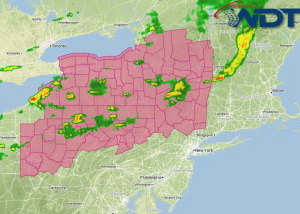
A Severe Thunderstorm Watch is in effect until 10pm EDT for portions of New York and Pennsylvania. Large hail to 2" and damaging winds to 70 miles per hour will …
Read Storyby WeatherOps, on Jul 7, 2014 12:23:42 PM
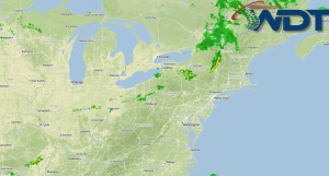
Thunderstorms are developing across the Northeast and Ohio River Valley ahead of a cold front. Ahead of the front, daytime heating and moisture advection will help to destabilize the atmosphere …
Read Storyby WeatherOps, on Jul 7, 2014 9:44:34 AM
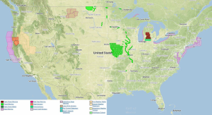
Scattered showers and thunderstorms will be possible today from the Central Plains to the Northeast; isolated severe thunderstorms are possible. Current NWS Advisories/Watches/Warnings:| An area of low pressure and the …
Read Storyby WeatherOps, on Jul 3, 2014 4:30:10 PM
Hurricane Arthur will continue to progress northward with heavy rain and fresh to gale winds expected. Strong to isolated severe thunderstorms with strong winds and large hail will be possible …
Read Storyby WeatherOps, on Jul 3, 2014 1:29:23 PM
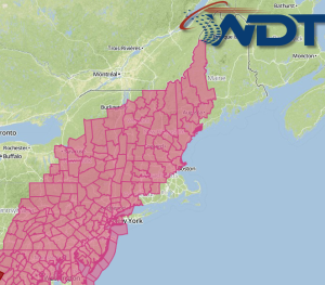
A Severe Thunderstorm Watch is in effect for portions of Connecticut, Delaware, Massachusetts, Maryland, Maine, New Hampshire, New Jersey, New York, Pennsylvania, and Vermont until 10pm EDT. Hail to 1", …
Read Storyby WeatherOps, on Jul 3, 2014 12:37:50 PM
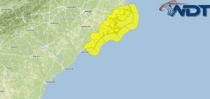
A Tornado Watch is in effect until 2am EDT Friday for Coastal North Carolina. Damaging winds to 75 mph and tornadoes will be possible. Watch Outline …
Read Storyby WeatherOps, on Jul 3, 2014 12:23:47 PM
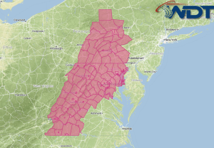
Severe thunderstorms are likely today across portions of the Northeast and Mid Atlantic as a cold front continues to move across the region. As thunderstorms develop, they will have the …
Read Storyby WeatherOps, on Jul 3, 2014 9:53:30 AM
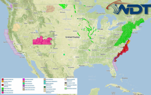
Hurricane Arthur will pass just offshore of North Carolina today with locally heavy rain and fresh to near gale winds likely. Across the Northeast, there will be a slight risk …
Read Storyby WeatherOps, on Jul 2, 2014 4:20:09 PM
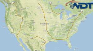
Hurricane Arthur will continue to intensify and move northward, strengthening to category 2 status will be possible. Heavy rain and moderate to fresh winds will be likely. An area of …
Read Storyby WeatherOps, on Jul 2, 2014 2:59:38 PM
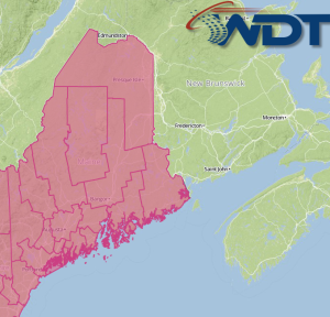
A Severe Thunderstorm Watch is in effect for portions of Maine until 9pm EDT. Hail to 1", damaging winds to 70 mph, and isolated tornadoes will be possible. Watch Outline …
Read Storyby WeatherOps, on Jul 2, 2014 2:28:48 PM
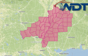
A Severe Thunderstorm Watch is in effect for portions of Louisiana and Mississippi until 9pm CDT. Damaging winds to 75 mph will be the main threats. Watch Outline …
Read Storyby WeatherOps, on Jul 2, 2014 12:53:08 PM
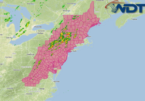
Showers and thunderstorms are developing ahead of a cold front moving across the New England region. As thunderstorms develop, large hail and damaging winds will be the main threats, but …
Read Storyby WeatherOps, on Jul 2, 2014 12:05:19 PM
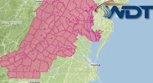
A Severe Thunderstorm Watch is in effect until 8pm EDT for portions of Maryland, North Carolina, Virginia, and West Virginia. Hail to 1" and damaging winds to 70 mph will …
Read Storyby WeatherOps, on Jul 2, 2014 10:55:40 AM
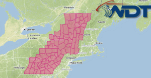
A Severe Thunderstorm Watch is in effect until 7pm EDT for portions of Connecticut, Massachusetts, New York, Pennsylvania, and Vermont. Damaging winds to 70 mph, hail to 1.5", and isolated …
Read Storyby WeatherOps, on Jul 2, 2014 9:50:59 AM
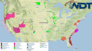
There is a slight risk for severe thunderstorms today across portions of the Mid Atlantic and Northeast; hail and damaging winds will be possible. Tropical Storm Arthur could become a …
Read Storyby WeatherOps, on Jul 1, 2014 4:27:21 PM
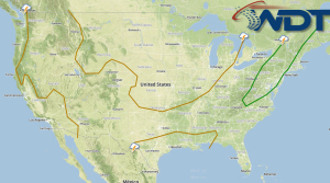
There is a slight risk for severe thunderstorms on Wednesday for portions of the Mid Atlantic and Northeast; hail and damaging winds will be possible. Along the Eastern Florida coast, …
Read Storyby WeatherOps, on Jul 1, 2014 2:30:43 PM
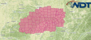
A Severe Thunderstorm Watch is in effect until 10pm CDT for portions of Arkansas, Illinois, Indiana, Kentucky, Missouri, and Tennessee. Hail to 2 inches and damaging winds to 70 mph …
Read Storyby WeatherOps, on Jul 1, 2014 2:08:25 PM
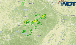
Thunderstorms are developing across portions of Missouri and Arkansas along a stationary front. As thunderstorms develop, large hail and damaging winds will be the main concerns. Radar …
Read Storyby WeatherOps, on Jul 1, 2014 11:06:42 AM
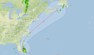
Tropical Depression 1 has become Tropical Storm Arthur and a Tropical Storm Watch is currently in effect for the East Coast of Florida from Fort Pierce to Flagler Beach. As …
Read Storyby WeatherOps, on Jul 1, 2014 9:52:26 AM
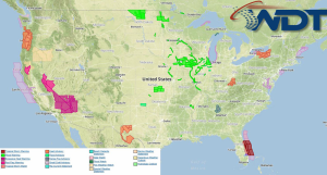
Severe thunderstorms are possible today for portions of the Midwest and Ohio River Valley; hail and damaging winds will be possible. Additional strengthening of Tropical Depression One off the east …
Read Storyby WeatherOps, on Jun 30, 2014 4:19:57 PM
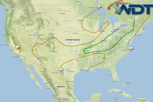
There will be a slight risk for thunderstorms capable of large hail and damaging winds tomorrow across the Midwest and Ohio River Valley. Heavy rain and strong winds will be …
Read Storyby WeatherOps, on Jun 30, 2014 2:21:16 PM
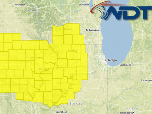
A Tornado Watch is in effect until 7pm CDT for portions of Iowa, Illinois, Missouri, and Wisconsin. Hail t0 2", damaging winds to 85 mph, and tornadoes will be possible …
Read Storyby WeatherOps, on Jun 30, 2014 12:09:01 PM
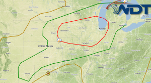
There is a moderate risk of severe weather today across portions of the Plains and Midwest ahead of a shortwave trough moving across the Northern Plains. While thunderstorms have developed …
Read Storyby WeatherOps, on Jun 30, 2014 9:55:27 AM
There is a risk for severe thunderstorms with the potential for large hail, damaging winds, and tornadoes for portions of the Central Plains, Midwest, and Great Lakes. Showers and thunderstorms, …
Read Storyby WeatherOps, on Jun 27, 2014 4:15:00 PM
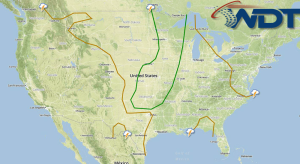
Scattered showers with isolated severe thunderstorms and flash flooding are possible for portions of the Northern and Central Plains and the Midwest on Saturday. Showers and thunderstorms that develop Friday …
Read Storyby WeatherOps, on Jun 27, 2014 2:08:10 PM
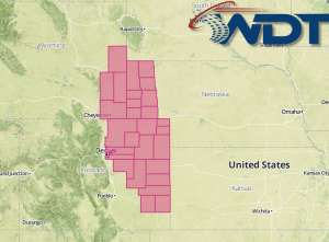
A Severe Thunderstorm Watch is in effect for portions of Colorado, Nebraska, and Wyoming until 7pm MDT. Hail to 2", damaging winds to 70 mph, and isolated tornadoes are possible …
Read Storyby WeatherOps, on Jun 27, 2014 12:36:54 PM
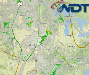
Thunderstorms are developing over portions over the Northern Plains ahead of a shortwave moving across the Rockies. At the surface, plentiful moisture and day time heating will allow for the …
Read Storyby WeatherOps, on Jun 27, 2014 9:42:29 AM
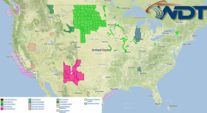
Scattered showers with isolated severe thunderstorms and localized flooding is possible today for portions of the Northern and Central Plains. NWS Advisories/Watches/Warnings in iMapPro: Storms from overnight will continue to …
Read Storyby WeatherOps, on Jun 26, 2014 4:29:39 PM
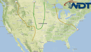
Severe thunderstorms are possible on Friday for portions of the Northern and Central Plains. Flooding in some areas will also be possible. Overnight thunderstorm activity will continue to move eastward …
Read Storyby WeatherOps, on Jun 26, 2014 3:25:20 PM
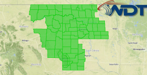
Flash Flood Watches are in effect for portions of the Northern Plains through Friday evening. Heavy rain will be likely across the region, allowing for the potential for flooding. Up …
Read Storyby WeatherOps, on Jun 26, 2014 2:54:10 PM
A Severe Thunderstorm Watch is in effect until 9pm MDT for portions of Montana and Wyoming. Hail to 2", damaging winds to 70 mph, and isolated tornadoes will be possible …
Read Storyby WeatherOps, on Jun 26, 2014 12:19:13 PM
Thunderstorms are developing across the High Plains ahead of an upper level trough over the Rockies. Plentiful low level moisture, daytime heating, and forcing from the trough will allow for …
Read Storyby WeatherOps, on Jun 26, 2014 9:41:19 AM
Severe thunderstorms are possible today for portions of the Central and Western High Plains while general showers and thunderstorms will continue for portions of the Midwest and Ohio River Valley …
Read Storyby WeatherOps, on Jun 25, 2014 4:20:32 PM
Severe thunderstorms will be possible on Thursday for portions of the Central and Western High Plains. Showers and thunderstorms (isolated severe) will be possible for portions of the Midwest and …
Read Storyby WeatherOps, on Jun 25, 2014 3:35:49 PM
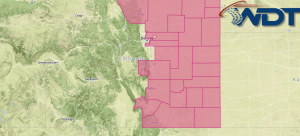
A Severe Thunderstorm Watch is in effect for portions of Eastern Colorado until 9pm MDT. Damaging winds to 70 mph and hail to 2 inches will be possible. Watch Outline …
Read Storyby WeatherOps, on Jun 25, 2014 3:07:04 PM
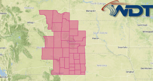
A Severe Thunderstorm Watch is in effect for portions of Montana, Nebraska, South Dakota, and Wyoming until 9pm MDT. Hail to 2" and damaging winds to 70 mph will be …
Read Storyby WeatherOps, on Jun 25, 2014 12:40:46 PM
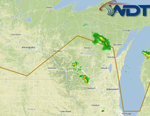
Thunderstorms are developing across portions of Southern Wisconsin and Northern Illinois ahead of a weak area of low pressure. While no widespread severe weather is expected, any storms that develop …
Read Storyby WeatherOps, on Jun 25, 2014 9:48:11 AM
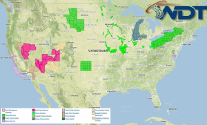
Severe thunderstorms are likely today across the Central and Western High Plains. Heavy rain and isolated thunderstorms will be possible with portions of New England; localized flooding possible. Current NWS …
Read Storyby WeatherOps, on Jun 24, 2014 4:10:40 PM
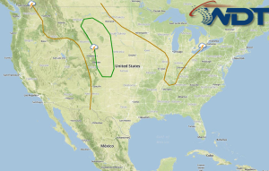
Severe thunderstorms are possible Wednesday for portions of the Central and Western High Plains. Heavy rain and flooding will be possible for the New England region. A deepening low pressure …
Read Storyby WeatherOps, on Jun 24, 2014 3:28:35 PM
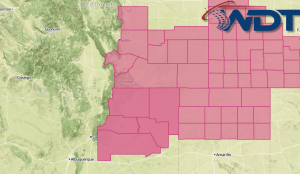
A Severe Thunderstorm Watch is in effect until 10pm MDT for portions of Colorado, New Mexico, Oklahoma, and Texas. Hail to 2" and damaging winds to 70 mph will be …
Read Storyby WeatherOps, on Jun 24, 2014 2:21:37 PM
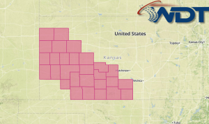
A Severe Thunderstorm Watch is in effect until 9pm CDT for portions of Western and South Central Kansas until 9pm CDT. Hail to 2" and damaging winds to 70 mph …
Read Story