National Weather Summary for Thursday, September 18, 2014
by WeatherOps, on Sep 18, 2014 9:54:34 AM
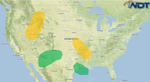
General thunderstorms with small hail and strong winds will be possible Thursday from portions of the Central Plains to the Gulf Coast. Strong to severe thunderstorms will be possible for portions of the Great Basin and Northern Rockies this afternoon and evening. Across the Southwest, rain and thunderstorms will continue with flooding likely.
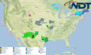
Current NWS Advisories/Watches/Warnings in iMapPro:

Overnight thunderstorm activity in Kansas and Missouri is weakening, but further development is anticipated later today in the same area and further south into Oklahoma and Arkansas. With any storms that develop, hail to 1" and wind gusts to 45 miles per hour will be possible. Heavy rain and flooding will spread eastward across portions of New Mexico and Texas; up to 2" of rain will be possible. A weak upper level disturbance will move across Texas, bringing general thunderstorms and heavy rain to portions of Southeast Texas. Across the Rockies and Great Basin, daytime heating will allow for the development of thunderstorms. Hail and gusty winds will be possible. Elsewhere, showers and general thunderstorms will be possible for portions of the Carolinas. Rain possible across portions of California and Oregon.


