National Weather Summary for Tuesday, July 22, 2014
by WeatherOps, on Jul 22, 2014 9:51:41 AM
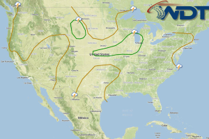
Showers and thunderstorms will be possible today for the Great Lakes and Ohio River Valley; severe thunderstorms possible this afternoon and evening. Thunderstorms with the potential for hail and damaging winds will be possible. In the Pacific Northwest, strong to severe thunderstorms will be possible this afternoon; hail and damaging winds will be the main concerns.
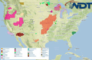
Current NWS Advisories/Watches/Warnings in iMapPro:

A cold front moving across the Upper Midwest, bringing a slight risk of severe thunderstorms from the Midwest into the Central Plains. While widespread severe weather is not expected, stronger storms may produce winds in excess of 60 miles per hour. Storms are expected to expand through the Midwest through tonight. Hail and damaging winds will be the main concerns, but an isolated tornado cannot be ruled out.
An area of low pressure over the Northern Rockies will allow showers and thunderstorms to develop from Montana into Nebraska. Large hail and winds over 50 miles per hour will be possible.
Thunderstorms will also be possible across the Pacific Northwest ahead of an area of low pressure. As thunderstorms develop, large hail and damaging winds will be the main concerns.


