National Weather Summary for Monday, July 13, 2015
by WeatherOps, on Jul 13, 2015 4:31:29 AM
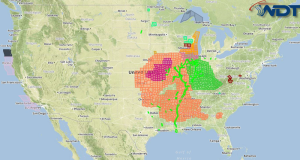
Severe thunderstorms are likely Monday across the Midwest.
Multiple rounds of severe thunderstorms are likely into Monday capable of producing damaging winds, large hail, and tornadoes across the region. Into the early
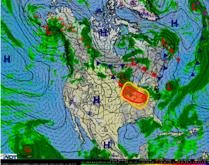
morning hours, a mesoscale convective system (MCS) will track to the southeast across the region with the potential for damaging winds associated with this system. With the MCS
moving through the region, during the afternoon the main focus for severe weather development will occur west and southwest of the areas impacted by the MCS during the
morning hours as outflow will assist in thunderstorm development. With very steep lapse rates and dewpoint temperatures in the low to mid 70s by afternoon, extreme instability is
expected, particularly across portions of Illinois, western Indiana, and eastern Iowa/Missouri. By mid to late afternoon, supercell development is expected, with very
large hail and the possibility for tornadoes as the primary impacts due to low level shear. By evening, thunderstorms will begin to merge into a new MCS tracking to the southeast
through the region, with widespread damaging wind gusts possible.


