National Weather Summary for Tuesday, February 4, 2015
by WeatherOps, on Feb 4, 2015 9:36:57 AM
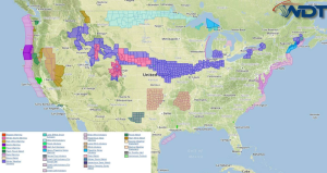
Isolated moderate to heavy snow is possible Tuesday across the Intermountain West. Light to moderate snow is possible for the Midwest and Northeast. Showers and isolated strong thunderstorms will continue for the Gulf of Mexico and northwest coast of Florida.
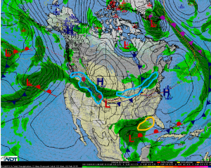
A strong northwesterly jet stream over the Northern and Central Rockies will allow for scattered snow showers for the higher elevations of the Intermountain West. Snow may be heavy at times with 6-12 inches and locally higher amounts possible.
High pressure building over the Central Plains will push a cold front into the Lower Mississippi River Valley and Eastern Seaboard. Ahead of the front, light snow will be possible from Northern Missouri, through the Ohio Valley, and into Upstate New York. Most areas are still expected to see only minor accumulations of 1-3 inches through tonight. Areas further east from Ohio into New York may see 2-4 inches with higher amounts of 6-8 inches,
Across the Gulf of Mexico and Northwest Florida Coast, scattered showers and thunderstorms will be possible. Wind gusts to 45 miles per hour will be the main concern.


