National Weather Summary for Wednesday, July 23, 2014
by WeatherOps, on Jul 23, 2014 9:47:13 AM
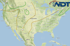
Showers and thunderstorms with hail and damaging winds will be possible for portions of the Ohio River Valley and Northeast ahead of a cold front. Afternoon thunderstorms are possible across the Western High Plains; hail and damaging winds will be the main concerns. Across the Southern Plains and Ozarks, thunderstorms capable of hail and damaging winds will be possible across the Southern Plains and Ozarks.
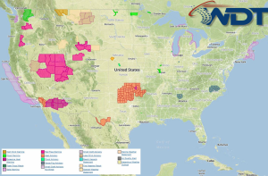
Current NWS Advisories/Watches/Warnings in iMapPro:

Thunderstorms will shift eastward into New England ahead of a cold front. Daytime heating will be sufficient for the development of thunderstorms along and ahead of the front. As thunderstorms develop, damaging winds will be the main concern. Further south, thunderstorms could develop through the Tennessee Valley and Ozarks. If storms are able to develop, some could become severe across portions of Missouri, Arkansas, and Oklahoma with hail and damaging winds possible. An upper level disturbance moving out of the Western US will bring a slight chance of severe thunderstorms to portions of the Northern Rockies. Large hail, damaging winds, and isolated tornadoes will be possible.


