National Weather Summary for Tuesday, February 9, 2016
by David Moran, on Feb 9, 2016 1:41:20 PM
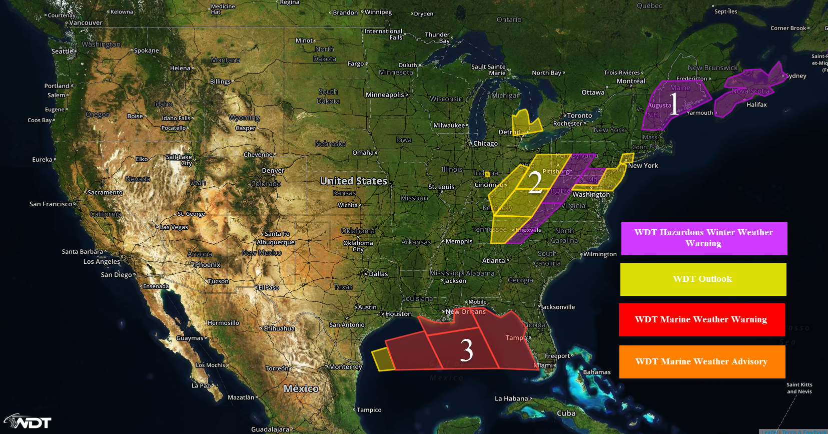
Light to moderate snowfall will be possible on Tuesday from the Northeastern US into the Ohio River Valley as a surface low deepens off the coast of Virginia. Elevated winds and seas are possible across the Northern Gulf of Mexico as high pressure building into the Gulf of Mexico interacts with an area of low pressure over the eastern United States.

US Hazards
REGION 1
![]()
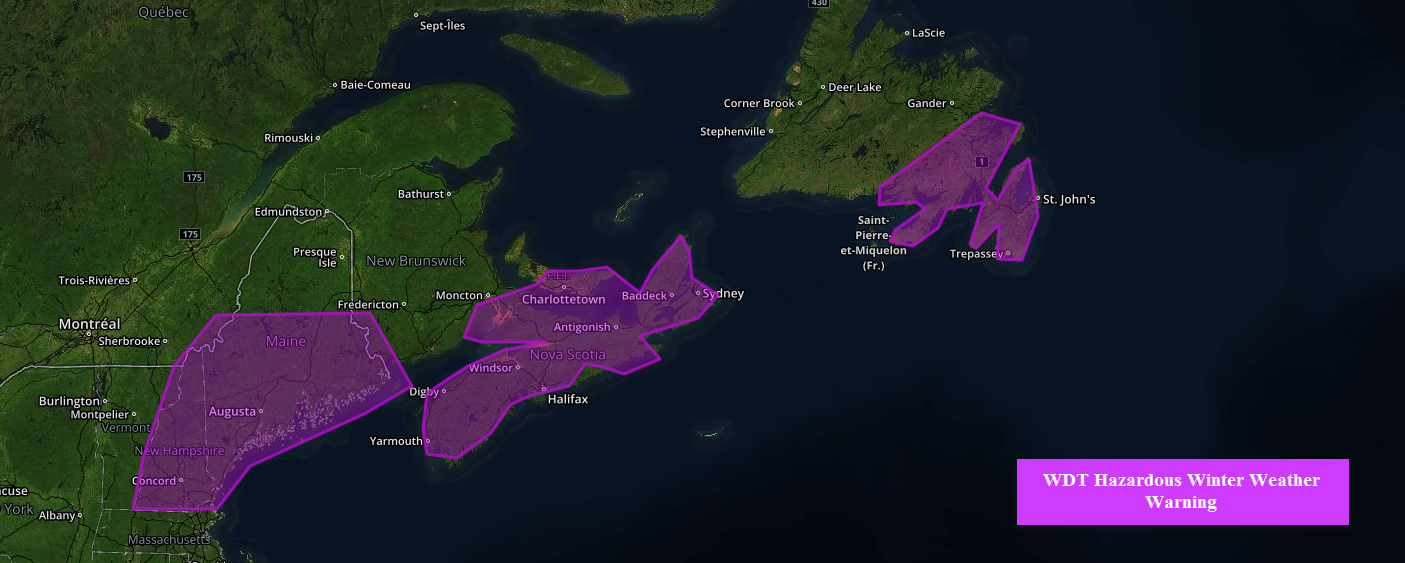
![]() Snow will wind down across Region 1 today as an area of low pressure moves northeastward away from the region. Total accumulations of 3-6 inches will be possible with locally higher accumulations in excess of 8 inches will be possible from Northeastern Massachusetts and northward across Coastal New Hampshire and Maine. Snow should end across most locations by noon. Blowing snow will reduce visibilities at times as strong northerly winds develop across the region.
Snow will wind down across Region 1 today as an area of low pressure moves northeastward away from the region. Total accumulations of 3-6 inches will be possible with locally higher accumulations in excess of 8 inches will be possible from Northeastern Massachusetts and northward across Coastal New Hampshire and Maine. Snow should end across most locations by noon. Blowing snow will reduce visibilities at times as strong northerly winds develop across the region.

Region 1
REGION 2
Snow will increase in coverage across region 2 throughout the day and into early Wednesday. Snow accumulations of 1-3 inches will be possible across eastern Kentucky, southeastern Ohio, southwestern Virginia, and Southern West Virginia. Locally higher amounts in excess of 4 inches will be possible. While widespread disruptions are not anticipated, hazardous travel conditions will be possible. Further east across the northern Delmarva peninsula, the Washington D.C. metro area, and the Lower Delaware Valley, 2-4 inches of snow with locally higher amounts in excess of 6 inches will be possible.
Across portions the Lower Peninsula of Michigan, lake effect snow will continue to develop off Lake Huron. Additional snowfall accumulations of 1-3 inches will be possible however, some heavier snowbands may produce locally higher amounts in excess of 4 inches. Breezy conditions will also lead to higher amounts in excess of 4 inches. Some travel disruptions will be possible.

Region 2
REGION 3
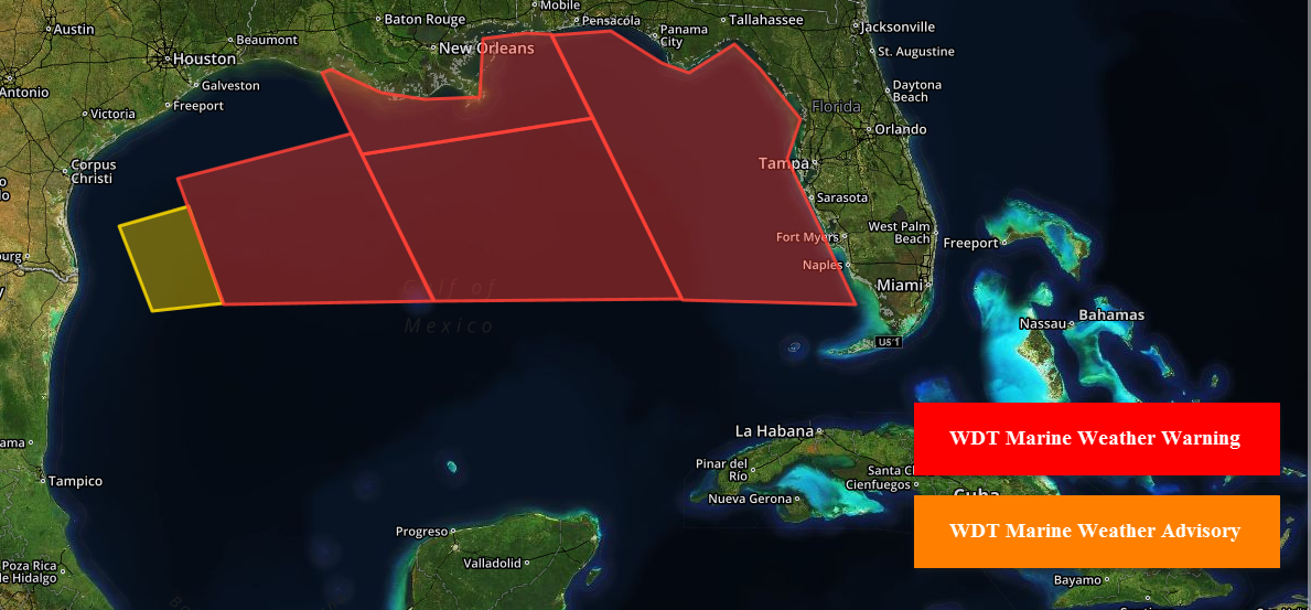
A large low pressure system over the eastern US will interact with an area of high pressure, bringing a prolonged period of elevated winds and seas to region 3. Winds in excess of 25 knots with gusts in excess of 40 knots will be possible. Seas of 11-15 feet will be possible before subsiding Wednesday morning.

Region 3


