National Weather Summary for Wednesday, August 19, 2015
by WeatherOps, on Aug 19, 2015 4:37:03 AM
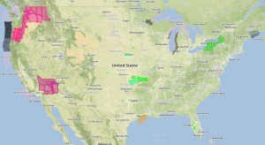
Strong to severe thunderstorms are possible Wednesday afternoon and evening across the Ohio Valley and Michigan. Excessive rainfall is possible for the Ohio and Mississippi Valleys.
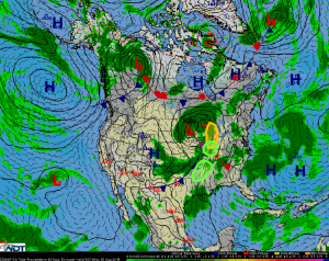
A cold front will continue to advance into the Ohio Valley region on Wednesday. Strong to severe thunderstorms will be possible ahead of the front where ample lift will be present as an upper level disturbance moves through the region. As thunderstorms develop, they will likely be in the form of line segments capable of hail and winds in excess of 50 mph. These storms will continue into the evening.
Locally heavy rainfall associated with the aforementioned thunderstorms will allow for a risk of excessive rainfall across the Ohio Valley. Rainfall in excess of 2 inches will be possible with these storms.
Across the Mississippi Valley, high moisture content is forecast ahead of the cold front extending into the Gulf States. A line of thunderstorms will move across the region and will bring heavy rainfall to the region in the late afternoon into the late evening. 1-2 inches of rain is possible with some isolated areas picking up in excess of 3 inches.


