National Weather Summary for Wednesday, December 31, 2014
by WeatherOps, on Dec 31, 2014 9:47:09 AM
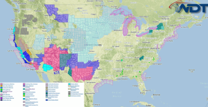
Moderate to heavy snow will be likely Wednesday in the higher elevations of the Southwest through the Four Corners. Light freezing rain and sleet is possible for portions of Central and Northern Texas.
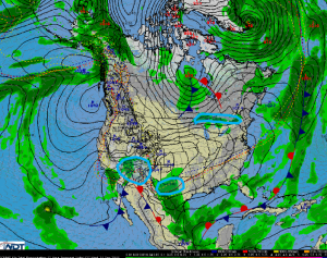
An upper level trough will continue to dig across the Desert Southwest with developing snow showers expected for the higher elevations. Areas of Southern California into Colorado and New Mexico will see periods of moderate to heavy snow. Low to mid elevations will average 4-8 inches, with the high elevations of Arizona may pick up over a foot of snow. Wind gusts to 25 miles per hour will allow for blowing snow and low visibility.
Across Central and Northern Texas, light icing is expected as moisture moves northward. Up to a tenth of an inch of icing will be possible.
Lake effect snow will continue through Friday for the Great Lakes with the heaviest snow forecast between Oswego, New York and Watertown, New York. Most areas will average a foot of snow, but where the heaviest banding sets up, up to 2 feet of snow will be possible.


