by WeatherOps, on Oct 28, 2014 9:51:17 AM

by WeatherOps, on Oct 28, 2014 9:51:17 AM
Isolated severe thunderstorms are possible today from the Ohio/Pennsylvania border to Arkansas. Showers and thunderstorms with isolated strong thunderstorms will be possible from the Ohio Valley into the Arklatex region.
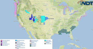
Current NWS Advisories/Watches/Warnings in iMapPro:

A strong cut off low over the Upper Midwest will lift into the Great Lakes with showers and thunderstorms expected along the attendant cold front. Some severe thunderstorms will be possible from Arkansas to Western Pennsylvania. Primary risks will be hail to 1" and winds to 55 miles per hour. Shower and thunderstorm activity will also extend from the Arklatex region northeastward into western portions of New York along a cold front. A few thunderstorms may be strong, producing small hail and winds to 45 miles per hour.
This is where you give the visitor a brief introduction to both this blog and your company. Keep it short. More →