by WeatherOps, on Jun 26, 2014 9:41:19 AM

by WeatherOps, on Jun 26, 2014 9:41:19 AM
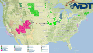
Severe thunderstorms are possible today for portions of the Central and Western High Plains while general showers and thunderstorms will continue for portions of the Midwest and Ohio River Valley (isolated severe thunderstorms will be possible).
Current NWS Advisories/Watches/Warnings

The trough that brought showers and thunderstorms to the Northern Rockies on Wednesday will continue to deepen and bring additional showers and thunderstorms to the region. These storms will have the potential for large hail, damaging winds, and isolated tornadoes. Further east, a shortwave trough will advance through the Midwest and Ohio River Valley. Showers and thunderstorms will develop through the afternoon and evening hours with hail and damaging winds becoming the primary concerns.
This is where you give the visitor a brief introduction to both this blog and your company. Keep it short. More →