National Weather Summary for Tuesday, September 30, 2014
by WeatherOps, on Sep 30, 2014 9:45:24 AM
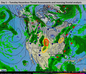
Severe thunderstorms are possible today for portions of the Central Plains with strong storms further south across the Southern Plains. Isolated showers and strong thunderstorms will be possible for portions of the Central Appalachians. Heavy rain and general thunderstorms possible for portions of the Central Plains.
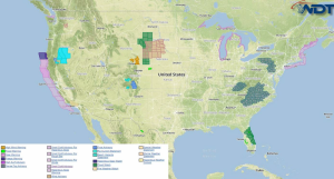
Current NWS Advisories/Watches/Warnings in iMapPro:

An area of low pressure will move from the High Plains into the Upper Midwest. A few severe thunderstorms will be possible across Eastern Nebraska. Hail to 1.5" and gusty winds to 55 mph will be possible. Further south, isolated strong to severe thunderstorms will be possible from Kansas into the Texas Panhandle. Showers and thunderstorms will also be possible from the Dakotas into the Southern High Plains. Across the Appalachians, an area of low pressure will move across the Ohio Valley and Mid Atlantic. Small hail and gusty winds to 45 mph will be possible. Scattered showers and thunderstorms will allow for a risk for heavy rain across the Central Plains. 1-2 inches of rain, with locally higher amounts will be possible.


