National Weather Summary for Tuesday, June 9, 2015
by WeatherOps, on Jun 9, 2015 4:55:31 AM
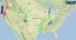
Hazardous thunderstorms will be possible Tuesday across the Upper Midwest and Northern Plains, as well as Upstate New York and New England.
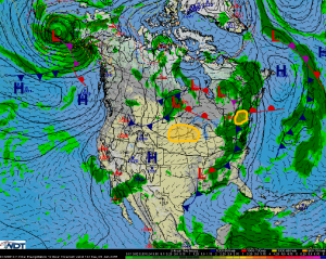
Upper Midwest and Northern Plains:Thunderstorms are expected to develop ahead of a cold front stretched across this region Tuesday afternoon. Conditions will be favorable for some of these storms to become severe. Large hail and damaging winds will be the primary hazards, with a few tornadoes also possible. The most likely time for severe weather will be during the late afternoon and early evening hours (3 PM –9 PM CDT).
Upstate New York and New England:Thunderstorms are expected to develop ahead of a cold front stretched across this region Tuesday afternoon. Conditions will be favorable for some of these storms to become strong. Damaging winds will be the primary hazard. While the tornado threat is low, severe thunderstorms can and occasionally do produce tornadoes, thus an isolated tornado or two cannot be ruled out. The most likely time for severe weather will be during the late afternoon and early evening hours (3 PM –9 PM EDT).


