National Weather Summary for Thursday, September 11, 2014
by WeatherOps, on Sep 11, 2014 9:47:40 AM
Showers and thunderstorms, some severe, will be possible for portions of the Mid Atlantic. In the Central and Northern High Plains, rain and snow will continue. Showers and thunderstorms will be possible for portions of the Southern Plains and Southeast.
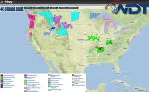
Current NWS Advisories/Watches/Warnings in iMapPro:

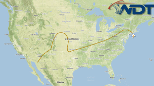
An area of low pressure will lift across Quebec as surface high pressure builds in across the western two-thirds of the country. A cold front stretching from Central Texas to New England will be the focus for showers and thunderstorms. Severe thunderstorms won't be as prevalent as they were yesterday, but a few severe thunderstorms will be possible across the Mid Atlantic. An area of low pressure over the Northern Rockies will begin to develop and move into the Northern High Plains. Overnight rain and snow will linger into the morning across Montana and could persist into the early morning hours across parts of Montana and into the higher elevations of Northern Wyoming with the heaviest snow ranging from 4-8 inches.


