by WeatherOps, on Sep 8, 2014 9:48:57 AM

by WeatherOps, on Sep 8, 2014 9:48:57 AM
Severe thunderstorms are possible today for the Central Plains. Showers and thunderstorms are possible for portions of the Great Basin/Four Corners region and across the Southeast.
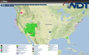
Current NWS Advisories/Watches/Warnings in iMapPro:

A front has stalled along the Gulf Coast and extends into the Carolinas. While significant severe weather is not expected, showers and thunderstorms will be possible ahead of the front. Coastal areas of the Carolinas could receive over 2 inches of rain, allowing for the potential for flash flooding and runoff. Across the west, a new area of low pressure will move into the Great Basin bringing showers and thunderstorms across much of the Southwest. In addition, excessive rainfall will be possible across this region where a Flash Flood Watch is in effect. Across portions of Nebraska and Iowa, a few severe thunderstorms with hail and gusty winds to 45 miles per hour will be possible.
This is where you give the visitor a brief introduction to both this blog and your company. Keep it short. More →