National Weather Summary for Tuesday, July 1, 2014
by WeatherOps, on Jul 1, 2014 9:52:26 AM
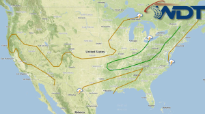
Severe thunderstorms are possible today for portions of the Midwest and Ohio River Valley; hail and damaging winds will be possible. Additional strengthening of Tropical Depression One off the east coast of Florida is expected today. Heavy rain and moderate to fresh winds are expected.
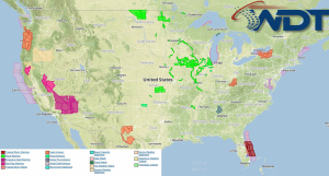
Current NWS Advisories/Watches/Warnings in iMapPro:

The same front producing showers and thunderstorms across the Central Plains and Midwest on Monday will continue eastward with additional activity from the Southern Plains into the Great Lakes, Ohio Valley, and Northeast. While severe weather isn't currently anticipated, a few isolated storms could become severe with hail and damaging winds to 60 miles per hour will be possible.
Additional strengthening of Tropical Depression One will continue, likely becoming Tropical Storm Arthur. Light to moderate rain and isolated thunderstorms will be possible as the system lingers offshore. Heavy rainfall accumulations and sustained winds 20-35 miles per hour will be possible. Additional strengthening is expected before lifting northward on Wednesday.


