National Weather Summary for Wednesday, March 4, 2015
by WeatherOps, on Mar 4, 2015 9:47:27 AM
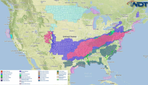
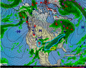
A light to moderate mix of freezing rain, sleet, and snow is expected Wednesday from the Southern Plains to the Northeast. Light to moderate snow will be possible across the Southern Rockies. Across the Lower Mississippi Valley, thunderstorms will be possible.
An area of low pressure will move across the Central US with lingering snow across the Southern Rockies. 2-5 inches of snow will be possible across the higher elevations.
From the Southern Plains to the Ohio Valley, freezing rain, sleet, and snow will be possible ahead of a cold front pushing across much of the eastern US. Initially, precipitation will be in the form of freezing rain and sleet and then transition to snow. Ice accumulations will range from a glaze to a quarter of an inch of ice. Snow accumulations across the Southern Plains and Mid South will range from 1-3 inches. Across the Midwest, 4-8 inches of snow will be possible with some isolated areas approaching a foot of snow.
A small risk for thunderstorms will be possible across the Lower Mississippi Valley from Louisiana into Mississippi. Any thunderstorms that develop will have the potential for winds gusting to 45 mph and a very low tornado threat.


