National Weather Summary for Wednesday, May 27, 2015
by WeatherOps, on May 27, 2015 4:55:13 AM
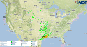
Strong to severe thunderstorms are possible Wednesday for the Central and Southern Plains, Great Lakes, Northeast, and Mid Atlantic.
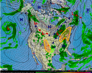
A broad upper level trough will begin to move eastward out of the Western US today. At the surface, an area of low pressure will track northeast across the Texas Panhandle, with an associated dryline extending to the south. In addition to remnant outflow boundaries from early morning convection will allow for the development of thunderstorms from the central High Plains into northern Texas. Thunderstorms should develop during the afternoon and weaken this evening. Strong to severe thunderstorms with the potential for large hail, damaging winds, and tornadoes will be possible. Flash flooding will also be possible due to heavy rains over the past week.
Additional showers and thunderstorms will be possible across portions of northeast Texas and Southeast Oklahoma. 1-3 inches of rain and flooding will be possible.
An upper level trough progressing across the Great Lakes will allow for the development of thunderstorms across the Great Lakes, Northeast, and Mid Atlantic. Thunderstorms should develop during the afternoon and continue into the evening. Strong to severe thunderstorms containing hail and gusty winds will be possible.


