Hazardous Weather Outlook for Wednesday, July 29, 2015
by WeatherOps, on Jul 28, 2015 9:24:50 AM
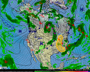
Strong thunderstorms are possible on Wednesday from the Great Lakes to Ohio Valley as well as from the Tennessee Valley to the Gulf Coast. Heavy rain is possible across the Southern High Plains.
Great Lakes to Ohio Valley: A cold front will continue moving eastward across the Great Lakes and Ohio Valley regions on Wednesday. Significant severe weather is currently not expected due to extensive cloud cover and ongoing convection from Tuesday. However, some destabilization along the front is possible, leading to some afternoon thunderstorms capable of damaging wind gusts.
Tennessee Valley to Gulf Coast: Between a low pressure system along the Atlantic Coastline and high pressure in the Central US, along with the front dipping down towards the Tennessee Valley, thunderstorm activity is expected for the region. A strong severe weather threat is not likely, however a few stronger thunderstorms possibly capable of strong winds or even downbursts is possible.
Southern High Plains:A frontal boundary is forecast to drop southward into the southern High Plains on Wednesday. Showers and thunderstorms are likely along the front throughout the day. Deep moisture in place across the region may allow for a heavy rainfall threat, with 1-3 inches possible.


