by WeatherOps, on Aug 21, 2014 9:42:21 AM

by WeatherOps, on Aug 21, 2014 9:42:21 AM
Isolated severe thunderstorms will be possible today for portions of the Midwest and Ohio River Valley; hail and damaging winds will be the main threats. Across the Northeast, scattered showers with isolated strong thunderstorms will be possible. Across the Desert Southwest, monsoonal thunderstorms will continue.
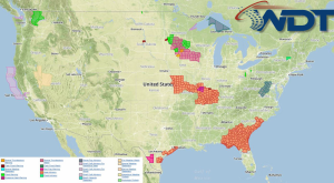
Current NWS Advisories/Watches/Warnings in iMapPro:

An area of low pressure will continue to move eastward through the Northeast, bringing showers and thunderstorms. Across the Plains, another round of showers and thunderstorms will develop this afternoon and evening. While severe weather is not anticipated, storms that develop will have the potential for hail and damaging winds. Additional showers and thunderstorms will continue across the Desert Southwest. Heavy rain and isolated strong to severe thunderstorms will be possible.
This is where you give the visitor a brief introduction to both this blog and your company. Keep it short. More →