National Weather Summary for Wednesday, December 10, 2014
by WeatherOps, on Dec 10, 2014 9:49:19 AM
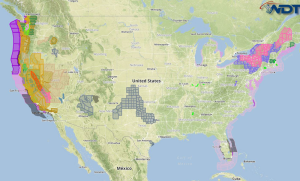
The winter storm over New England will continue Wednesday with additional snow and ice accumulation. Heavy rain and strong winds will be possible across the Pacific Northwest and Northern California. Heavy rainfall will continue for portions of Eastern Maine.
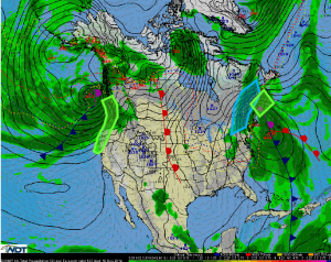
A large area of low pressure will remain in place over the Northeast, allowing snow to continue. The highest threat for heavy snow will be across the interior and western New England region. 4-8 inches of additional snow with locally higher amounts will be possible. As warm air moves northward around the low, some sleet and freezing rain will be possible. In Western Maine, ice accumulations could exceed a quarter inch.
A strong area of low pressure will bring heavy rain and strong winds into the Pacific Northwest and California. 1-2 inches of rain will be possible over many areas, but some isolated amounts of 3-6 inches will be possible. With winds to 50 miles per hour expected, wind damage is possible, in addition to flooding.
Heavy rain in excess of 2 inches will be possible across Eastern Maine as an area of low pressure lingers off the coast.


