National Weather Summary for Thursday, October 2, 2014
by WeatherOps, on Oct 2, 2014 9:45:51 AM
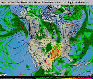
Severe thunderstorms are possible today from the Midwest to the Southern Plains. Strong to borderline severe thunderstorms are possible from the Lower Great Lakes to Southern Texas. Heavy rain and general thunderstorms are possible from the Lower Great Lakes into the Arklatex region.
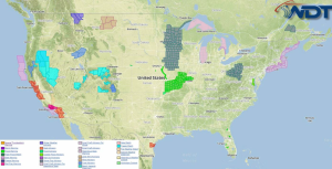
Current NWS Advisories/Watches/Warnings in iMapPro:

A trough and the associated cold front progressing through the Plains and Midwest will allow for thunderstorm development during the early afternoon. Supercells with the potential for large hail, damaging winds, and tornadoes will be possible. As storms continue into the evening, storms will become linear with damaging winds and a few embedded tornadoes possible.
General thunderstorms will be possible from the Lower Great Lakes. Hail to 1" and winds to 40 mph will be possible.
From the Lower Great Lakes into the Arklatex region, heavy rain and flash flooding will be possible. 1.5"-2" of rain, with locally higher amounts, will be possible, especially along the border of Missouri and Illinois.


