National Weather Summary for Tuesday, June 2, 2015
by WeatherOps, on Jun 2, 2015 4:53:44 AM
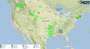
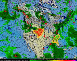
Particularly hazardous thunderstorms are possible Tuesday for the Northern Plains. Marginally hazardous thunderstorms are possible across the Southeast. Moderate to heavy rainfall is possible for the Carolinas and Virginia.
A shortwave trough over the Rockies will lift across the Northern Plains allowing for the potential for severe weather. Increasing moisture across the Great Plains will contribute to moderate instability from the Dakotas into the Central Plains. Initial areas of showers and thunderstorms will be possible during the day, but the most significant threat will be during the mid afternoon. Storms will begin as individual supercells with the potential for large hail and possibly a tornado before becoming clustered and possibly line out, allowing for hail and damaging winds as primary hazards with a possible embedded tornado.
A weak upper level low will linger over the Southeast with marginally severe impacts from Georgia into the Carolinas.
Heavy rainfall will be possible for the Carolinas and Virginia. 1-2 inches of rain and isolated flooding will be possible.


