Hazardous Weather Outlook for Friday, August 29, 2014
by WeatherOps, on Aug 28, 2014 4:20:13 PM
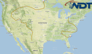
Showers and thunderstorms will continue for portions of the Midwest and Great Lakes on Friday. Thunderstorms will develop across the Northern Plains ahead of a front. Thunderstorms and heavy rain will continue from the Texas/Mexico border to the Texas/Louisiana border.
A trough of low pressure will slowly advance eastward from the Central Plains to the Ohio Valley allowing for scattered showers and isolated strong thunderstorms to redevelop again on Friday. Due to anticipated ongoing morning convection, afternoon environmental instability is expected to remain limited. Therefore, widespread severe weather is not anticipated at this time. However, a few isolated stronger to severe storms could occur through the Mississippi Valley, with damaging winds and hail the primary threats. Moderate to heavy rain will continue through the region with up to an additional 2.5 inches expected. Localized flooding could occur.
Further west, another frontal boundary will begin to drift southeastward from Southern Canada across the Northern Rockies allowing for isolated showers and thunderstorms with no severe weather expected at this time.
TROPICAL
In the southern Gulf of Mexico, isolated showers and thunderstorms will be possible along the Texas/Mexico border and northward into the central and upper Texas coast and Louisiana coast as an area of low pressure drifts inland and a low pressure trough remains in place across the western Gulf.


