National Weather Summary for Tuesday, August 19, 2014
by WeatherOps, on Aug 19, 2014 9:48:39 AM
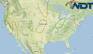
Severe thunderstorms are possible today for portions of the Ohio and Mississippi Valleys. Thunderstorms with locally heavy rainfall are possible for portions of the Southeast; some storms may be severe. Across the Central Rockies, strong to severe thunderstorms with hail and damaging winds possible. Thunderstorms will continue across the Southwest; flash flooding will be possible.
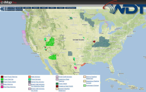
NWS Advisories/Watches/Warnings in iMapPro:

A frontal boundary over the Great Lakes will shift eastward through the day today. Ahead of the front, an area of enhanced shear will exist over Ohio, aiding in the development of thunderstorms this afternoon. Scattered strong to isolated severe thunderstorms with hail and damaging winds will be possible. Further south, an area of low pressure over the Southeast will continue to move eastward. Afternoon heating combined with weak upper level winds will allow for strong to severe thunderstorms with hail and damaging winds possible. Storms should diminish through the evening. A shortwave trough over the Rockies will promote additional showers and thunderstorms. While widespread severe weather is not expected, some stronger storms could become severe with hail and damaging winds the main threats.


