National Weather Summary for Thursday, April 16, 2015
by WeatherOps, on Apr 16, 2015 9:48:41 AM
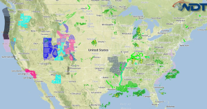
Severe thunderstorms and moderate to heavy rain is possible Thursday for portions of the Southern Plains. Moderate to heavy snow will continue for the Central Rockies.
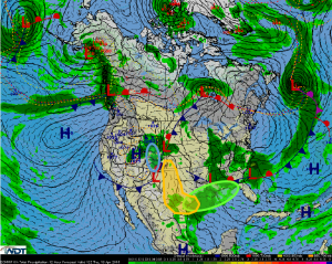
A disturbance deepening in the Rockies will begin to advance into the Southern Plains, allowing for showers and thunderstorms across portions of Texas, the Oklahoma Panhandle, and Southwestern Kansas. Plentiful moisture, enhanced instability, and wind shear will allow for the potential for strong to severe thunderstorms. The primary concerns with any storm will be large hail and damaging winds. While the tornado potential is low, the best time for tornado development would be during the evening hours.
Showers and thunderstorms are anticipated to continue across the Southern Plains as a trough pushes eastward. 2-3 inches of rain will be possible.
Rain and snow showers will continue across the Central Rockies as an area of low pressure moves through the region. 4-8 inches of snow will be possible with higher amounts in the highest elevations. Travel impacts are expected.


