National Weather Summary for Thursday, May 28, 2015
by WeatherOps, on May 28, 2015 4:47:41 AM
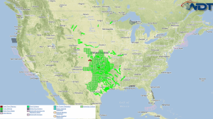
Strong to severe thunderstorms are possible Thursday for the Central and Southern Plains, as well as the Upper Northeast. Heavy rainfall is possible for the Central and Southern Plains.
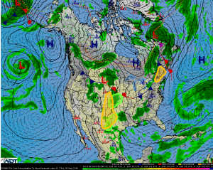
An upper level trough will continue to progress eastward across the Rockies today. Meanwhile, an area of low pressure will lift into the central High Plains with a dry line extending southward. Instability and moderate wind shear will allow for supercellular and clustered thunderstorms capable of large hail and damaging winds. During the late afternoon and early evening, the tornado threat will be enhanced as the low level jet intensifies. Into the evening, some storms could become linear, allowing for a hail and wind threat.
Thunderstorms will be possible across the Upper northeast where instability and wind shear will be high enough for some supercells. Hail and damaging winds will be the main threats with these storms.
A complex of thunderstorms will develop across the Central and Southern Plains with 1-3 inches of rain possible. The threat for flooding will continue.


