National Weather Summary for Wednesday, September 17, 2014
by WeatherOps, on Sep 17, 2014 9:50:00 AM
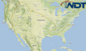
General thunderstorms are possible today for portions of Texas, the Gulf Coast, and the Carolinas. For the Central Plains and Midwest, general thunderstorms will be possible with some isolated severe thunderstorms capable of hail and damaging winds. In the Desert Southwest, showers and thunderstorms with locally heavy rain and flooding will be possible.
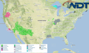
Current NWS Advisories/Watches/Warnings in iMapPro:

Thunderstorms will remain possible for portions of the Central Plains ahead of an area of low pressure. Strong to isolated severe thunderstorms are possible through the morning with small hail and winds to 50 mph possible. Across the Southeast, additional showers and thunderstorms are possible through the Northern Gulf of Mexico, Florida, and into the Carolinas. Severe weather is not anticipated at this time, but a few strong to severe thunderstorms with wind gusts over 40 mph will be possible.
Tropical Storm Odile will continue to lift northward keeping showers and thunderstorms possible through the Desert Southwest. 4-5 inches of rain will be possible in addition to flooding, flash flooding, and locally heavy rainfall. Isolated higher accumulations will be possible.


