National Weather Summary for Friday, August 22, 2014
by WeatherOps, on Aug 22, 2014 9:53:49 AM
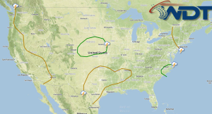
Widespread showers and thunderstorms will be possible today for the Great Lakes and Northeast. Scattered showers and isolated thunderstorms will be possible from portions of the Pacific Northwest to the Northern Rockies; heavy rain is also possible. Monsoonal thunderstorms will continue for portions of the Desert Southwest.
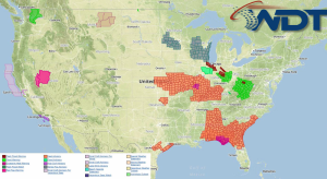
Current NWS Advisories/Watches/Warnings in iMapPro:

Showers and thunderstorms will remain possible across the Northeast and Mid Atlantic as an area of low pressure continues to move offshore. Isolated severe thunderstorms are possible across Eastern North Carolina with hail and damaging winds being the main threats. A shortwave trough over the Northern Plains will bring more thunderstorms to the region. A few of the stronger storms could produce hail, damaging winds, lightning, and heavy rain. An area of low pressure over the Pacific Northwest will allow for thunderstorms and heavy rain; up to 2.5 inches of rain will be possible over portions of Idaho and Montana. Additional moderate to heavy precipitation is expected across the Desert Southwest due to monsoonal thunderstorms.


