by WeatherOps, on Aug 4, 2014 9:49:00 AM

by WeatherOps, on Aug 4, 2014 9:49:00 AM
Scattered and isolated thunderstorms will be possible today from portions of the Northeast to the Gulf Coast. Isolated showers and thunderstorms will be possible for portions of the Great Lakes and Midwest. Across the Southeast,scattered showers will allow for heavy rain and periods of flash flooding.
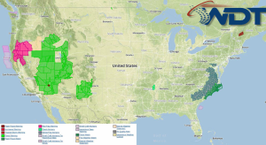
Current NWS Advisories/Watches/Warnings in iMapPro:

Severe weather is not expected today. Tropical Storm Bertha will move northward through the Western Atlantic with no impacts expected across the country. Showers and thunderstorms will be possible across the Gulf Coast along a stalled front. Further north, an area of low pressure moving through the Great Lakes and Midwest will allow for isolated showers and thunderstorms.
Rain will continue for portions of the Southwest. Rainfall totals will range between 1 and 1.5 inches. Due to the heavy rain over the weekend, some flash flooding is possible.
SPC Convective Outlook for Monday
This is where you give the visitor a brief introduction to both this blog and your company. Keep it short. More →