National Weather Summary for Friday, August 7, 2015
by WeatherOps, on Aug 7, 2015 4:35:50 AM
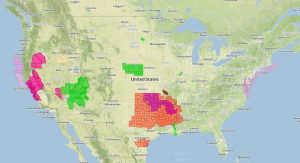
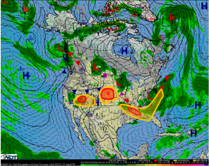
Scattered strong to severe thunderstorms are expected to develop on Friday across the Central Plains, as well as across Utah and Nevada. Excessive rainfall is possible across portions of Utah and Nevada. Scattered strong to severe thunderstorms are possible across the Southeast ahead of a cold front.
Central Plains: An approaching disturbance will aid in the development of scattered strong
to severe thunderstorms during the afternoon and evening hours today with severe winds
and hail being the primary threats. The storms are then expected to organize into a large
complex and advance eastward into the overnight hours before weakening by Saturday
morning.
Southeast: Scattered thunderstorms are expected to develop along and ahead of a slow
moving cold front. At least a few of the storms may become severe (especially over MS, AL,
and the Florida Panhandle) with damaging wind gusts being the primary concern. Locally
heavy rainfall will also be possible.
Utah and Nevada: A strong disturbance advancing eastward into the region will interact
with increasing moisture to produce scattered showers and thunderstorms. A few of the
storms may be severe with damaging wind and hail being the primary concerns. Locally
heavy to excessive rainfall is expected and may result in isolated flash flooding.


