Hazardous Weather Outlook for Friday, July 4, 2014
by WeatherOps, on Jul 3, 2014 4:30:10 PM
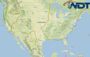
Hurricane Arthur will continue to progress northward with heavy rain and fresh to gale winds expected. Strong to isolated severe thunderstorms with strong winds and large hail will be possible across the Western High Plains.
Additional showers and thunderstorms will be possible again on Friday as a series of weak low pressure disturbances advance through the Western High Plains. Moderate instability and a strengthening low to mid-level wind streak will help to produce stronger to severe storms during the late afternoon and evening hours with the main threats remaining damaging wind gusts and large hail.
Hurricane Arthur will lift to the northeast after passing just offshore of North Carolina early Friday. Arthur will begin to weaken and lose its tropical characteristics late Friday into Saturday as it moves out to sea and begins to be absorbed by the main wind flow pattern through the weekend. Sustained winds are expected to weaken considerably with sustained winds of 60 mph and gusts up to 70 mph dropping to 40 mph sustained and gusts close to 50 mph possible. Heavy rain between 3 to 5 inches is expected mainly offshore of the Mid-Atlantic and through the Northeast. Locations along the coast could experience rainfall accumulations up to an inch mainly early in the day across parts Eastern North Carolina with extreme coastal locations through the Northeast receiving up to 4.5 inches.


