by WeatherOps, on Jun 25, 2014 9:48:11 AM

by WeatherOps, on Jun 25, 2014 9:48:11 AM
Severe thunderstorms are likely today across the Central and Western High Plains. Heavy rain and isolated thunderstorms will be possible with portions of New England; localized flooding possible.
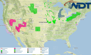
Current NWS Advisories/Watches/Warnings in iMapPro:

An area of low pressure will continue to develop through the Northern Plains today, allowing for the potential for showers and thunderstorms. From Montana and Wyoming into Nebraska, storms will form along the higher terrain and then slowly move eastward. Large hail and damaging winds will be the main threats, but an isolated tornado cannot be ruled out. Thunderstorms will be possible for portions of the Ohio River Valley and Northeast along a weak front. Up to 3 inches of rain will be possible on top of the 1-2 inches of rain already received; localized flooding will be possible.
This is where you give the visitor a brief introduction to both this blog and your company. Keep it short. More →