by WeatherOps, on Jul 31, 2014 9:47:06 AM

by WeatherOps, on Jul 31, 2014 9:47:06 AM
Isolated showers and thunderstorms will be possible today across the Northeast; small hail and gusty winds will be possible. Heavy rain will continue from Southeastern Oklahoma into the Arklatex region.
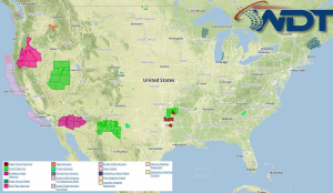
Current NWS Advisories/Watches/Warnings in iMapPro:

An upper level disturbance will continue to slide to the southeast, allowing for showers and thunderstorms from the Southern Plains to the Gulf Coast. Heavy rain will be possible in some areas with 1-2 inches of additional rain and flash flooding possible. Scattered thunderstorms are possible along the Northern Gulf Coast ahead of a stalled front, but no severe impacts are expected. Showers and thunderstorms are possible for portions of the Great Lakes and along the East Coast. While widespread severe weather is not anticipated, damaging winds and hail will be possible with some storms.
This is where you give the visitor a brief introduction to both this blog and your company. Keep it short. More →