National Weather Summary for Wednesday, August 20, 2014
by WeatherOps, on Aug 20, 2014 9:55:41 AM
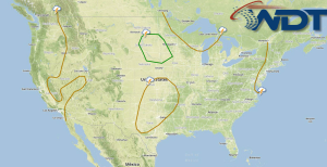
Severe thunderstorms are possible today for portions of the Ohio River Valley. Severe thunderstorms with the potential for large hail, damaging winds, and isolated tornadoes will be possible across the Northern and High Plains; some heavy rain and flash flooding will be possible. Monsoonal thunderstorms will continue across the Southwest.
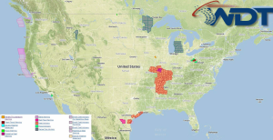
Current NWS Advisories/Watches/Warnings in iMapPro:

Activity will continue through the Great Lakes and into the Northeast ahead of an area low pressure. Showers and thunderstorm development will increase as daytime heating occurs. Storms will be capable of producing hail and damaging winds from bowed line segments. An intensifying area of low pressure in the Northern Plains will create conditions favorable for severe thunderstorms capable of hail, damaging winds, and heavy rain. A few isolated tornadoes cannot be ruled out. Flash flooding with up to 2 inches of rain will be possible. Into the Desert Southwest, monsoonal moisture will keep isolated showers and thunderstorms possible. Heavy rain and winds to over 40 mph will be possible.


