National Weather Summary for Tuesday, March 3, 2015
by WeatherOps, on Mar 3, 2015 9:51:36 AM
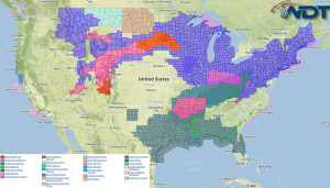
Moderate to heavy snow is likely across the Upper Midwest and Great Lakes on Tuesday. Light to moderate snow will be possible across the Central Rockies and the Colorado Front Range. Light to moderate snow is possible across the Northeast.
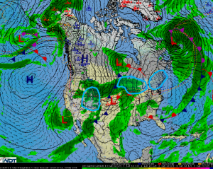
An area of low pressure will track across the Great Lakes on Tuesday with light to moderate snow expected from Minnesota to Upstate New York. Snow across the Upper Midwest will move eastward into the Great Lakes region by late morning or early afternoon. 2-4 inches of snow will be possible. Some areas of Michigan may see some light ice (accumulations less than a tenth of an inch.
Light to moderate snow is expected across the Northeast. Temperatures will support a wintry mix of snow, sleet, and freezing rain before moving out Wednesday morning. Snow and sleet accumulations of 2-4 inches with locally higher amounts of 6 inches will be possible. Up to a tenth of an inch of ice will make travel hazardous through Wednesday morning.
Across the Central Rockies, light to moderate snow is expected across much of Colorado. 4-8 inches of snow will be possible in the mountains with 1-3 inches possible for the lower elevations.


