National Weather Summary for Monday, May 11, 2015
by WeatherOps, on May 11, 2015 9:57:24 AM
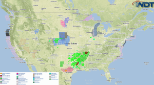
Strong to severe thunderstorms are possible Monday from the Great Lakes to Texas. Moderate to heavy rainfall is possible across the Central Atlantic Coast. Moderate snowfall will continue across the Northern Plains.
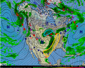
As a weakening low lifts into the Great Lakes, a trailing cold front will progress eastward. Multiple lines of thunderstorms are expected with all severe threats possible. Any storms that remain discrete will have the strongest chance of severe weather, however, embedded supercells are possible. The best risk for severe weather will be in Northern Ohio and Southeastern Michigan where a slightly elevated tornado risk will be possible.
Now that Ana has weakened, locally heavy rainfall will be the main concern across the Central Atlantic Coast. 1-2 inches of rain with isolated higher amounts will be possible, in addition to an isolated thunderstorm with gusty winds.
As the low lifts into the Great Lakes, 4-6 inches of snow with isolated heavier amounts will be possible.


