National Weather Summary for Friday, June 5, 2015
by WeatherOps, on Jun 5, 2015 4:55:21 AM
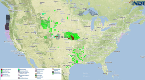
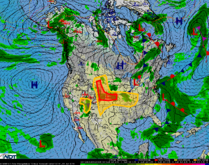
Hazardous thunderstorms are possible Friday for portions of the Central Plains, Midwest, and Southwest. Heavy rain is possible across the Upper Midwest.
Low level moisture will move into the central and northern High Plains today. As the moisture reaches the Front Range, thunderstorms are expected to develop from Southeast Montana through east central Colorado and east central New Mexico during the afternoon and early evening. Some activity may move into portions of Nebraska and Kansas during the late evening and overnight hours. Strong to severe thunderstorms will be possible with large hail being the main threat. Some of the more organized activity will be capable of damaging winds and a few isolated tornadoes.
Across the Lower Missouri River and Middle Mississippi Valleys, thunderstorms will be possible this afternoon as a weak cold front sags southward and instability increases. The main severe threat will be this afternoon and early evening with large hail and damaging winds the primary threats.
An upper level low is forecast to move into the Southwestern US today. With strong wind shear in place, a few strong to severe thunderstorms will be possible during the afternoon and evening across portions of Utah and Arizona. Hail and gusty winds will be the main concerns.


