National Weather Summary for Thursday, June 4, 2015
by WeatherOps, on Jun 4, 2015 4:51:32 AM
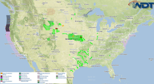
Particularly hazardous thunderstorms are possible Thursday across the Central Plains. Hazardous thunderstorms are possible for the High Plains and Central US. Heavy rain is possible across the Mid Atlantic.
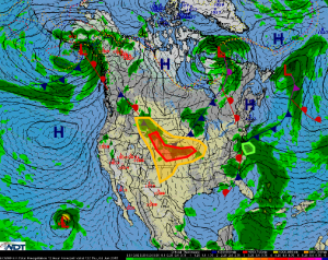
An upper level disturbance moving out of the western US will interact with a weak cold front dropping slowly southeastward across central portions of the country today. This will help provide a focus for strong to severe thunderstorms for the Central Plains and adjacent areas. Thunderstorms are expected to re-develop and re-intensify this afternoon and evening with more organized activity overnight into Friday morning. Large hail, damaging winds, and tornadoes will be possible, though tornadoes will be most likely this afternoon and evening. Multiple rounds of thunderstorms may also lead to a heavy rain threat for portions of the lower Missouri River Valley with rainfall in excess of 2 inches.
A wave of low pressure just off the Mid Atlantic situated along a stationary frontal boundary with showers and thunderstorms across the region. Heavy rainfall is possible across southeast Virginia and northeast North Carolina with 1-3 inches of rain possible.


