National Weather Summary for Thursday, March 26, 2015
by WeatherOps, on Mar 26, 2015 9:47:58 AM
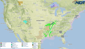
Light to moderate snow will be possible Thursday for the Interior Northeast. Strong to severe thunderstorms are possible across the Mid Atlantic. Moderate to heavy rain is possible along the Gulf Coast.
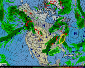
An area of low pressure will move eastward from Southern Canada through the Northeast allowing for moderate snow from Ohio to Maine. Accumulations of 3-6 inches of snow will be possible with some isolated areas up to 8 inches. Elevated winds could allow for reduced visibilities and could cause possible travel disruptions.
Showers and thunderstorms are expected to develop across the Mid Atlantic ahead of an approaching frontal boundary. Damaging winds and small hail will be possible with the stronger storms.
A surface low associated with an approaching frontal boundary through the Southern Plains will generate additional showers and thunderstorms through the region. Moderate to heavy rainfall accumulations up to 2.5 inches will be possible with the heaviest rain anticipated along the Gulf Coast. Severe weather is not expected, however some storms could produce winds in excess of 30 miles per hour.


