National Weather Summary for Tuesday, January 13, 2015
by WeatherOps, on Jan 13, 2015 9:43:11 AM
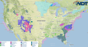
Light to moderate snow will be possible Tuesday across the Four Corners region. A wintry mix is possible overnight into Wednesday morning across the Southern Appalachians and into the Mid Atlantic; some light icing will be possible.
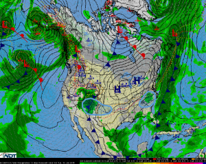
A slow moving surface low and cold front will allow for light to moderate snow across the high terrain of the Four Corners region. Accumulations are expected to average 4-8 inches with isolated areas receiving as much as 10 inches. This system will move into the Southern Plains late in the day and bring up to an inch of snow or wintry mix late tonight into tomorrow morning.
As a frontal boundary moves off the east coast, a weak area of low pressure will develop across the Southern Appalachians and Mid Atlantic. Surface temperatures will remain at or slightly below freezing allowing for freezing rain, sleet, and snow to develop late tonight into tomorrow morning. While significant accumulations are not expected, some areas could pick up between a tenth and a quarter inch of precipitation.


