National Weather Summary for Wednesday, January 21, 2015
by WeatherOps, on Jan 21, 2015 9:42:48 AM
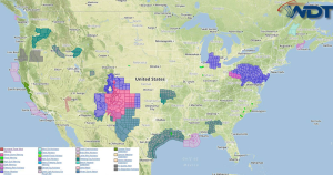
Moderate to heavy snow is expected on Wednesday across the Southern Rockies and High Plains. Light to moderate snowfall is expected across the Mid Atlantic; mainly from West Virginia and Delaware.
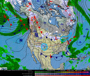
A fast moving clipper system will move from the Great Lakes to off the Mid Atlantic Coast. 2-4 inches of snow will be possible from Eastern Ohio to Pennsylvania, and south to the Virginia/West Virginia border. A rain/snow mix is likely for the Washington, DC area, however, as temperatures fall in the afternoon and evening, precipitation will change over to snow; up to an inch of snow will be possible. Across Maryland, Delaware, and southern New Jersey, 2-4 inches will be possible. 1-3 inches of snow will be possible for the Philadelphia region. Light snow will be possible along the coast of New England as the low moves offshore.
An upper level low moving across the southern Rockies has allowed light to moderate snow to develop across southeastern Colorado. Snow will shift into New Mexico and the Texas Panhandle. 6-12 inches of snow will be possible with 12-18 inches possible in portions of Northeastern New Mexico toward the Texas and Oklahoma Panhandles. Gusty winds could cause blowing and drifting snow, in addition to reduced visibilities.


