National Weather Summary for Wednesday, August 13, 2014
by WeatherOps, on Aug 13, 2014 9:43:33 AM
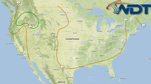
There will be a slight risk of severe thunderstorms across portions of the Pacific Northwest and Northern Rockies today. Across the Southwest, High Plains, and Northeast, general thunderstorms and heavy rainfall will be possible.
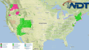
Current NWS Advisories/Watches/Warnings from iMapPro:

An upper level low will continue to move across the Pacific Northwest and toward the northern Rockies. At the surface, an area of low pressure and the attendant cold front will allow for a slight risk of scattered thunderstorms this afternoon and evening. With any storms that develop, large hail and damaging winds will be the main concerns, but isolated tornadoes cannot be ruled out.
Elsewhere, a disturbance moving northeastward out of the Southwest will bring a threat of thunderstorms from the Four Corners region to the High Plains. Hail and gusty winds will be the main concerns with these storms. Additional thunderstorms will be possible across the New England region ahead of an area of low pressure. Heavy rain and flooding will be possible for portions of the Southwest, Great Basin, and New England.


