by WeatherOps, on Jul 2, 2014 9:50:59 AM

by WeatherOps, on Jul 2, 2014 9:50:59 AM
There is a slight risk for severe thunderstorms today across portions of the Mid Atlantic and Northeast; hail and damaging winds will be possible. Tropical Storm Arthur could become a hurricane later today with locally heavy rain and moderate to fresh winds likely.
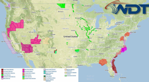
Current NWS Advisories/Watches/Warnings in iMapPro:

As a cold front continues to progress eastward across the Eastern US, another round of showers and thunderstorms will develop from portions of the Southern Plains to New England. As temperatures begin to rise and conditions begin to destabilize through the Appalachians and the Northern Gulf Coast states, some isolated strong to severe storms will be possible; hail and damaging winds will be the main concerns.
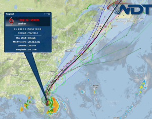
Tropical Storm Arthur will continue to strengthen and lift northward through the day. Arthur could reach hurricane status late Wednesday or early on Thursday. Up to 5 inches of rain will be possible in some areas.
Current iMapPro Radar Mosaic/IR Satellite/Forecast Track for Tropical Storm Arthur

This is where you give the visitor a brief introduction to both this blog and your company. Keep it short. More →