National Weather Summary for Friday, June 12, 2015
by WeatherOps, on Jun 12, 2015 4:49:54 AM
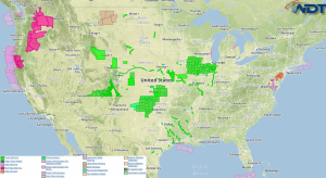
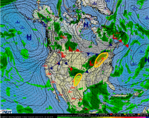
Isolated to strong severe thunderstorms are possible Friday for the Texas Panhandle and Western Oklahoma, as well as from the Ohio Valley to Central New York. Heavy rain is possible expected across the Texas Panhandle and Western Oklahoma.
Ohio Valley to Central New York: A strong cold front will continue to move across the
country on Friday along with an upper level trough that will allow for the development of
another line of showers and thunderstorms by the early afternoon from the Ohio Valley to
Central New York. Showers and storms will likely develop along the cold front and will
spread eastward throughout the day with the primary threats likely to be damaging wind
gusts and large hail.
Texas Panhandle and Western Oklahoma: The trail end of the decaying cold front across
the Southern Plains on Friday will mix with afternoon heating allowing for the development
of isolated showers and thunderstorms on Friday. While widespread activity is not
expected lack any thunderstorms that develop will likely become severe as a low level jet
develops across the region during the late afternoon. Isolated supercells will also be
possible into the evening period due to moderate instability and decent mid level shear
across the region. Primary threats with any severe thunderstorms on Friday will likely be
damaging wind gusts and large hail. While the tornado threat is expected to be low, an
isolated tornado or two cannot be ruled out.
Texas Panhandle and Western Oklahoma: As showers and storms develop across the
region Friday afternoon deep moisture will likely allow for periods of heavy rainfall that will
continue into the early evening. Accumulations in excess of 3 inches are possible on Friday
and could allow for flash flooding across the region.


