National Weather Summary for Thursday, August 28, 2014
by WeatherOps, on Aug 28, 2014 9:53:36 AM
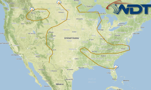
Showers and thunderstorms (some strong) will be possible today for portions of the Central Plains and Midwest. Scattered showers and thunderstorms will be possible for portions of the Southeast and Gulf Coast.
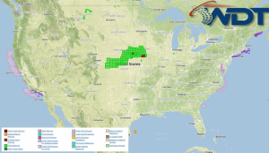
Current NWS Advisories/Watches/Warnings in iMapPro:

Ongoing showers and thunderstorms will continue across the Central Plains and Midwest through this afternoon ahead of a stalled front. By afternoon, the boundary will begin to advance eastward and activity will expand much of the Central and Southern Plains and into the Midwest and Ohio River Valley. Moderate to heavy rain will be possible for portions of the Central Plains and Midwest with up to 3 inches of rain possible. There will also be a slight to moderate risk for flash flooding across portions of Iowa, Southern Minnesota, and Western Wisconsin. While severe weather is not anticipated, some isolated strong storms will be possible for portions of Iowa, Missouri, and Nebraska. Large hail and damaging winds will be the primary concern, but an isolated tornado cannot be ruled out.
Hurricane Cristobol will begin to move northeastward across the Central Atlantic and will begin to become extratropical on Friday. A disturbance through the Gulf of Mexico will continue to move westward with additional showers and thunderstorms possible for the Northwestern Gulf of Mexico. Significant strengthening is not anticipated.


