National Weather Summary for Tuesday, December 9, 2014
by WeatherOps, on Dec 9, 2014 9:49:38 AM
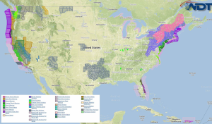
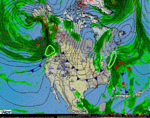
Freezing rain, sleet, and snow will continue today for portions of the Appalachians through the Upper Northeast. Moderate to heavy rainfall and flooding will be likely for the coast line of Maine and the Pacific Northwest.
The area of low pressure off the east coast will continue to deepen and additional precipitation will develop along the coastal areas of New England. The heaviest snow will be from the borders of Pennsylvania and New Jersey into Central New York and Maine. Temperatures along the coast will hover just above freezing, keeping most of the precipitation as rain, but further inland where the temperatures are colder, 4-12 inches of snow will be possible, in addition to a mixture of freezing rain and sleet. Ice accumulations to a quarter of an inch and winds to 40 miles an hour will be possible, creating low visibilities and power outages.
Along the New England coastline, moisture moving into the region will allow for heavy rainfall from Delaware to Maine. 2-3 inches, with locally higher amounts, strong winds, flooding, and low visibilities will be possible.
More heavy rain is expected from Northwestern Oregon through Washington. 2-4 inches of rain, with locally heavier amounts, will be possible.


