by WeatherOps, on Jul 24, 2014 9:55:54 AM

by WeatherOps, on Jul 24, 2014 9:55:54 AM
Strong to severe thunderstorms with the potential for hail and damaging winds will be possible today across the Northern Rockies and Plains. Strong storms capable of producing hail and strong winds will be possible for portions of the Carolinas.
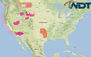
Current NWS Advisories/Watches/Warnings in iMapPro:

Showers and thunderstorms are expected across portions of the Southeast and Mid Atlantic ahead of a cold front. No widespread severe weather is expected, but some isolated severe thunderstorms with the potential for heavy rain will be possible for the Carolinas and Virginia. The better chance for severe weather will be across portions of the northern and central Plains. A new area of low pressure will move across the Rockies and into the Northern Plains. The best chance for severe weather will be across portions of Montana and the Dakotas. Large hail, damaging winds, and tornadoes will be possible.
This is where you give the visitor a brief introduction to both this blog and your company. Keep it short. More →