National Weather Summary for Friday, June 26, 2015
by WeatherOps, on Jun 26, 2015 4:55:24 AM
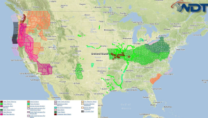
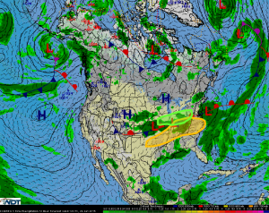
Severe thunderstorms are possible Friday from the Southern Plains to the Mid Atlantic. Heavy rain and flooding is possible from the Midwest to the Ohio Valley.
Southern Plains to Mid-Atlantic: An upper level trough of low pressure will dig and strengthen today, allowing for the surface low and cold front to dive further southward.
This will present a broad, heightened severe weather risk from Oklahoma to the Virginias, with an enhanced risk for Kentucky and Tennessee. One very noteworthy feature with this
severe risk will be the ongoing thunderstorms this morning, which could both inhibit fresh severe development, and help initiate thunderstorm development due to the outflow
boundaries associated with this activity. Nonetheless, damaging wind gusts will be the most prominent threat as gusts in excess of 70 mph will be possible, with a heightened
tornado risk in Kentucky, and a general large hail threat throughout.
Midwest to Ohio Valley: Another round of moderate to heavy rainfall is likely, with already moist areas seeing another 1-2+ inches. Further flooding is likely.


