National Weather Summary for Friday, December 19, 2014
by WeatherOps, on Dec 19, 2014 9:55:48 AM
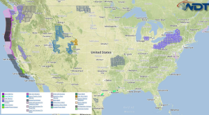
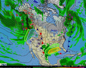
Showers and thunderstorms, with some isolated severe thunderstorms, will be possible Friday for portions of the Gulf Coast. Across Texas and the Southeast, heavy rain will be possible. Moderate to heavy snow, as well as flooding and mudslides, will continue for the Pacific Northwest.
An upper level disturbance moving across Texas and toward the Lower Mississippi Valley will bring a chance of thunderstorms across the Gulf Coast. A few thunderstorms may become strong or marginally severe with gusty winds and hail possible. Across Texas, the same system will bring heavy rainfall to portions of Eastern and Southern Texas and into the Southeast. Rainfall amounts of 1-3 inches with isolated higher amounts will be possible. Rainfall up to 2 inches of rain is possible for portions of Northern and Central Louisiana into Western Mississippi. Across the Pacific Northwest, snowfall will continue for the Cascades and spread eastward into the Northern Rockies and Sierra Nevada. 3-6 inches of snow will be possible for the higher elevations, except for the Coastal Range in Southern British Columbia, where 6-15 inches of snow will be possible. In the lower elevations, heavy rain will continue. .25-1.75 inches of rain will be possible. Where heavy rains have fallen recently, flooding and mudslides will be possible.


